The Snowstorm Passes
27th November 2023
Last modified on December 3rd, 2023
It remains cold in the Alps after the latest storm bought plenty of snow in places. The sun is now out with some excellent conditions. UPDATED
Sunday 3rd December
Blue sky has followed the heavy snow and rain of the past few days.
Weekend skiing conditions are excellent in places.
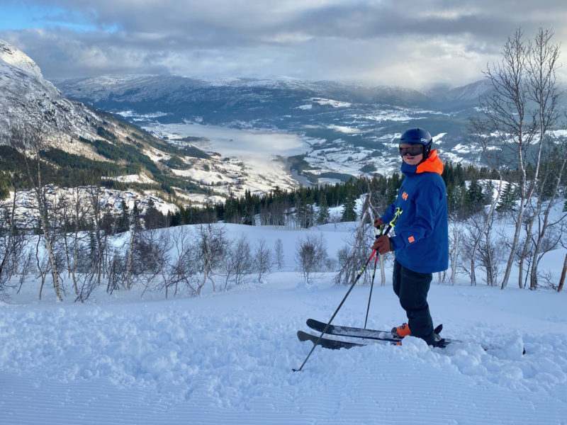
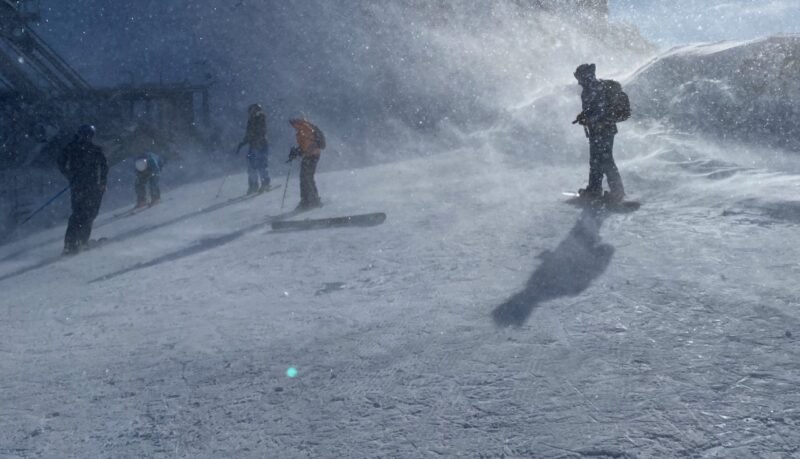
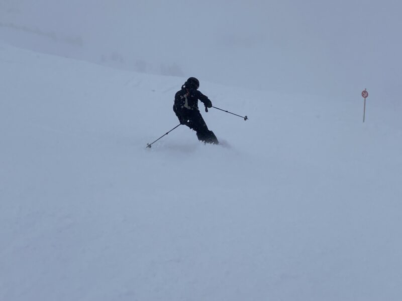
One of our regular PlanetSKI readers, Holger Gassler, has been out ski touring near Innsbruck.
He’s been in Birgitzer Alm & Axamer Lizum, where there is a depth of 1.5m and about 50 cm of powder from the latest storm.
Check out his images:
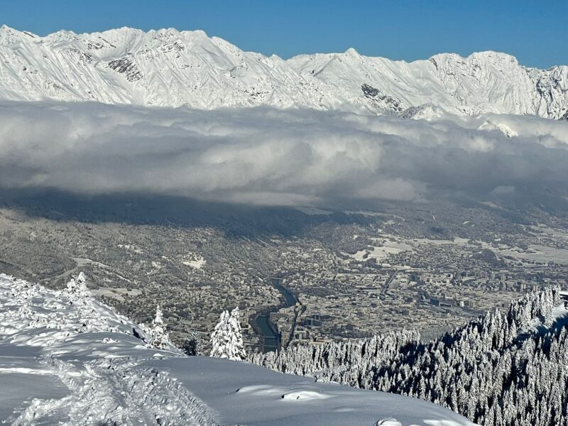
Ski touring in the Tirol. Image © Holger Gassler

Ski touring in the Tirol. Image © Holger Gassler

Ski touring in the Tirol. Image © Holger Gassler

Ski touring in the Tirol. Image © Holger Gassler

Ski touring in the Tirol. Image © Holger Gassler
We’ll be updating on conditions across the Alps later once we have assessed exactly how much snow the latest storm has left.
Here’s the scene in St Anton in Austria that has seen some of the best of the recent snow.
Evening and Night Wonders at STANTON SKI OPEN! Relive the Enchanting Winter Atmosphere with Clips from our Spectacular Friday and Saturday Evening Programs 😍 #stantonamarlberg #stantonskiopen #inTirol pic.twitter.com/07y1HoD7JB
— St. Anton am Arlberg (@StantonReview) December 2, 2023
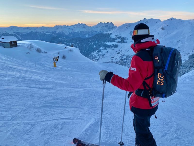
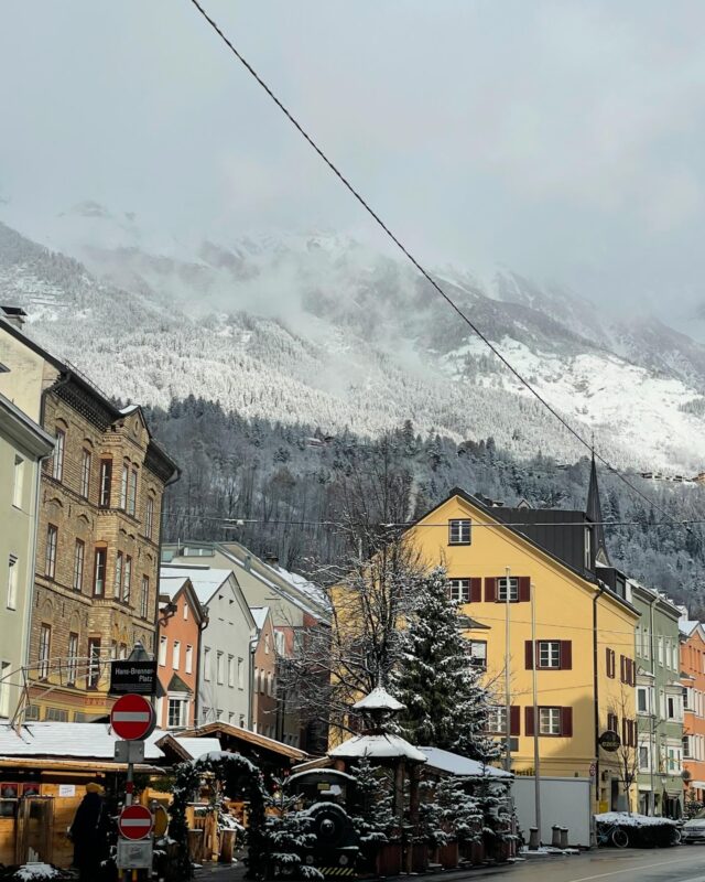
PlanetSKI has been in The Tirol in Austria the past week where we have seen snow, rain, high winds, sun and pretty much anything the weather can come up with.
Kaunertal, Tirol, Austria. Image © PlanetSKI
The Tirol, Austria. Image © PlanetSKI
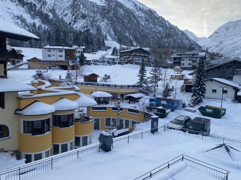
Innsbruck, Austria. Image © PlanetSKI
Kaunertal, Tirol, Austria. Image © PlanetSKI
Italian Alps. Image © PlanetSKI
Snow in the Tirol. Image © PlanetSKI
Sometimes the freezing level has been at over 2,000m.
Other times it has been a few hundred metres.
Do check back…
Saturday 2nd December
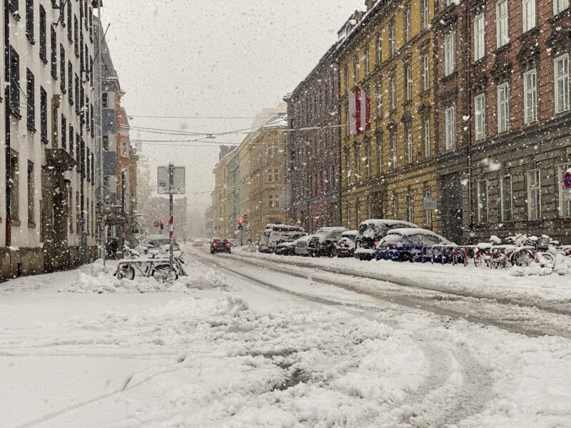
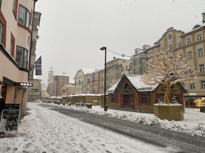
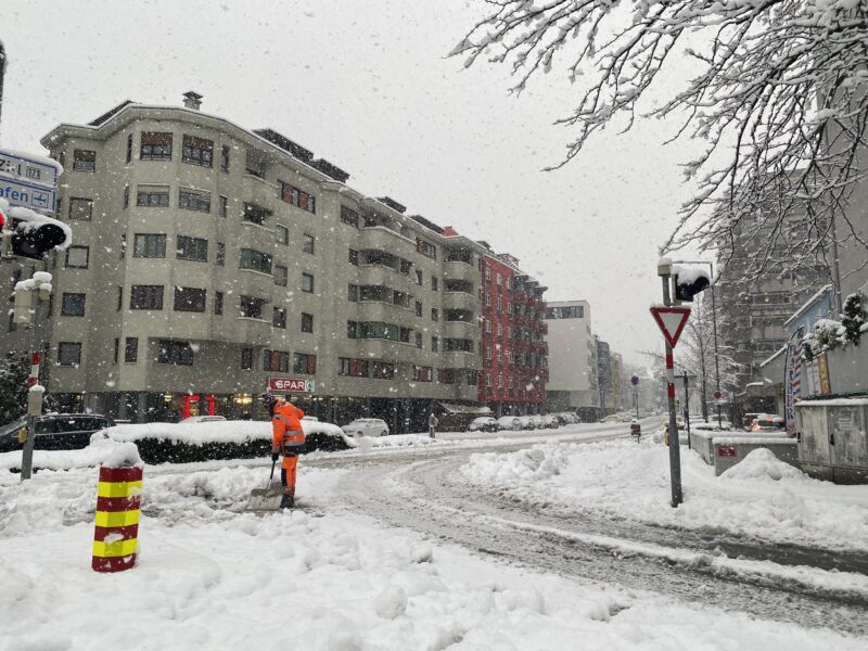
We start today’s snow report not in a high-altitude alpine ski resort, rather in Innsbruck in the Tirol at 574m.
Innsbruck, Austria. Image © PlanetSKI
Innsbruck, Austria. Image © PlanetSKI
Innsbruck, Austria. Image © PlanetSKI
Innsbruck, Austria. Image © PlanetSKI
Innsbruck, Austria. Image © PlanetSKI
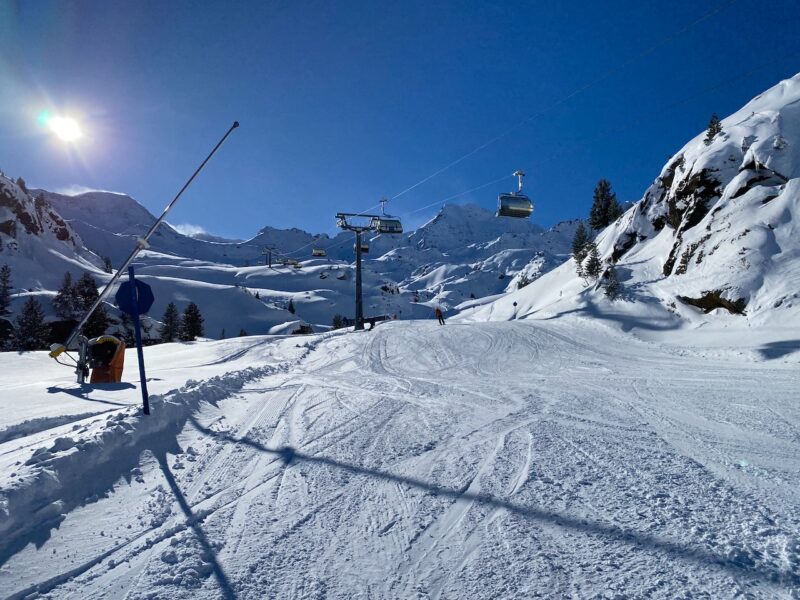
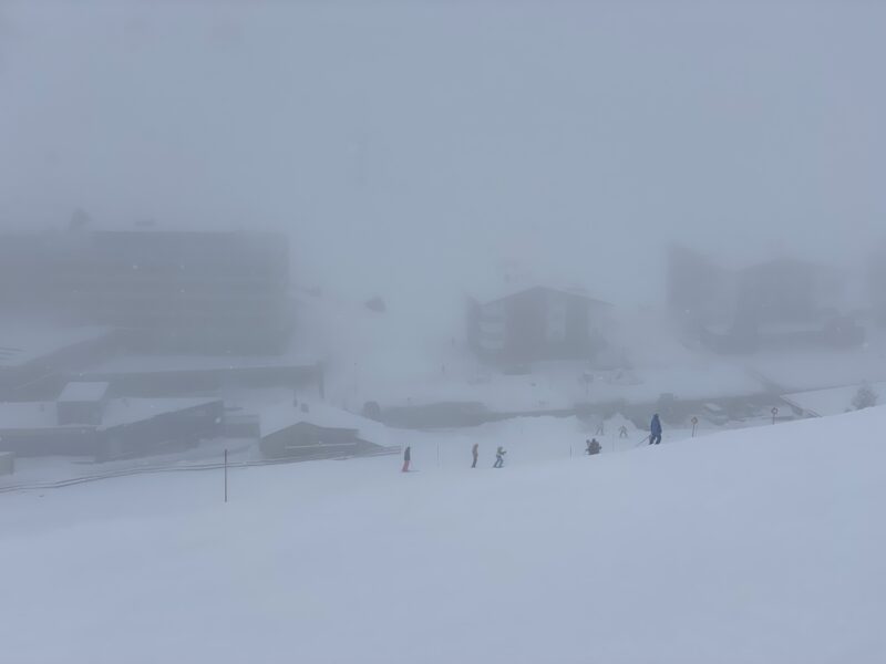
So, what’s it like up in the ski resorts?
In Austria heavy snow has been falling, though there is poor visibility as the storm strikes.
Up to 50cm has fallen in some of the resorts in the Tirol as the storm continues.

Kuhtai, The Tirol. Image © PlanetSKI
Kuhtai, The Tirol. Image © PlanetSKI
Pitztal, Tirol, Austria. Image © PlanetSKI
“Today in the Tirol we’re seeing the most snow of anywhere in the Alps, though I’m pleased to report the Dolomites in Italy to the south of Innsbruck is finally seeing good snowfalls too,” said the PlanetSKI content editor, James Cove, who is in the city.
The Dolomites has largely missed out on the heavy snow of the past few weeks in parts of the northern and western Alps.
Other areas to have missed out are the south-west Alps, in resorts like Sestierre in Italy and Isola 2000 in France.
It is though cold, so snow-making can take place.
It’s hard to generalise about the weather at the moment with the temperature fluctuating wildly, bringing rain and thaw conditions.
A couple of days ago it was raining above Val d’Isere at 2,800m.
Now the temperature has fallen sharply.
James has been skiing in Kuhtai during the current storm.
And if you want to see more of the snow in Innsbruck….
More to follow…
Friday 1st December
Several more resorts opened today in the Alps ahead of more on Saturday.
Around 20 are hoping to fire up some lifts and open terrain this weekend – weather permitting.
Many are being affected by the latest storm that is hitting parts of the Alps.
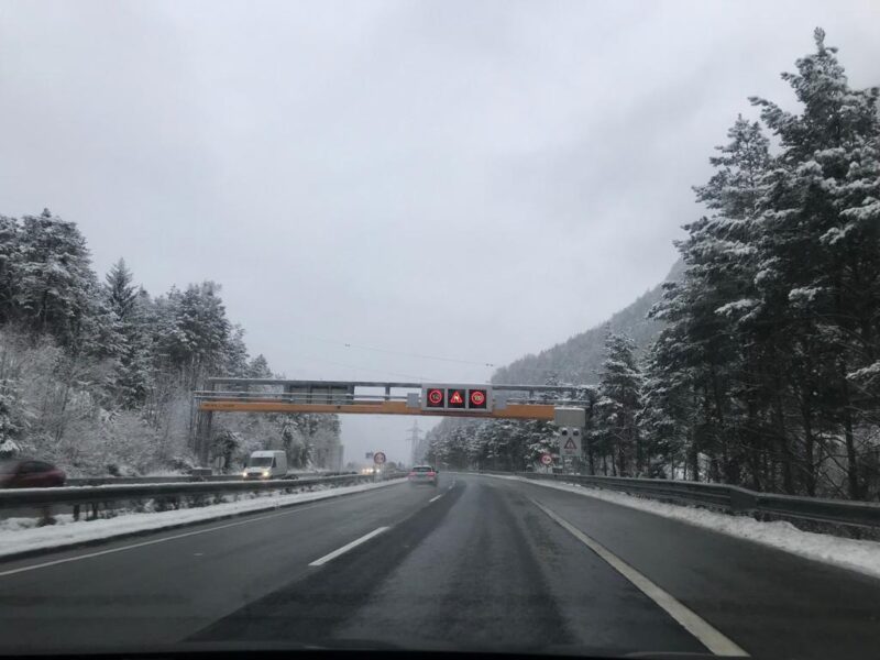
In France rain has been falling up to 2,300m in some places.
In Austria the freezing level was about 2,000m today.
There is heavy snow at altitude and heavy rain lower down in the northern and western Alps.
Austria saw the heaviest of the rain/snow today.
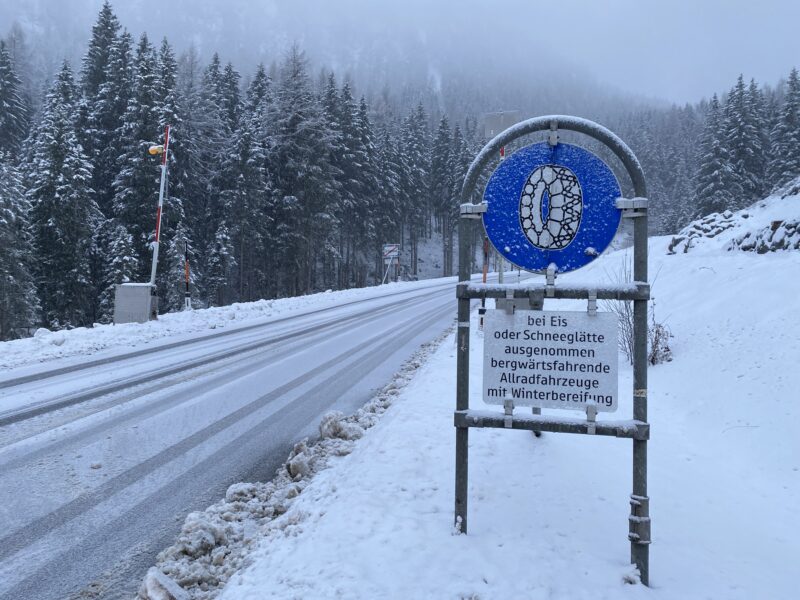
Here’s the scene at 600m on the main 180 motorway near Innsbruck – a combination of rain and wet snow.
The Tirol, Austria. Image © PlanetSKI
The Tirol, Austria. Image © PlanetSKI
The Tirol, Austria. Image © PlanetSKI
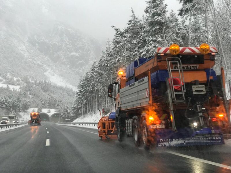
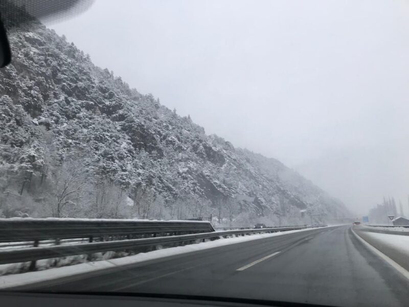
PlanetSKI was on its way to Kuhtai in the Tirol for its opening today.
The roads became challenging on the way up to the highest ski resort town in Austria that sits at 2,020m.
The Tirol, Austria. Image © PlanetSKI
We reached the resort without needing to put chains on.
Kuhtai, the Tirol, Austria. Image © PlanetSKI
Up on the slopes the visibility was limited though there was good cover of snow on the slopes for its opening weekend of the season.
Kuhtai, the Tirol, Austria. Image © PlanetSKI
Only a few people were out.

Kuhtai, the Tirol, Austria. Image © PlanetSKI
Here’s PlanetSKI editor, James Cove:
As James said, we’ll be updating later today on conditions across the Alps, so do check back…
Thursday 30th November
The one thing we do know is that another storm is going to affect large parts of the Alps over the next couple of days.
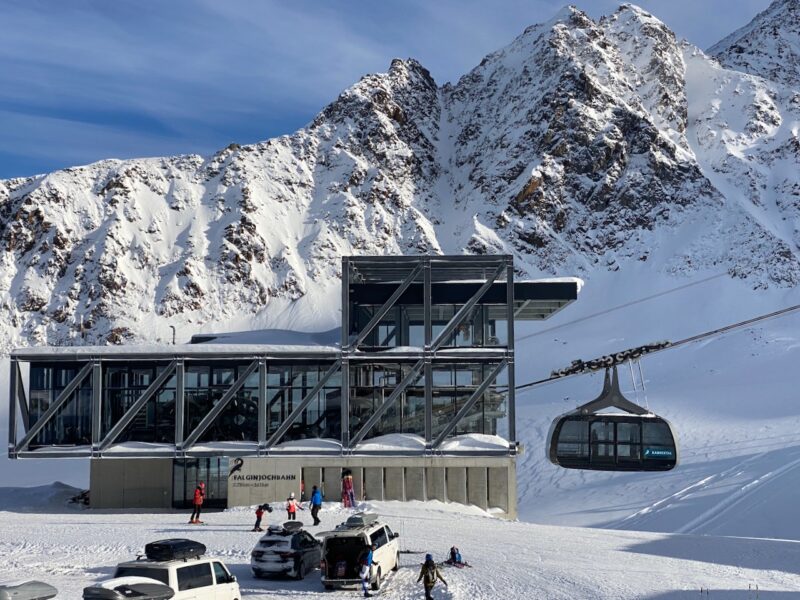
It had already started as we arrived at the top of Kaunertal in the Tirol – Falginjoch at 3,113m:
Today it is -3c at the top of the resort – yesterday it was -17c.
Temperature is going to be all important over the next 48-hours, but it remains unclear where the freezing level will be with the temperatures set to yo-yo all over the place.
There will be heavy snow & heavy rain.
The latest storm started last night in the western Alps and will progress east.
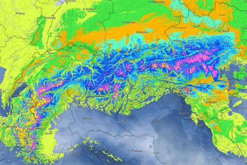
Image c/o bergfex.com, 29.11.23
Here are the thoughts from the alpine weather expert, Fraser Wilkin from weathertoski.co.uk:
“This new storm is extremely complicated to forecast because the rain/snow line will be all over the place.
“On Thursday, the rain and snow will move steadily further east reaching most parts of the Alps over the course of the day.
“The rain/snow limit will again start low in the more enclosed valleys of the central and eastern Alps, but will soon rise to 2,200-2,400m across the western Alps (e.g. France).
“It will also rise further east, albeit more slowly.”
Sadly it seems there will be a significant loss of snow at lower altitudes over the next couple of days with the heavy rain, especially in the western Alps.
Above 2,200m there likely will be 50cm, and much more in places, of fresh snow.
PlanetSKI is currenty in the Tirol and we’ll be reporting first hand on how the storm affects this part of Austria.
Also do check out weathertoski.co.uk for the very latest.
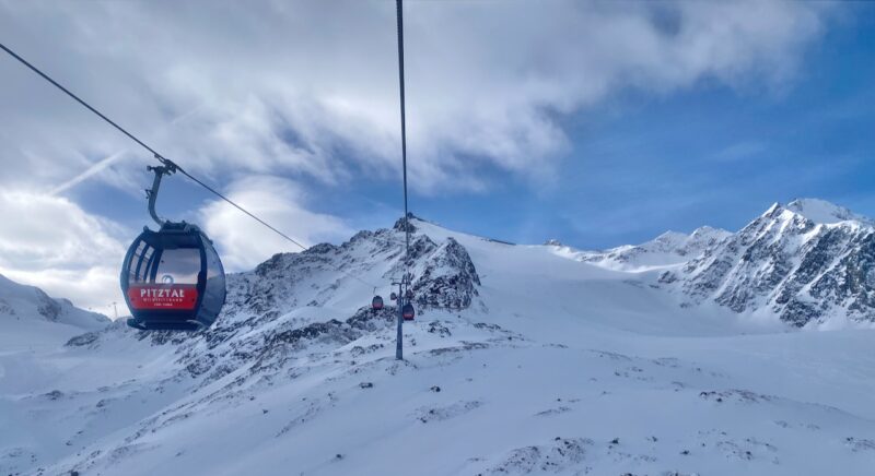
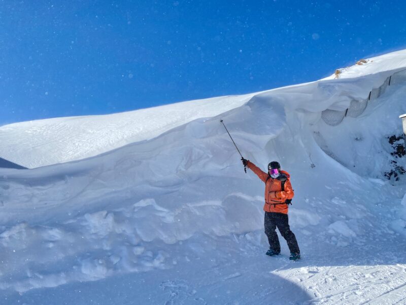
Pitztal, The Tirol, Austria. Image © PlanetSKI
There are a swathe of resorts opening across the Alps this coming weekend that will be affected by the latest storm.
See our article on the resorts set to open:
For further details, see our coverage below over the past few days.
Wednesday 29th November
Today there’s been a lull in the alpine weather before another storm begins later.
Things are relatively quiet by recent standards.
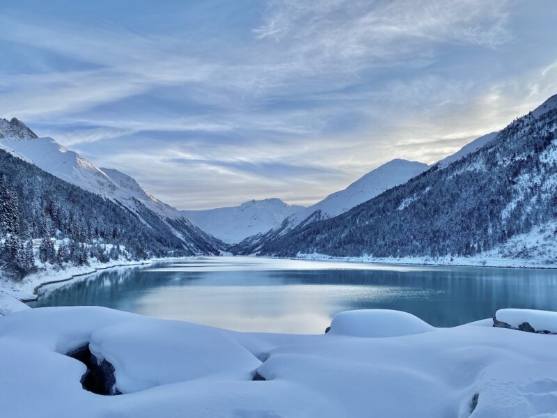
PlanetSKI is now in Kaunertal in the Tirol.
Here was the scene as we flung open the curtains of our hotel room ahead of what promised to be a great day out on the slopes:
Kaunertal, Tirol, Austria. Image © PlanetSKI
The blue sky made a change from yesterday’s weather in this part of the Alps.
We’ll be updating from the slopes of Kauntertal in a moment, but first the picture across the Alps.
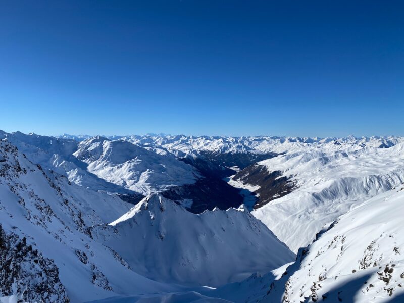
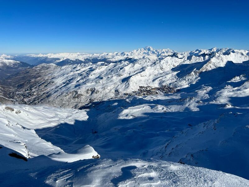
As November draws to a close the snow cover is impressive for the time of year across many northern parts of the Alps.
High-altitude resorts are doing well, and we highlight some of the best:
Austria – St Anton, Kitzbühel & Obertauern.
France – Val d’Isère, Flaine, Avoriaz & Val Thorens.
Switzerland – Mürren, Engelberg & Klosters.
See yesterday’s video report (below) from PlanetSKI editor James Cove who was in Pitztal in the Tirol.
He details the current scene across the Alps and what the current snow levels may mean for the approaching season.
The conditions are less good in the southern Alps – for resorts in the Milky Way and over into the Dolomites.
Low-level resorts are also under threat as the temperature is set to rise, and much can happen over the next few weeks.
Now, what about today in Kaunertal?
The road up is an experience in itself as a single track road (with passing points) goes round the lake and then twists up the mountain side to the resort in the distant peaks.
Kaunertal, Tirol, Austria. Image © PlanetSKI
On arrival there was 12cms or so of fresh powder, blue sky over ahead and barely a soul around.
Kaunertal, Tirol, Austria. Image © PlanetSKI
Kaunertal, Tirol, Austria. Image © PlanetSKI
So, what was the skiing like?
Seems PlanetSKI editor, James Cove, can barely contain himself!
And here’s some of the off piste James was talking about:
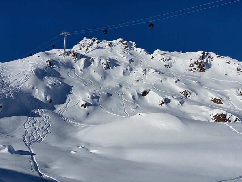
Kaunertal, Tirol, Austria. Image © PlanetSKI

Kaunertal, Tirol, Austria. Image © PlanetSKI
James will be posting a full resort review article on Kaunertal next week, so look out for that if you like off-the-beaten-track gems.
Elsewhere in the Alps here are some of the latest social media posts from resorts where good snow has fallen.
Zauberhaftes Schneeparadies in St. Anton am Arlberg: Die frisch gefallenen Schneeflocken verwandeln die Landschaft in ein atemberaubendes Wintermärchen. Ein weißes Wunderland, das zum Träumen einlädt … 😍❄️☃️#stantonamarlberg #arlberg #inTirol #austriahttps://t.co/4OCOVBVOSl pic.twitter.com/vmohsIe7EV
— St. Anton am Arlberg (@StantonReview) November 28, 2023
LIVE🔴 Fresh delivery ❄️📦
.
.#verbier #valdebagnes #valais #switzerland #snow @valaiswallis @MySwitzerland_f pic.twitter.com/S1L4EqhY9y— Verbier (@VerbierResorts) November 28, 2023
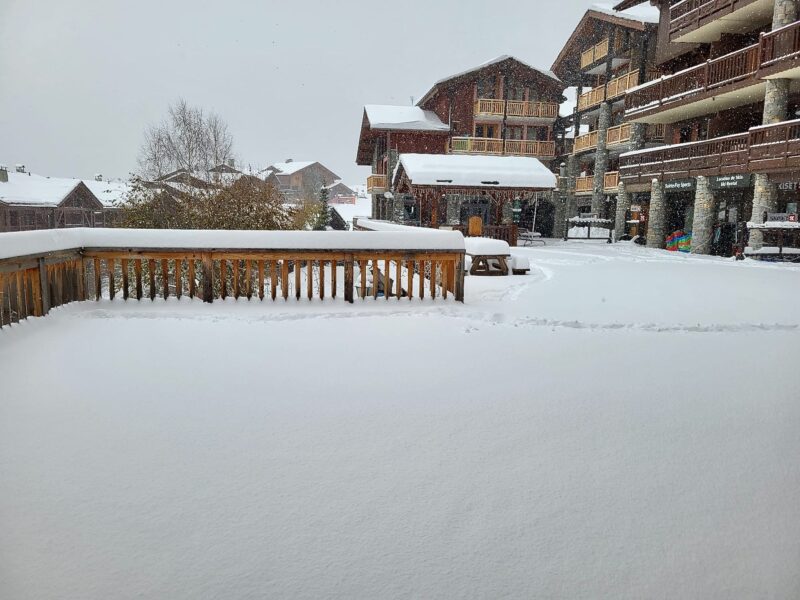
While here are some of the latest images we have received from our readers in France.
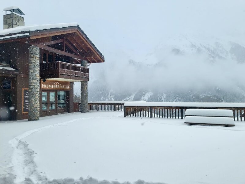
Ste Foy. Image ©premiere-neige
Ste Foy. Image ©premiere-neige

Les Carroz. Image ©Les Carroz.
More to follow…
Tuesday 28th November
Last weekend saw snow across large parts of the Alps – mainly in western Austria and eastern Switzerland.
Now it is falling heavily in the northern French Alps and parts of western Switzerland.
Here’s the latest from PlanetSKI editor, James Cove, who is in Pitztal in the Austrian Tirol:
As James mentioned the freezing level is down to 600m in Les3Vallees.
Here’s the scene above Brides-les-Bains at the base of the ski area.

Brides-les-Bains, France. Image c/o Zac Brown.

Brides-les-Bains, Fracnce. Image c/o Zac Brown.
“Great signs that it’s snowing right down to the valley,” said PlanetSKI reader, Zac Brown.
So, what about the new storm that James mentions in the video?
“After a temporary lull on Wednesday, a new storm will reach the Alps later in the day which will continue to influence proceedings on Thursday and Friday,” said Fraser Wilkin from weathertoski.co.uk.
“This storm is more complicated to forecast and will affect a wider swathe of the Alps, including the south.
“However, it will drag some warmer air in for a time, meaning that some rain is possible to 2,000m or so in places, albeit temporarily.”
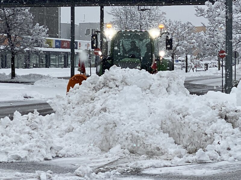
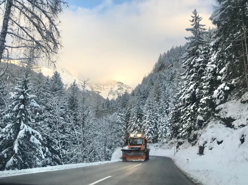
In Pitztal first thing Tuesday morning the snow clearing operation was underway.
Minutes later the first skiers appeared heading for the fresh powder.
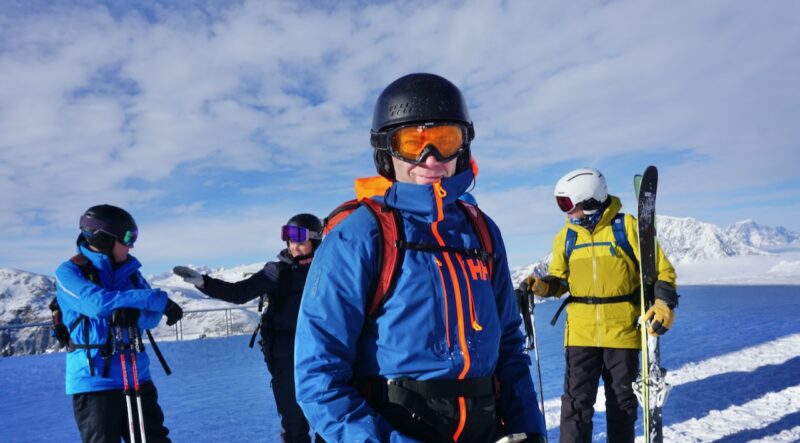
On Monday we were out enjoying the fresh snow and assessing the winter ahead:
In places this is the best start to winter in many years.
Here are some of the latest posts from resorts on social media:
St Anton has seen significant amounts of snow and opens on Friday 1st December.
STANTON SKI OPEN
01.- 03.12.2023 🤩https://t.co/tnzaRBWQfZ#stantonamarlberg #stantonskiopen #arlberg #inTirol pic.twitter.com/npc2RCbrxY— St. Anton am Arlberg (@StantonReview) November 27, 2023
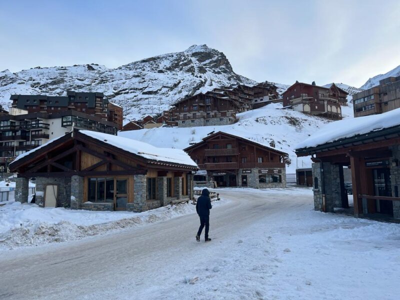
Val Thorens is seeing some of the best of the new snow.
PlanetSKI’s Simon Wilson was in Val Thorens last weekend as the resort officially opened for the season:
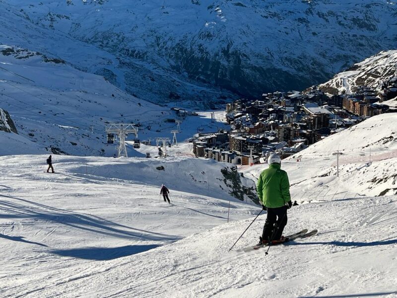
Val Thorens, France. Image © PlanetSKI
The weather is set to remain unsettled throughout the rest of this week.
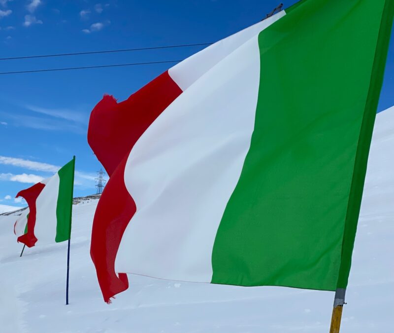
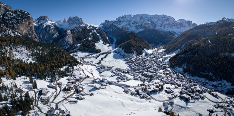
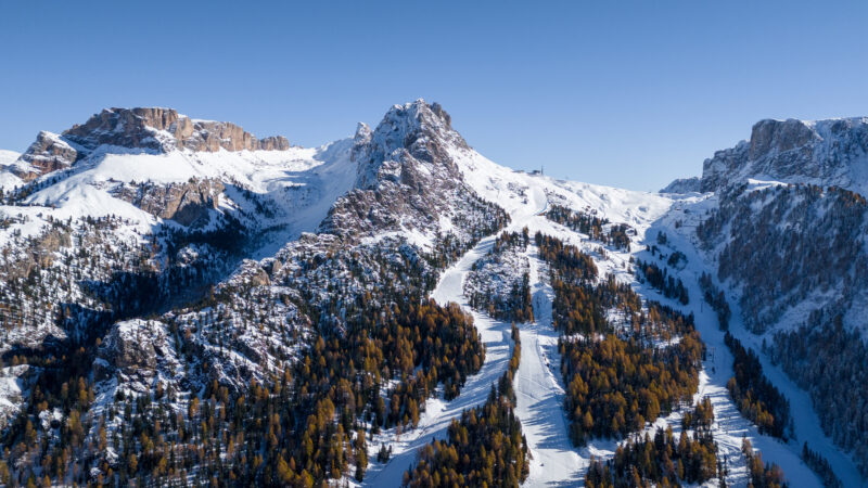
The southern Alps has largely missed out on the recent action, but we are pleased to reported snow has fallen in the Dolomites in Italy with some ski areas opening early.
Cold temperatures have helped things along as the resorts in the Dolomiti Superski area have some of the best snowmaking of anywhere in the world.
Val Gardena is opening Saturday 2nd December 2023
Dantercepies above Selva in Val Gardena is opening earlier than planned on Saturday December 2nd.
One gondola and two lifts will be open offering about 50kms of varied slopes.
The full Val Gardena ski area is planning to open on 5th December.
First snow in Dolomites. Image © Damian Holzknecht Val Gardena
First snow in Dolomites. Image © Damian Holzknecht Val Gardena

First snow in Dolomites. Image © Damian Holzknecht Val Gardena

First snow in Dolomites. Image © Damian Holzknecht Val Gardena
More to follow…
Monday 27th November
The weekend weather delivered the snow that was forecast, and then some more.
We have reported on it all over the past few days.
PlanetSKI as arrived in Pitztal in the Tirol in Austria that saw some of the best of the action.
Here is the scene first thing on Monday morning in the valley with the ski area in the distance.
Pitztal, Tirol, Austria. Image © PlanetSKI
Pitztal, Tirol, Austria. Image © PlanetSKI
Pitztal, Tirol, Austria. Image © PlanetSKI
And up top after a few turns?
PlanetSKI editor, James Cove, seems to have had a rather good Monday morning.
We’re in the area all week.
PlanetSKI reporter Simon Wilson has been in Val Thorens in France for its opening weekend.
“Very quiet here this morning and seems like many of the weekend visitors have left,” said Simon.
” Weather is bright with a thin veil of cloud which is meant thicken later and bring another moderate fall of snow overnight.
“Much less cold today -3 in resort going up to -1.
“Great base for the season here now with a claimed 50cm in the village and 1.1m on the highest pistes.”
Val Thorens, France. Image c/o PlanetSKI
Val Thorens, France. Image c/o PlanetSKI
Over the weekend in France snow was falling down to 500m in the Vosges, Jura, Alps, Massif Central, and Morvan areas.
The southern Alps and the Dolomites have largely missed out on the snow, but cold temperatures have helped the snowmaking as the main season is set to start in a few weeks.
All in all it is looking very good with most resorts opening in the next few weeks.
Sunday 26th November
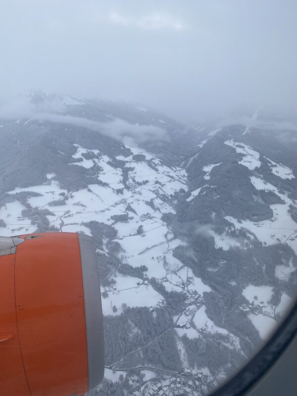
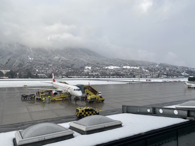
PlanetSKI editor James Cove headed to the Tirol today, flying from Gatwick to Innsbruck.
We have seen plenty of pictures of all the snow at altitude, but what about lower down?
The freezing level has been around 500m in places and that means there is snow all the way down to the valley floor.
The first glimpse came from altitude, through a gap in the clouds.
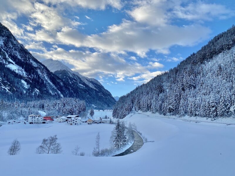
Snow in the Tirol. Image © PlanetSKI
As we we flew closer to Innsbruck things became clearer.
Snow in the Tirol. Image © PlanetSKI
Landing at Innsbruck with snow on the ground is a great sign of things to come.
It is the first snowfall in Innsbruck itself this winter.
Snow in the Tirol. Image © PlanetSKI
James is heading to the area in the Alps that has seen some of the best snow in the past few days, north-western Austria.
He has chosen to ski in Pitztal, Kaunertaler and Kuhtai over the next week as that seems to be where some of the best snow has been falling and this week should be a cracker with more snow in the forecast.
There were some stunning views of the mountains draped in snow at motorway level.
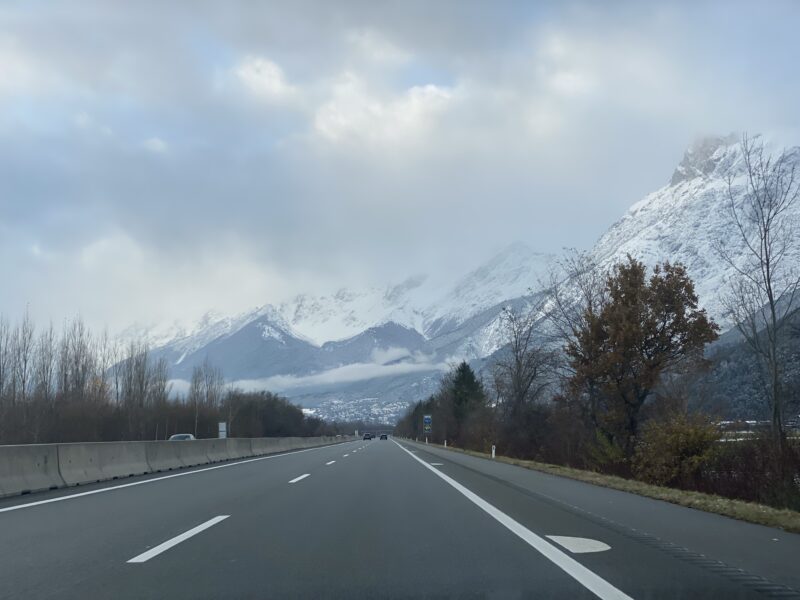
Snow in the Tirol. Image © PlanetSKI
And then higher up on the mountain road heading to Pitztal it was dripping off the trees.
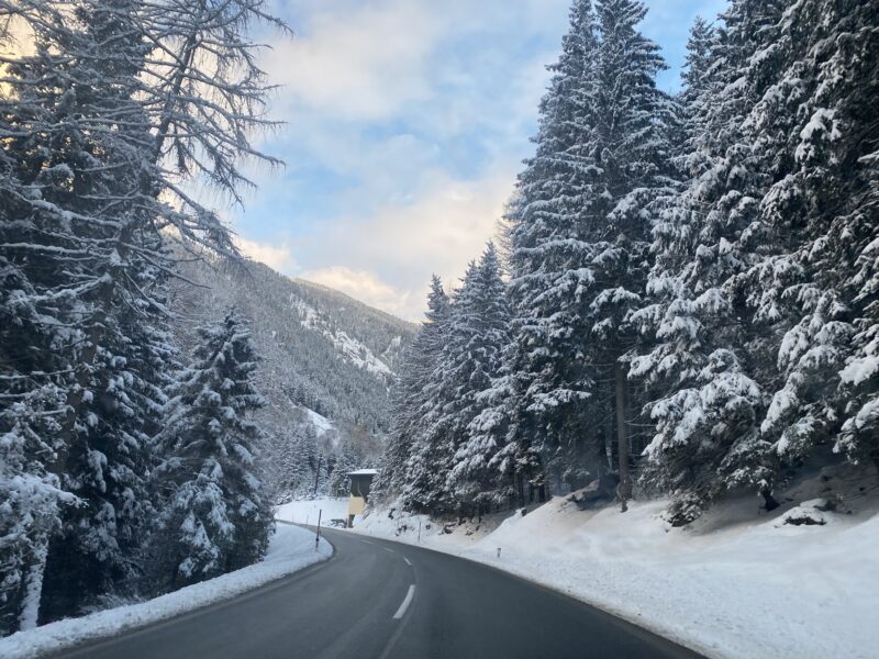
Snow in the Tirol. Image © PlanetSKI
Snow in the Tirol. Image © PlanetSKI
Snow in the Tirol. Image © PlanetSKI
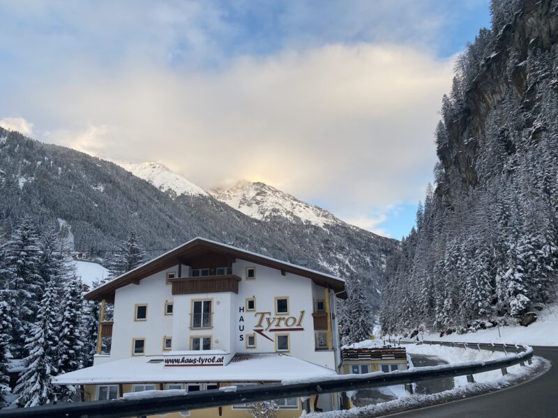
It was dusk as we arrived at our hotel and the view of the snow at valley level could hardly be better for late November.

Snow in the Tirol. Image © PlanetSKI
Today’s PlanetSKI snow report started in Ischgl.
At the the Demi Lovato concert to be precise – where it was snowing.
The US singer was performing at the concert for the official opening of the Austrian resort’s ski season on Saturday night.
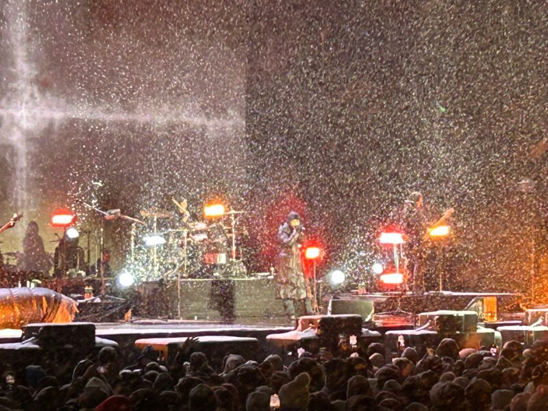
Demi Lovato. Image © Lynsey Devon
Over in Val Thorens in France the weather has cleared after the storms of yesterday.
“Blue skies today after 10cm of fresh snow yesterday,” said PlanetSKI reporter, Simon Wilson, from the resort.
“The wind dropped has dropped but it’s still cold, -8 in resort and -12 at the top.
“The resort is hoping to open all the main lifts today, including Cime Caron.”
And here is the view from the top of the Cime Caron as it opened:

Val Thorens, France. Image © PlanetSKI
Val Thorens, France. Image © PlanetSKI
It was very windy at the top, with the windchill making things bitterly cold:
See here for Simon’s first reports as he arrived in the resort and hit the slopes.
It is now the last week in November so we are entering the territory where some accurate predictions & assessments can be made on what the early season may look like.
Plus, where are the best resorts for skiing in December and into New Year.
All in all, it is looking pretty darn good.
One of the best starts to a winter season that we can remember.
Look out for that report later in the week,
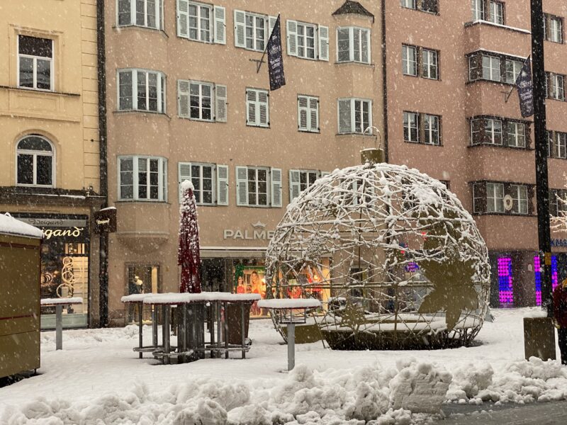
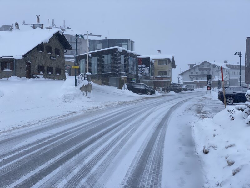
As we reported earlier James landed in Innsbruck but didn’t pop into the city to see the first snow of the season on its streets.
No matter.
One of our regular readers and great friend of PlanetSKI, Holger Gasler, has posted pictures of his home city:
Innsbruck. Image c/o Holger Gasler.

Innsbruck. Image c/o Holger Gasler.
James will be in Innsbruck later in the week using it as a base to ski in Kuhtai that opens on Friday.
And of course going to the Christmas Markets.
Val Thorens, France. Image © PlanetSKI