What Does PlanetSKI Do In The Summer? Part One…
15th May 2022
Last modified on June 27th, 2022
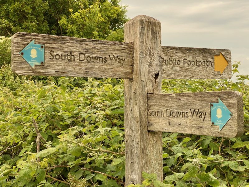
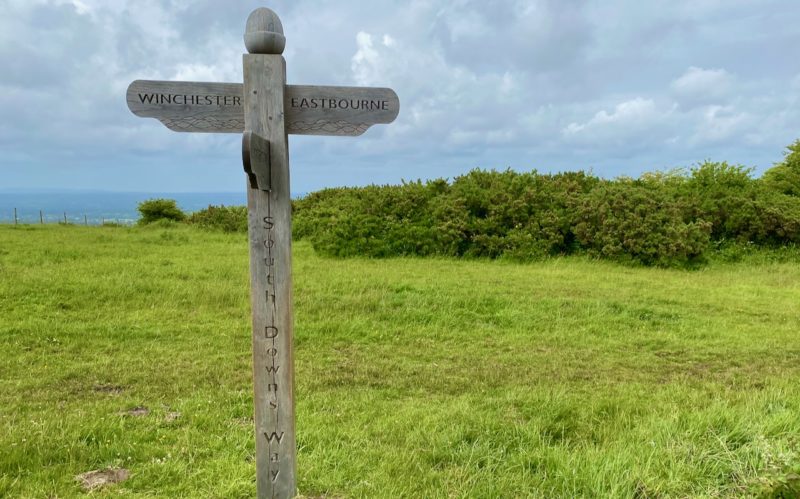
It’s the question we are asked most at this time of year. We’re currently hiking the South Downs Way in preparation for walking at altitude in the Alps later this summer. We’ve now done a third of the route, Eastbourne to Brighton. UPDATED
We started in Eastbourne in East Sussex and are now heading west towards Winchester in Hampshire – 100 miles of some of the most stunning scenery this part of the UK has to offer.
We have now done more than a third – Eastbourne to Brighton and have crossed the symbolic A23 into West Sussex.
We’re not doing it one go, but rather spread out over a few weeks, heading from our base in London for day trips combined with a few overnight stops.
It should set us up well for some hiking in the Alps later this summer.
South Downs Way. Image © PlanetSKI
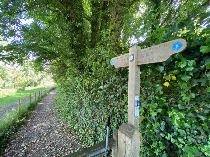
We are not going to attack it in any sort of ‘boot camp’ way, but rather take it easy and head off the beaten track if we feel like it.
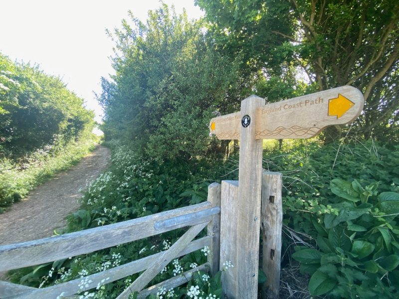
That will include sections of the England Coast Path away from the main South Downs Way.
We’re going to be meandering, rather than marching.
Our coverage will be more of a photo gallery of the route, rather than an article packed with information.
Getting ‘match fit’ for the Alps is our primary goal.
And maybe we’ll be inspiring a few of our readers to do sections of the South Downs Way too if it is within reach.
Below are the Five stages so far completed, in chronological order:
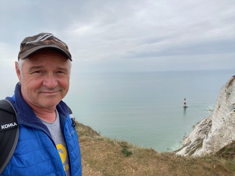
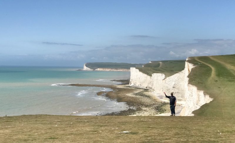
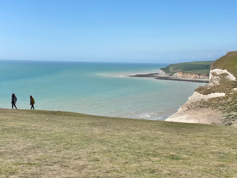
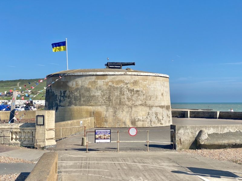
Stage One – Eastbourne to Birling Gap
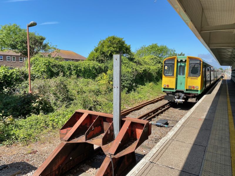
It’s a simple train ride from London down to Eastbourne and we’re starting with a circular walk so we end up back at Eastbourne station to head home after our day’s efforts.
The start is a steep affair from the seaside town and soon it slips away in the distance as nature takes over.
South Downs Way. Image © PlanetSKI
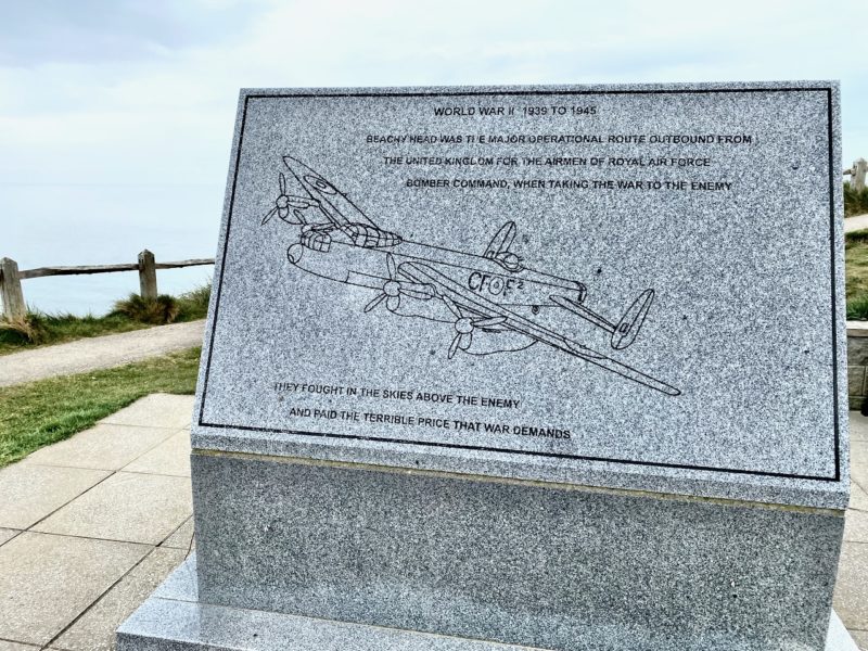
There is information about what happened overhead more than 80 years ago.
South Downs Way. Image © PlanetSKI
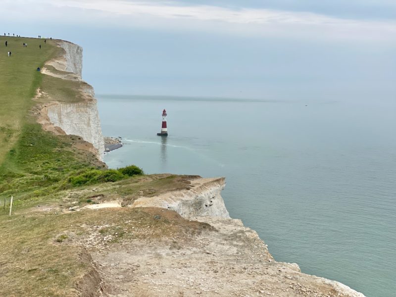
Then Beachy Head itself.
South Downs Way. Image © PlanetSKI
South Downs Way. Image © PlanetSKI
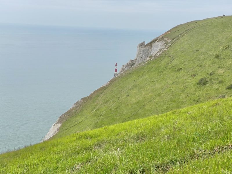
The views towards the Belle Tout lighthouse were simply stunning.
South Downs Way. Image © PlanetSKI
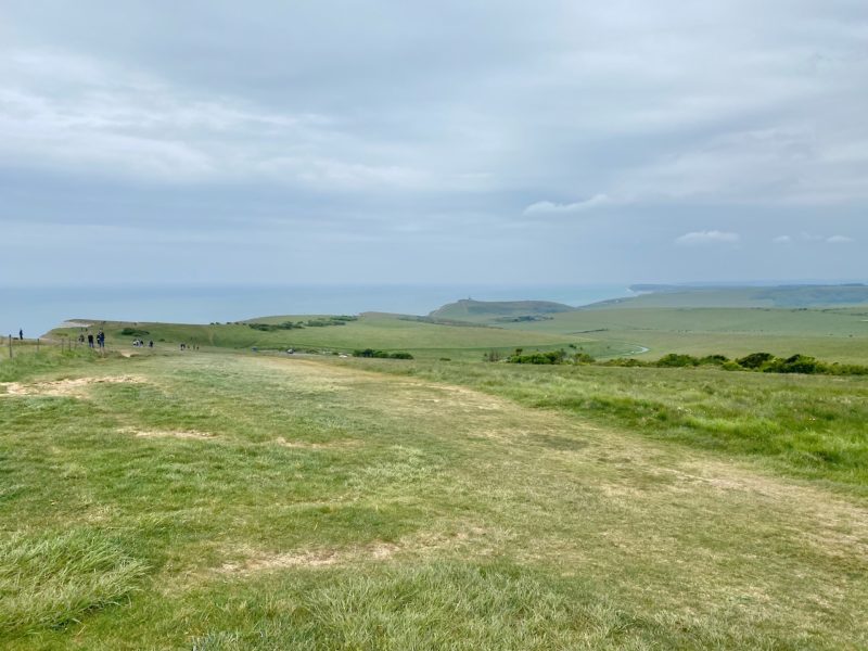
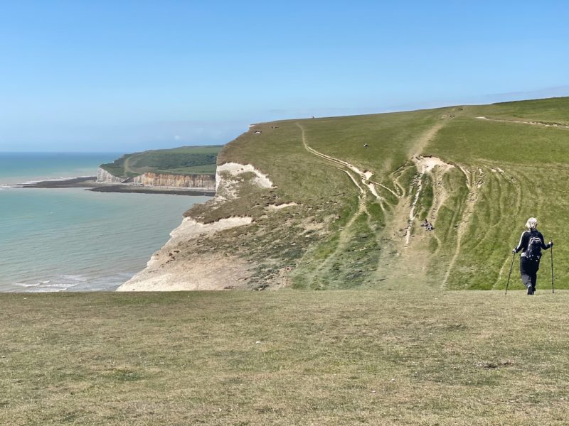
Like hiking in the mountains in the summer or ski touring in the winter it is a challenge to see where you have to get to, but surprising how simple putting one in front of the other gets you there.
Patience and plodding is required.
South Downs Way. Image © PlanetSKI
South Downs Way. Image © PlanetSKI
South Downs Way. Image © PlanetSKI
It was a simple hike to Birling Gap and then we turned inland to walk back through the fields and farms.
South Downs Way. Image © PlanetSKI
South Downs Way. Image © PlanetSKI
The circular walk is a simple day excursion form London and we hiked 18.9 kms (11.7 miles) miles over five hours or so.
South Downs Way. Image © PlanetSKI
South Downs Way. Image © PlanetSKI
South Downs Way. Image © PlanetSKI

South Downs Way. Image © PlanetSKI
South Downs Way. Image © PlanetSKI
Stage One of our quest to get fit for summer hikes in the mountains of the Alps was a success.
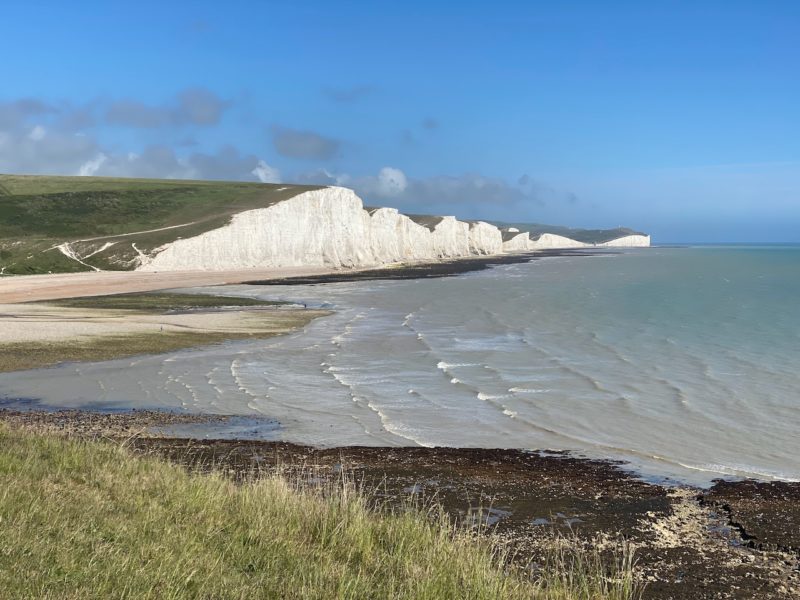
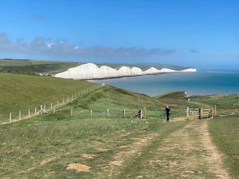
Next we’re starting at Birling Gap and walking the famous 7 Sisters, then veering off the main South Downs Way that heads inland as we’ve heard the views from Seaford Head are some of the best ones.
Meandering off the main route proved to be the right call.
South Downs Way. Image © PlanetSKI
Stage Two – Birling Gap to Seaford
Reaching the start was a simple train ride from London to Seaford and then the number 12x bus that stops 16 minutes later at East Dean.
Seaford is a single track railway and is the end of the line.
South Downs Way. Image © PlanetSKI
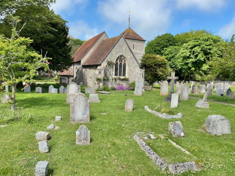
East Dean is noteworthy for its church on the way to Birling Gap and the start of the Seven Sisters.
South Downs Way. Image © PlanetSKI
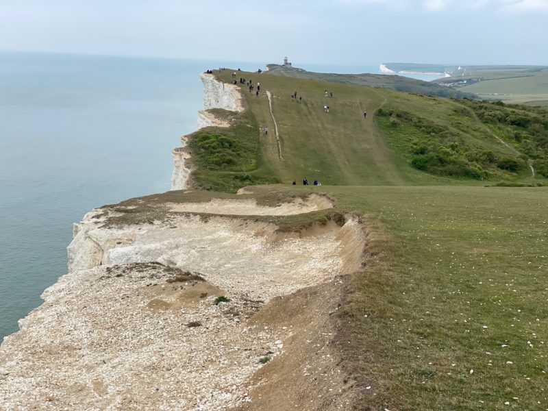
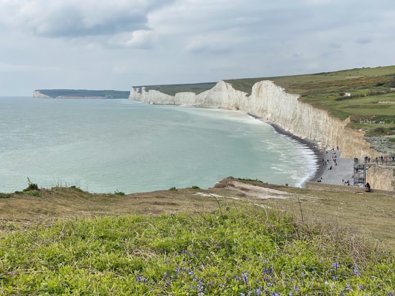
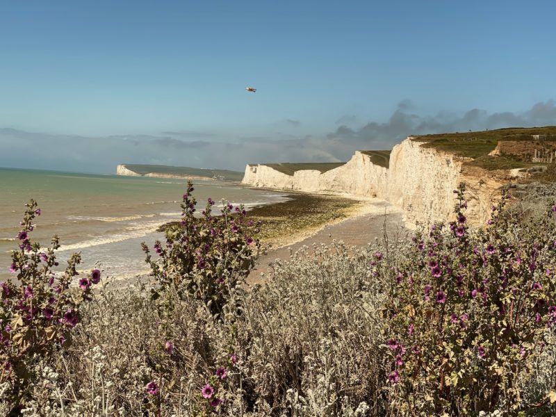
The views from Birling Gap itself towards the 7 Sisters and beyond remain stunning.
South Downs Way. Image © PlanetSKI
Up on the cliff top as we set off to hike the 7 Sisters it’s even better.
South Downs Way. Image © PlanetSKI
South Downs Way. Image © PlanetSKI
The cliffs are known as the Seven Sisters due to the seven distinct hilltops:
- Went Hill,
- Baily’s Hill
- Flat Hill
- Brass Point
- Rough Brow
- Short Brow
- Haven Brow
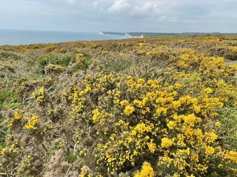
The bright white color of the cliffs is thanks to the abundance of chalk that makes up most of the cliff face.
It was deposited around 85 million years ago when the area was under water.
Chalk is mainly comprised of the skeletal remains of planktonic algae, known as coccolithophores, which accumulated to form a white substance on the seabed.

South Downs Way. Image © PlanetSKI
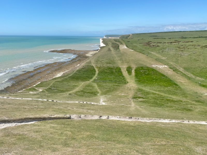
Today the chalk is above sea level.
The shifting of the European and African continental tectonic plates that created the Alps also pushed up the Seven Sisters.
This took place 25-30 million years ago.
They were then sculpted by melt-water during the ice ages and subsequent rainfall.
The series of chalk cliffs also continued to be eroded by the sea.
Man comes into the picture fairly late on in proceedings, but there is evidence of human habitation and presence in the area going back 4,000 years.
It was interesting contemplating such facts as we put one foot in front of the other on a glorious and sunny Spring day in 2022.
Who would have thought that the same forces that created the Alps helped form the Seven Sisters?
South Downs Way. Image © PlanetSKI
South Downs Way. Image © PlanetSKI
South Downs Way. Image © PlanetSKI
South Downs Way. Image © PlanetSKI
South Downs Way. Image © PlanetSKI
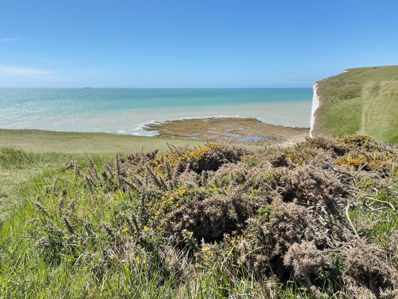
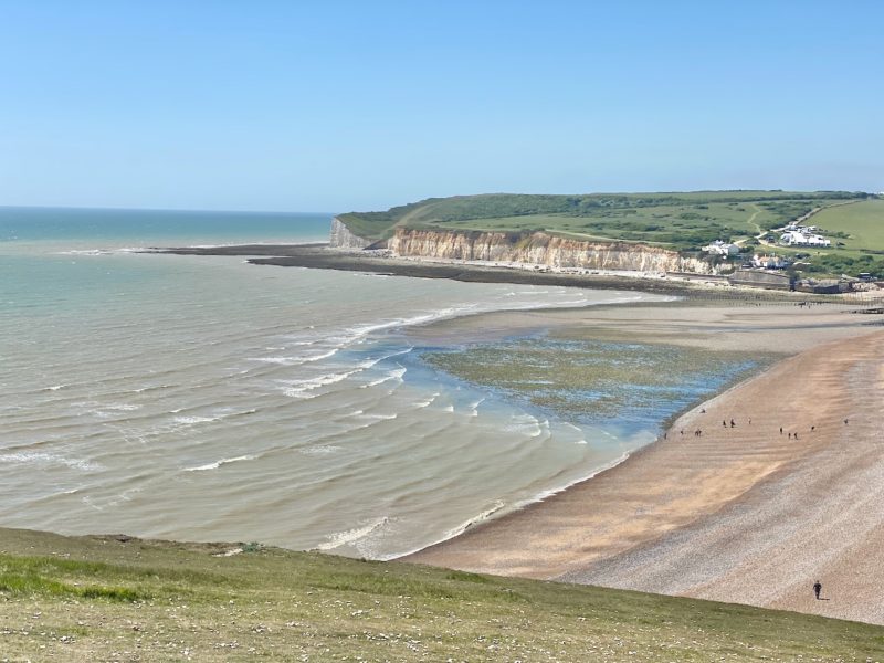
Once we had walked up down the Seven Sisters, perfect training for the alpine hikes to come later this summer, we reached Cuckmere Haven.
South Downs Way. Image © PlanetSKI
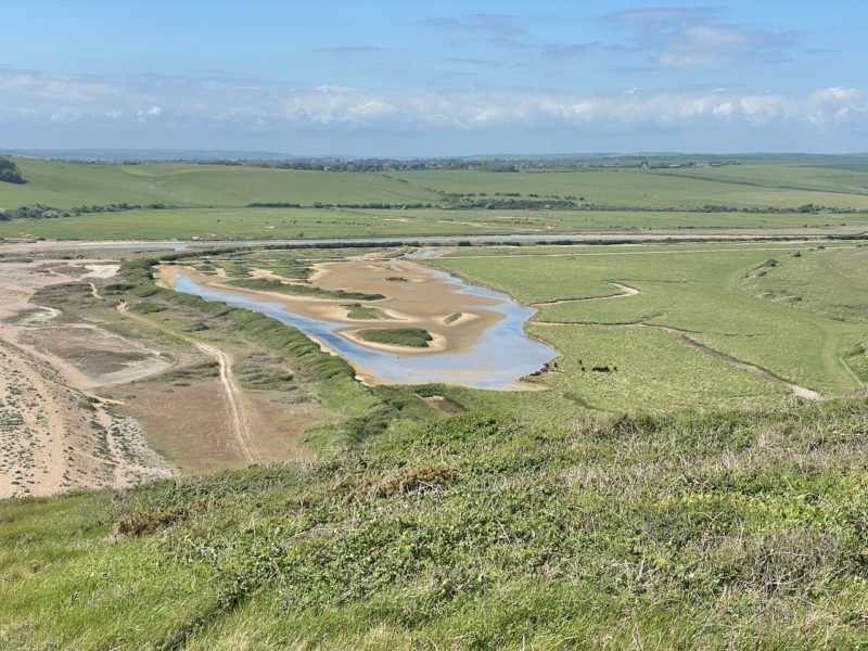
The views over the Cuckmere estuary were stunning and it remains the only unspoilt estuary in the south east of England.
South Downs Way. Image © PlanetSKI
It is home to waders such as dunlin, ringed polver and redshank.
The beach would have made a perfect landing ground for any Nazi invasion of Britain in World War Two and evidence of defensive fortifications remain.
The pill boxes:
South Downs Way. Image © PlanetSKI
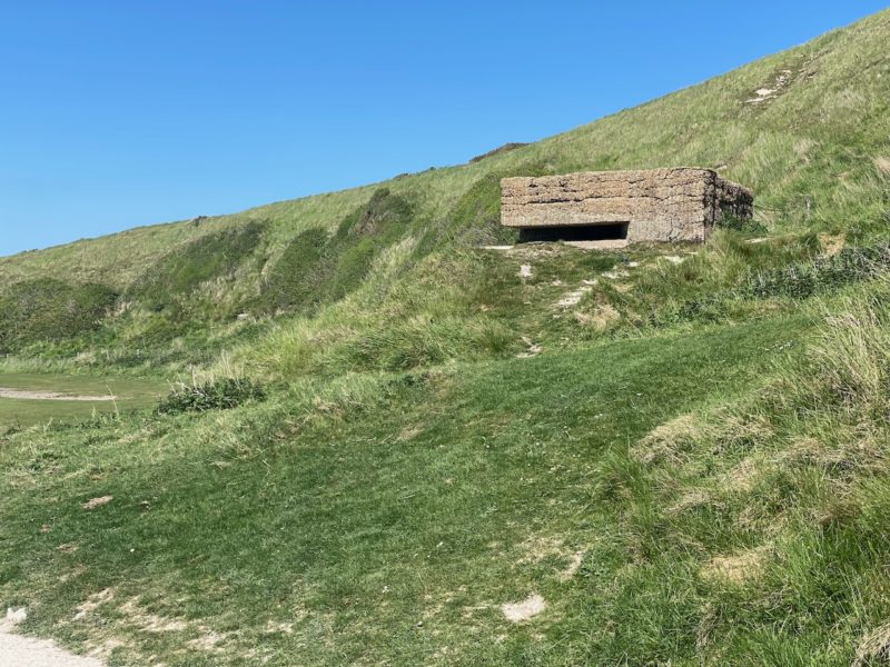
South Downs Way. Image © PlanetSKI
Tank traps:
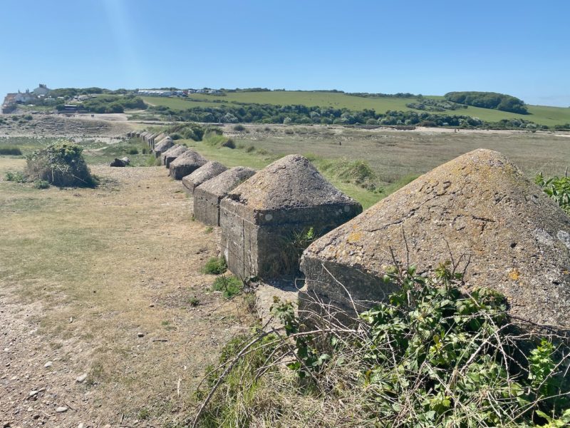
South Downs Way. Image © PlanetSKI
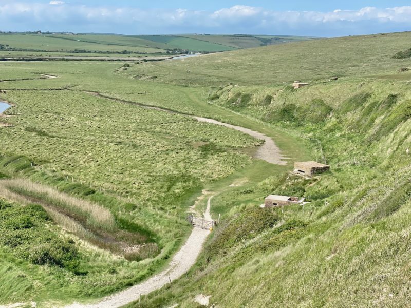
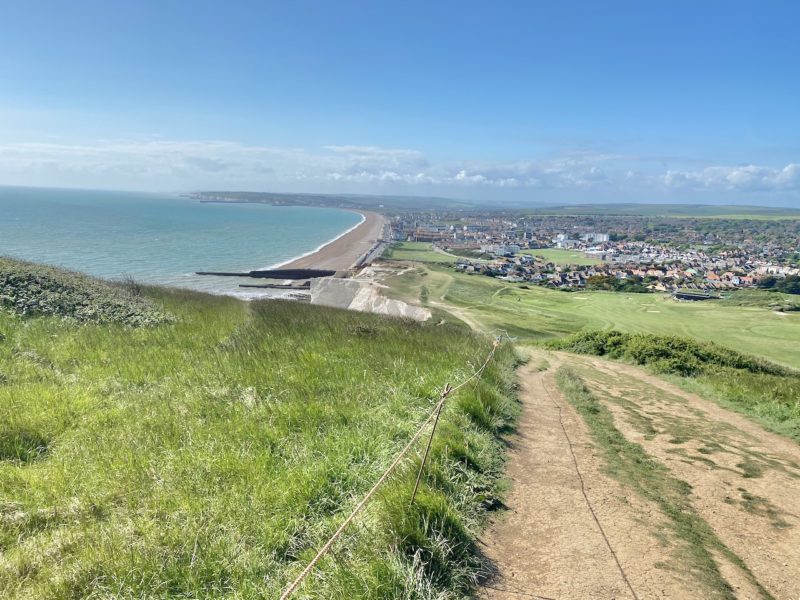
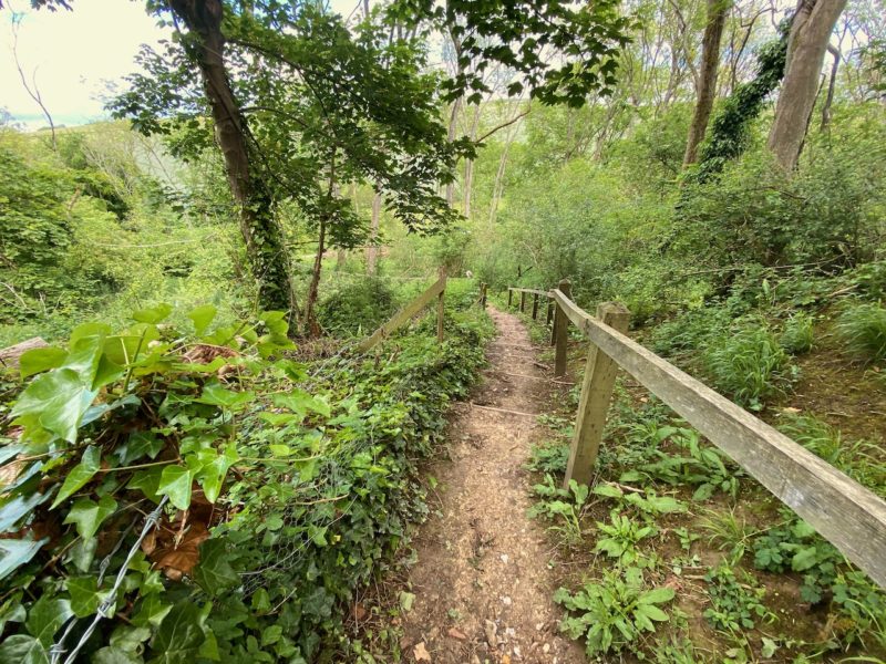
The main South Downs Way turns inland at this point following the Cuckmere river, but we decided to go off piste as we had heard that Seaford Head is worth a visit along the England Coast Path.
England Coast Path. Image © PlanetSKI
England Coast Path. Image © PlanetSKI
And so it turned out to be.
England Coast Path. Image © PlanetSKI

England Coast Path. Image © PlanetSKI
England Coast Path. Image © PlanetSKI
All too soon we were in Seaford.
England Coast Path. Image © PlanetSKI
In the past the British had not only feared invasion from Nazi Germany in this part of the world.
Back in the early 19th century Napoleon and his armies threatened invasion and 103 Martello towers were built to act as lookout posts for any approaching French fleet.
They stretch from in Aldeburgh in Suffolk to Seaford in East Sussex.
The one before us in Seaford was built in 1808 and is the most westerly one of them all.

England Coastal Path. Image © PlanetSKI
They stand up to 12m high and inside are two floors.
They had a garrison of one officer and 15–25 men.
Their round structure and thick walls of solid masonry made them resistant to cannon fire, while their height made them an ideal platform for a single heavy artillery piece, mounted on the flat roof and able to fire over a complete 360° circle.
England Coastal Path. Image © PlanetSKI
The walk from Birling Gap to Seaford, including our diversion, was 19.2kms.
It was, quite simply, stunning and worthy of any alpine hike.
Next we’re back to Cuckmere Haven to head inland towards Southease via Alfriston and then on to Lewes…
Stage Three – Lewes to Southease

South Downs Way. Image © PlanetSKI
All plans are made to be changed
Weekend engineering works on the railway line out of Victoria meant the journey to Seaford to pick up the stretch of the South Downs Way from Cuckmere Haven to Southease would take 2.5 hours instead of 1 .5 hours.
There was then a bus journey to reach the start.
Better to catch the train to Lewes and aproach Southease from the other direction.
That journey was under 2 hours and we could do the other section when rail services were back to normal.
We picked up the trail near Housedean Farm on the A27 after a short bus ride from Lewes.
South Downs Way. Image © PlanetSKI
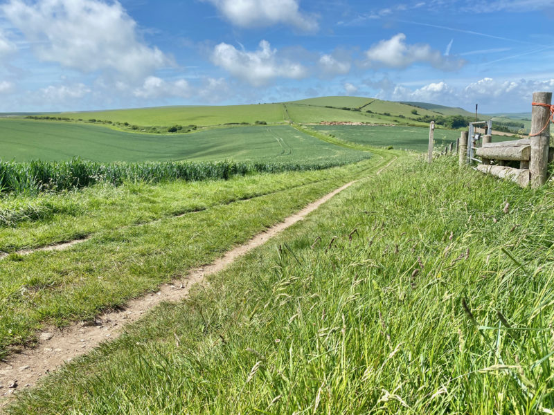
This inland section of the South Downs Way proved a stunning contrast to the cliff top walks at Beachy Head, the Seven Sisters and Seaford Head that we detail lower down this blog.
We were deep in the South Downs.
South Downs Way. Image © PlanetSKI

South Downs Way. Image © PlanetSKI
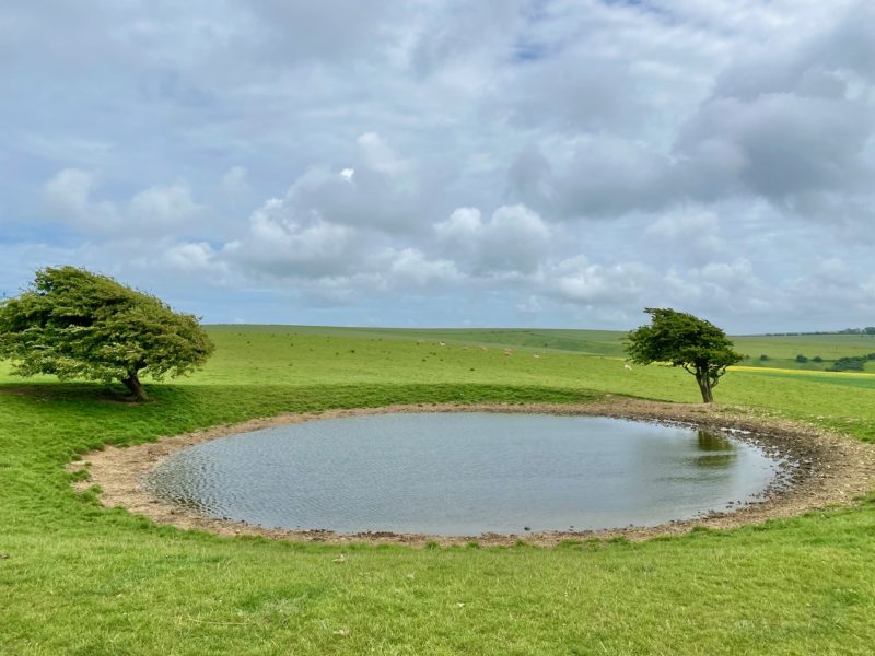
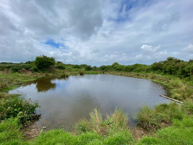
We soon spotted one of its famous ‘dew ponds’.
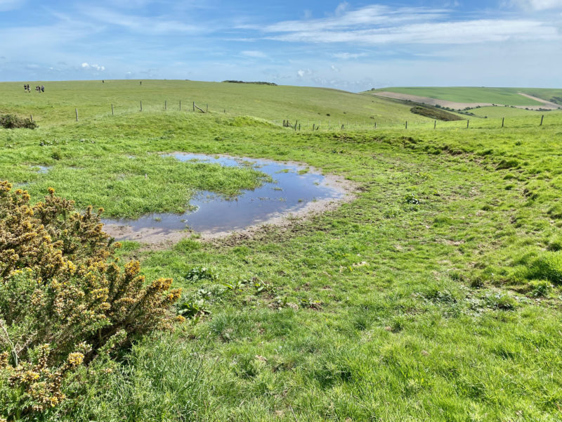
South Downs Way. Image © PlanetSKI
They are artificial ponds usually situated on the top of a hill and intended for watering livestock.
Dew ponds are used in areas where a natural supply of surface water may not be readily available.
The name dew pond is first found in the Journal of the Royal Agricultural Society in 1865.
Despite the name, their primary source of water is believed to be rainfall rather than dew.
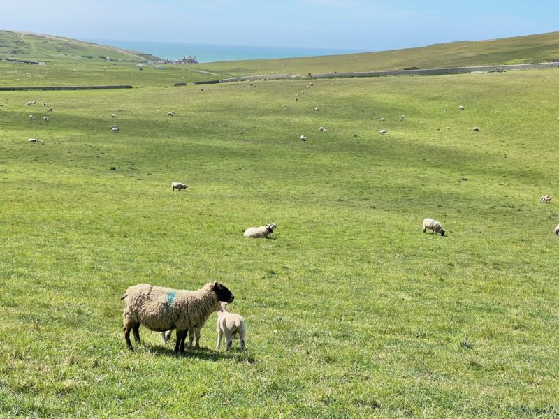
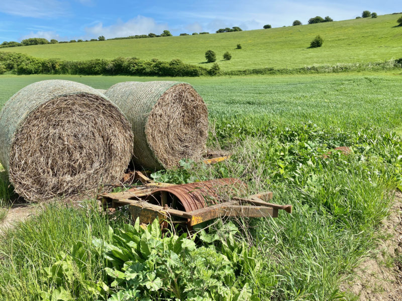
This is Sussex farming country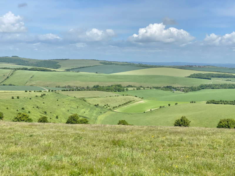
South Downs Way. Image © PlanetSKI
South Downs Way. Image © PlanetSKI
South Downs Way. Image © PlanetSKI

South Downs Way. Image © PlanetSKI
And it was important to look up too, as the cloud formations were simply spectacular.

South Downs Way. Image © PlanetSKI
South Downs Way. Image © PlanetSKI
South Downs Way. Image © PlanetSKI
South Downs Way. Image © PlanetSKI
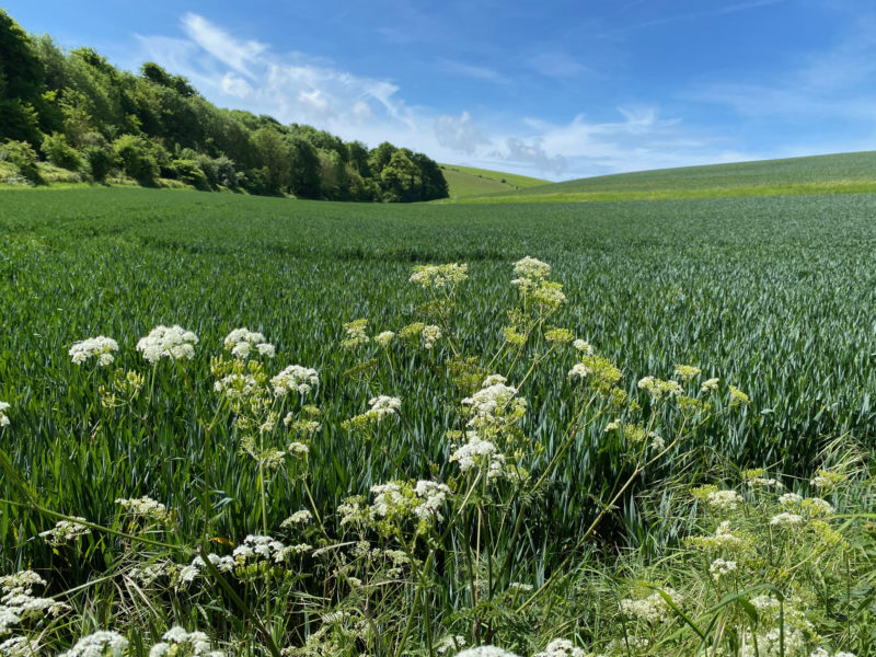
The flowers were just as pretty as on an alpine walk.
South Downs Way. Image © PlanetSKI
South Downs Way. Image © PlanetSKI
With some of the cows having bells round their necks it almost felt like the Swiss Alps with the sound of gentle ringing of cow bells.

South Downs Way. Image © PlanetSKI
However not all wear bells in this part of the world.
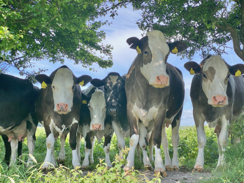
South Downs Way. Image © PlanetSKI
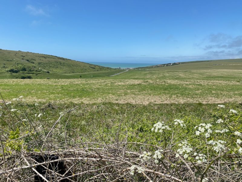
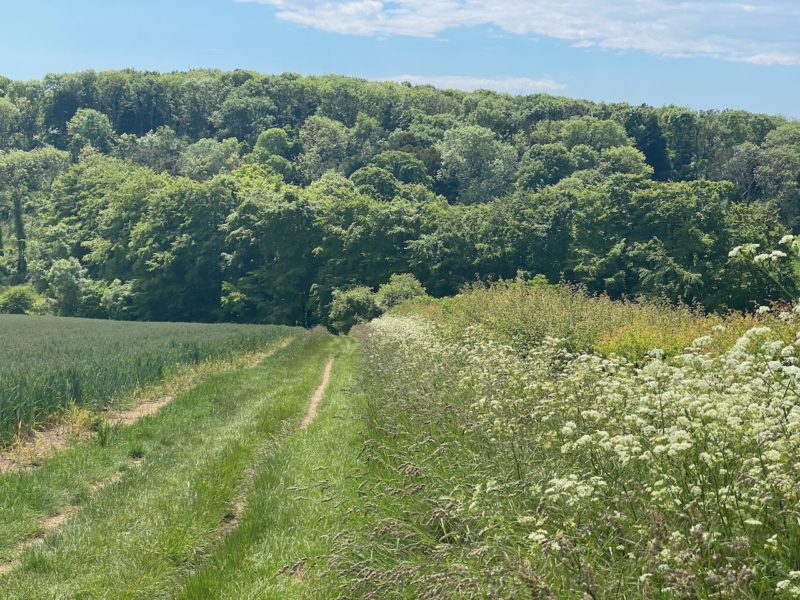
It was probably not such good training for high altitude alpine hikes as once we hiked up to the top of the Down the path was fairly flat.
More like cross-country skiing than steep ascents.
We simply meandered along the path enjoying the stunning scenery and talking of alpine hikes to come.
South Downs Way. Image © PlanetSKI
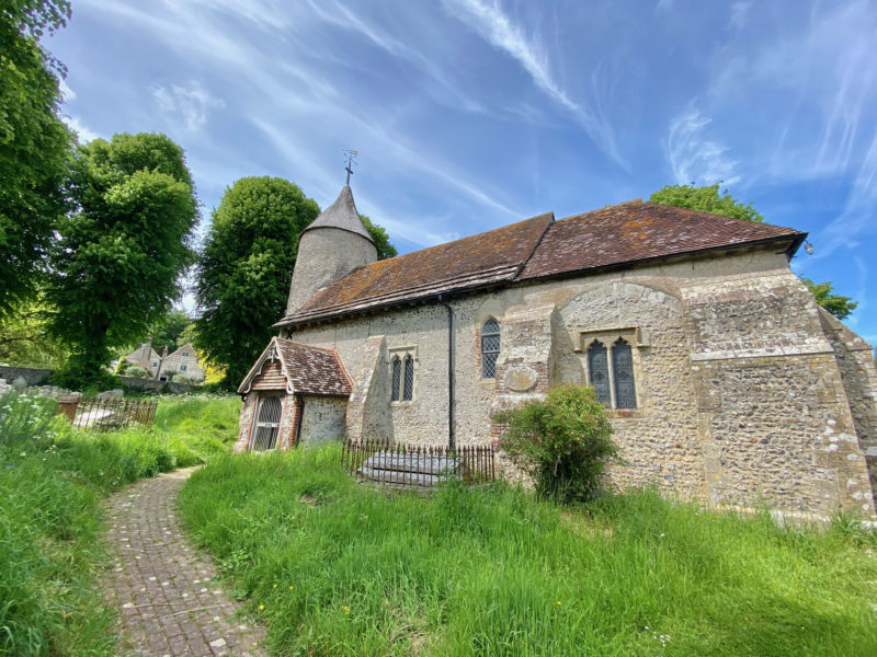
We paused at Southease church that is over 1,000 years old and parts of it pre-date the Norman Conquest of 1066.
The church has one of only three round towers in Sussex, all of which are located in the Ouse Valley with all three built in the first half of the 12th century.

South Downs Way. Image © PlanetSKI
South Downs Way. Image © PlanetSKI
Sadly the church was closed for roof repairs so we were unable to ventures inside.
We’d been planning to visit Virginia Woolf’s house in nearby Rodmell, Monk’s House, but that too was shut.

South Downs Way. Image © PlanetSKI
No matter.
A Virginia Woolf quote sprung to mind as I reflected on the day so far, “The Downs… too much for one pair of eyes, enough to float a whole population in happiness, if only they would look.”
We wandered along the River Ouse taking in some different scenery.

South Downs Way. Image © PlanetSKI
We found something just as interesting as we sought a crossing of the River Ouse to the local railway station – a swing bridge on the tidal section of the river.
The original bridge was constructed in 1790 and then replaced in 1880.

South Downs Way. Image © PlanetSKI
During the 18th and 19th centuries transport by road was poor and the railways barely existed so the industries that thrived in Lewes used the river as their preferred form of transport.
The boats mostly carried lime, chalk and coal.
The Southease swing bridge is a remnant of this forgotten age.

South Downs Way. Image © PlanetSKI
With the development of the railways in the mid 19th century traffic slowed and with the closure of the Lewes cement works in the 1960s the bridge was closed for good and welded shut.
The railway station itself is just 5-minutes from the swing bridge and time to head back to London.

South Downs Way. Image © PlanetSKI

South Downs Way. Image © PlanetSKI
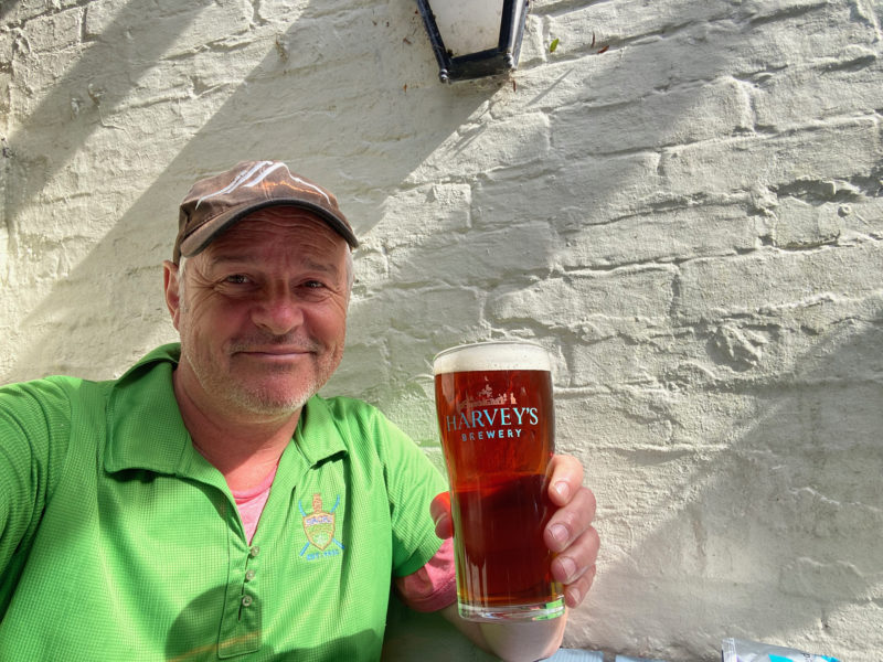
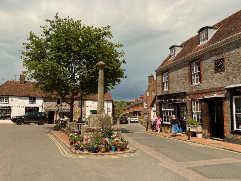
With a quick pit stop in Lewes.
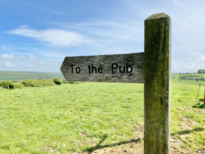
South Downs Way. Image © PlanetSKI
To enjoy a pint of the local Harvey’s bitter that comes in slightly cheaper than London prices – £4.40 a pint.
In the mountains an apres ski beer is a good way to round off a day’s skiing.
An apres hike beer is the perfect way to round off a day when hiking in the UK.
South Downs Way. Image © PlanetSKI
Cheers.
Next stop its back to try Cuckmere Haven to Southease (works on the railway line allowing), and then Lewes to Pyecombe via Ditchling Beacon.
Section Four – Exceat to Southease

South Downs Way. Image © PlanetSKI
We’re back doing a section of the walk that we missed out on due to weekend engineering works on the railway line (see details from Section Three below).
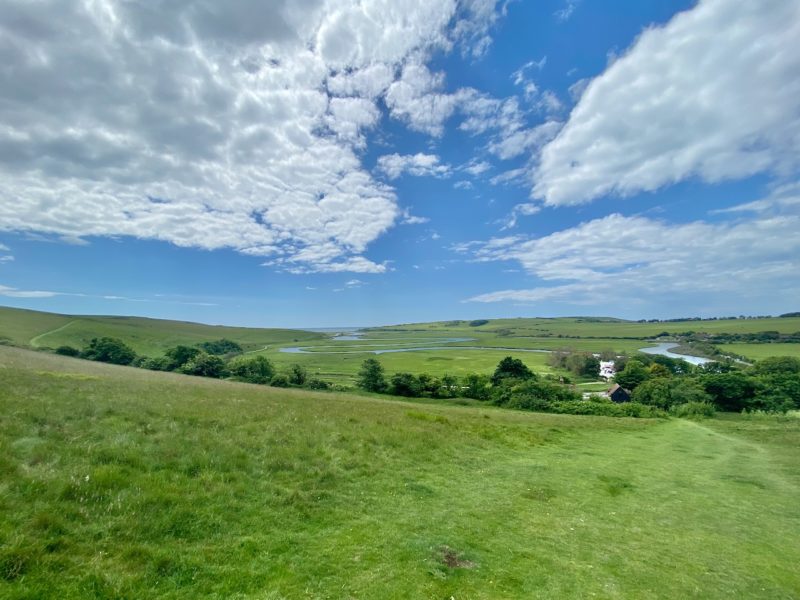
It starts near Cuckmere Haven with fabulous views down to the Cuckmere Estuary and the English Channel beyond.
South Downs Way. Image © PlanetSKI
The River Cuckmere rises near Heathfield in East Sussex.
It’s name probably comes from an Old English word meaning fast-flowing as it descends over 100 m (328 ft) in its initial 6.4kms (four miles).
It remains the only undeveloped river mouth on the Sussex coast

South Downs Way. Image © PlanetSKI
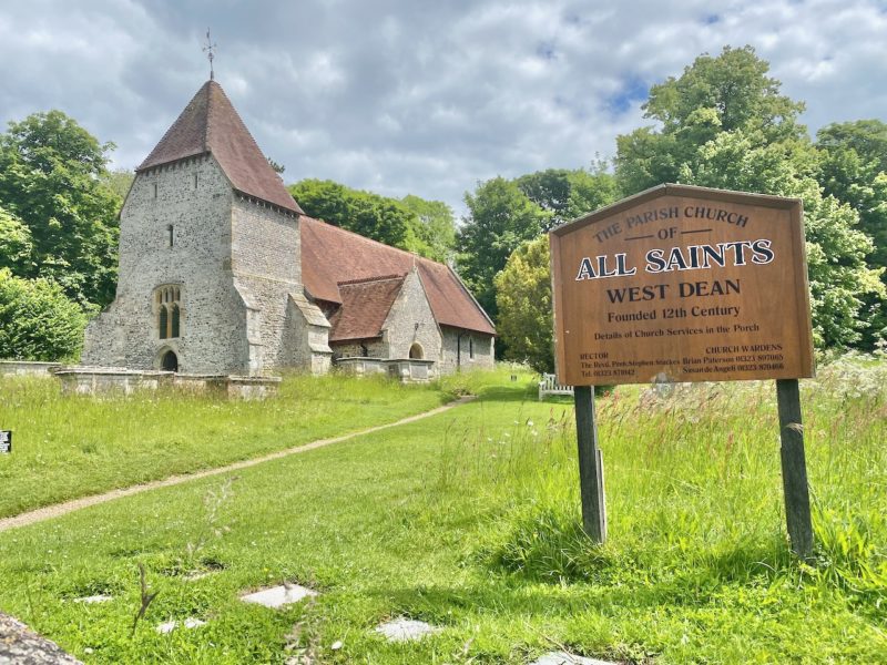
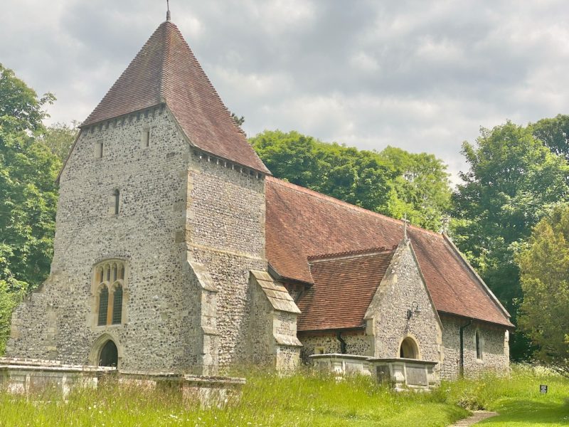
First stop today is the tiny village of West Dean, population 481, with another fabulous Saxon church to admire.
South Downs Way. Image © PlanetSKI
South Downs Way. Image © PlanetSKI
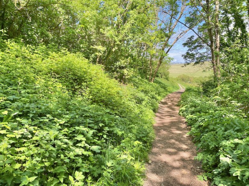
Unlike the previous walks high up on the South Downs Way, with views across the county and to the sea, this one started in the woods.

South Downs Way. Image © PlanetSKI
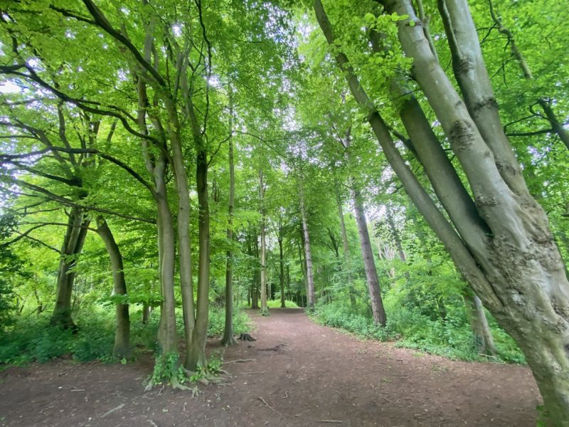
South Downs Way. Image © PlanetSKI
South Downs Way. Image © PlanetSKI

South Downs Way. Image © PlanetSKI
South Downs Way. Image © PlanetSKI
The path continues for three miles or so at a low level by the Cuckmere River to the village of Alfriston.

South Downs Way. Image © PlanetSKI
South Downs Way. Image © PlanetSKI
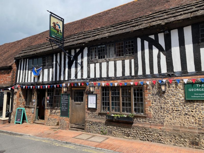
Alfriston is well worth a stop at its many pubs and/or tea houses depending on your tipple.
There was a pub on this site back in 1397 when the first innkeeper’s license was granted.
South Downs Way. Image © PlanetSKI
It is then a steepish walk back up to the top of the Downs with stunning views to match – this time across to the English Channel and deep into the Sussex countryside.
They say a picture is worth a thousand words, so we’ll let the pictures do the talking for the 5-mile hike to Southease high up on the South Downs.
Looking south:
South Downs Way. Image © PlanetSKI
Looking north:

South Downs Way. Image © PlanetSKI
South Downs Way. Image © PlanetSKI

South Downs Way. Image © PlanetSKI
South Downs Way. Image © PlanetSKI
Just under a couple of hours later we were back at the magnificent Southease railway station, just down the line from Lewes.

South Downs Way. Image © PlanetSKI
When we first began of our day trips from London to walk the South Downs Way we had made Lewes our first primary goal as it is about a quarter of the route.
Tick.

South Downs Way. Image © PlanetSKI

South Downs Way. Image © PlanetSKI
Next stop Lewes to Pyecombe…
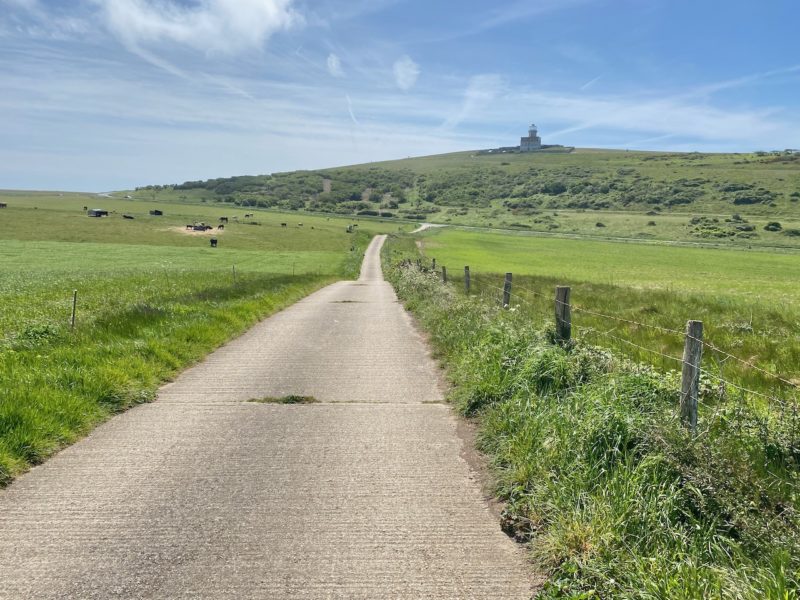
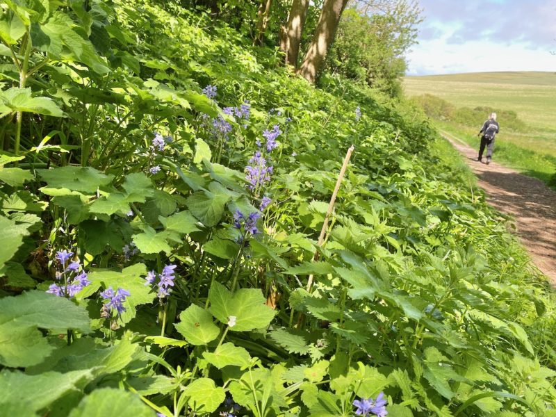
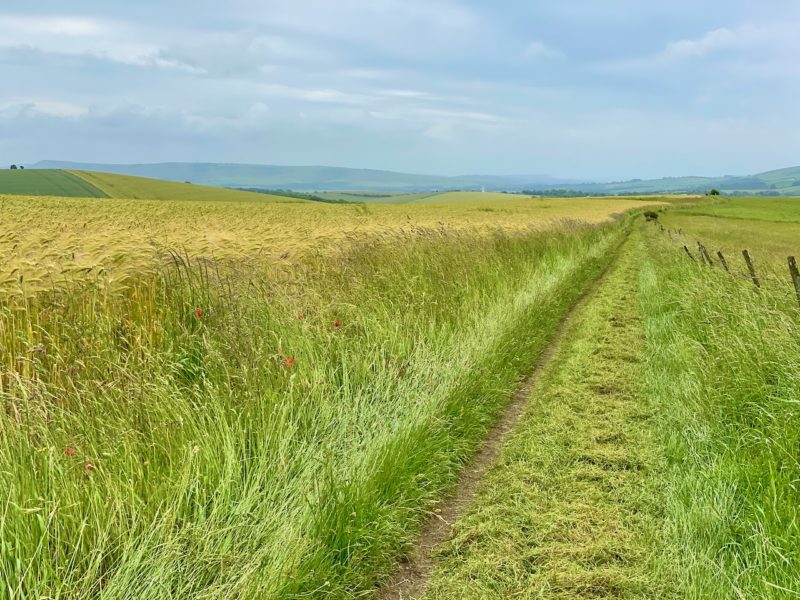
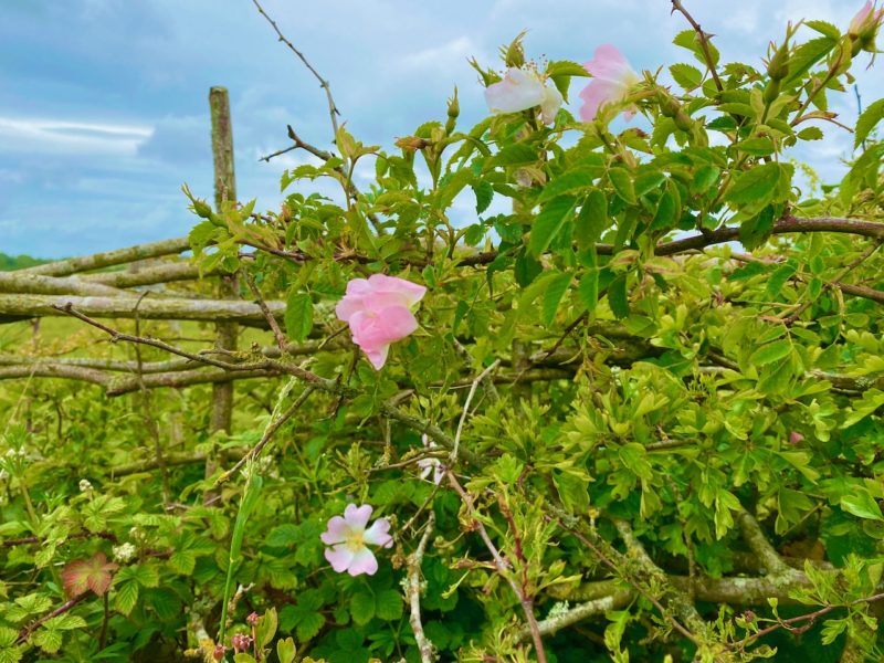
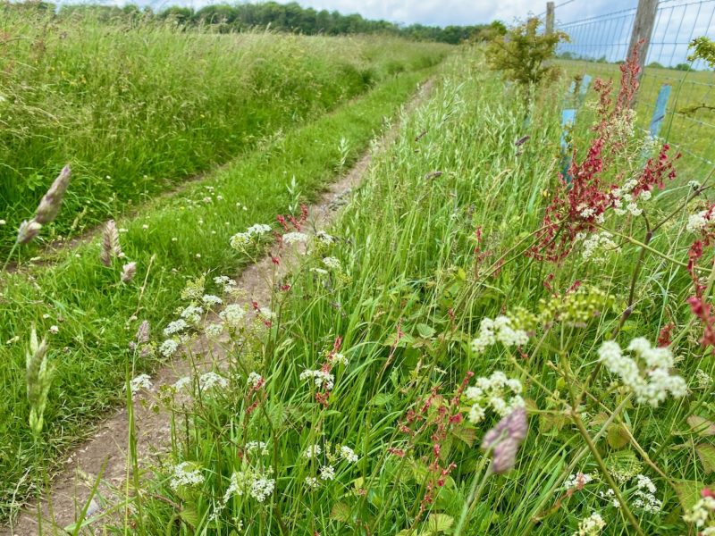
Stage Five – Lewes to Pyecombe (Brighton)

South Downs Way. Image © PlanetSKI
It was a familiar start as we took the train from Clapham Junction to Lewes then the bus to Housedean Farm a few weeks back as we headed to Southease (Stage Three).

South Downs Way. Image © PlanetSKI
That time we turned east, this time we are heading west.
South Downs Way. Image © PlanetSKI
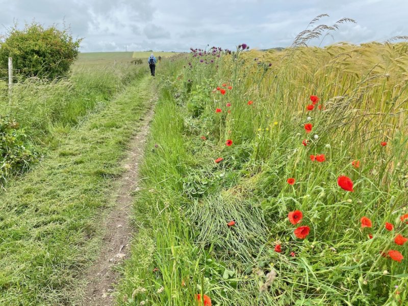
Deep into the Sussex Downs, where for the first couple of hours we saw just one other hiker.

South Downs Way. Image © PlanetSKI
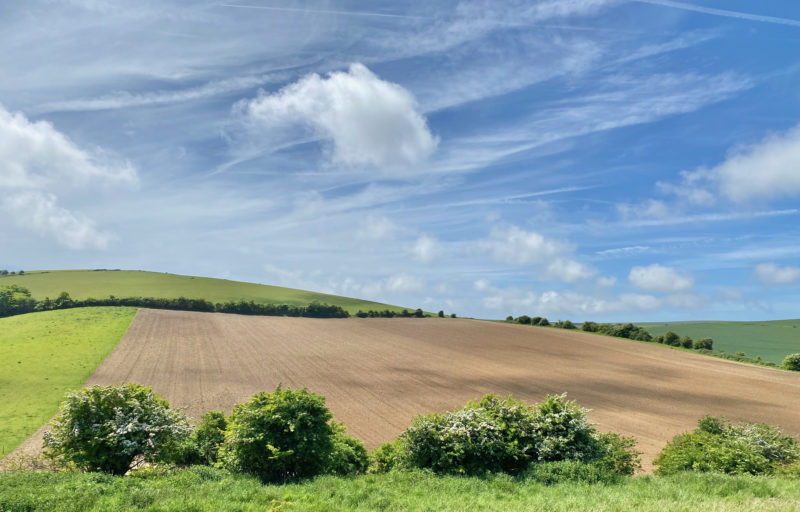
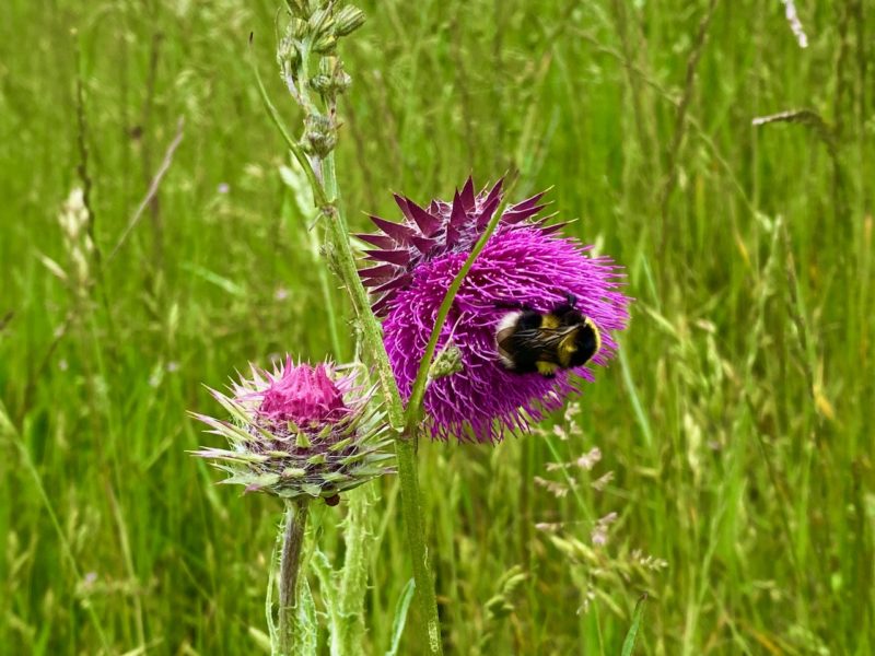
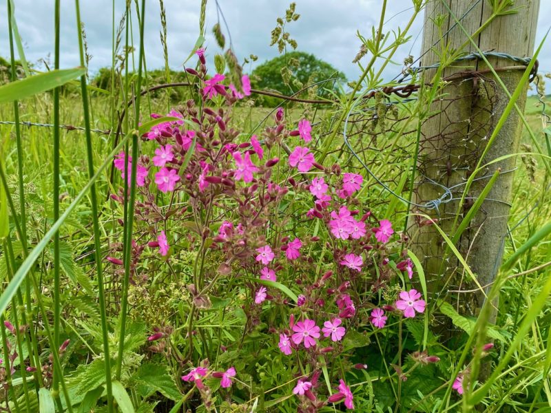
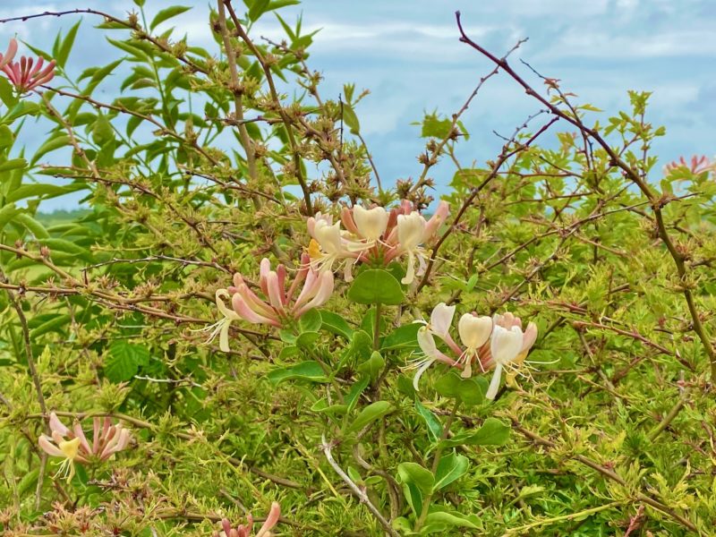
Now previous blogs have produced images of some stunning panoramic views in this part of the world.
Today we are going mainly to concentrate our images on things closer to hand.
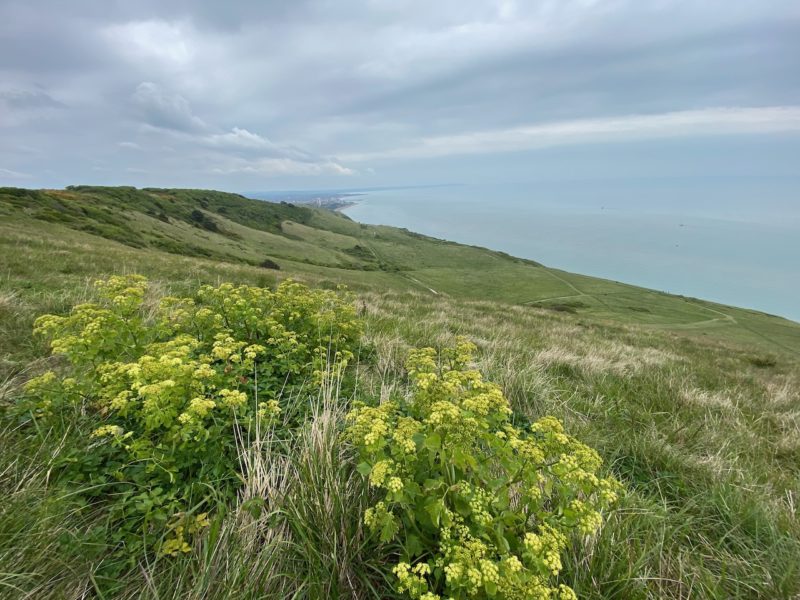
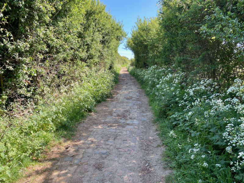
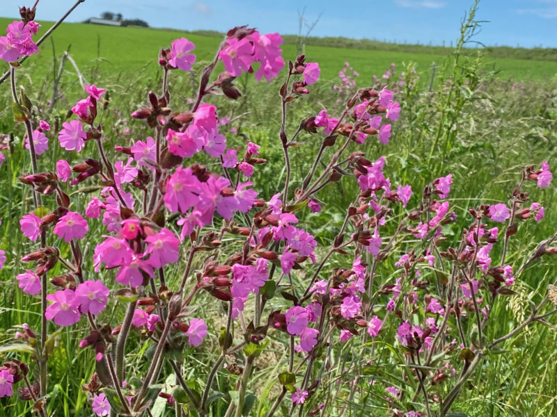
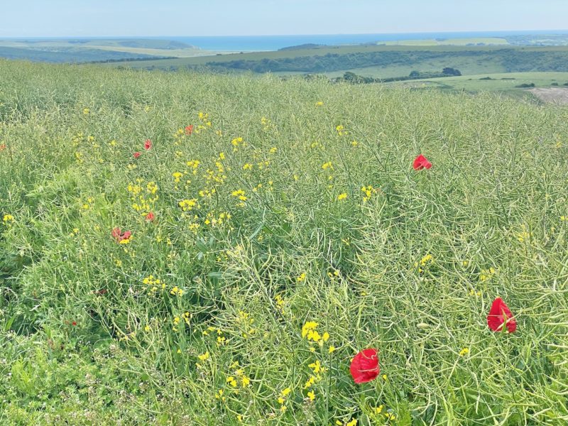
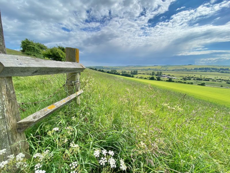
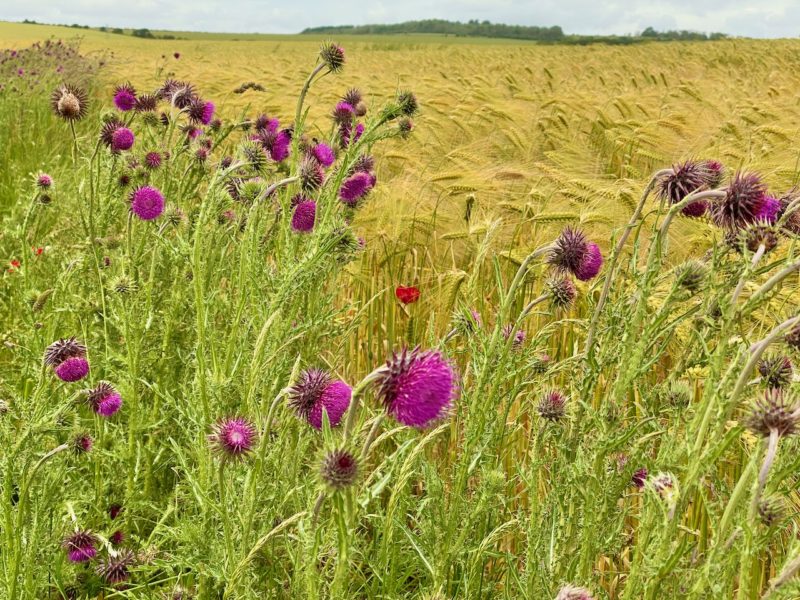
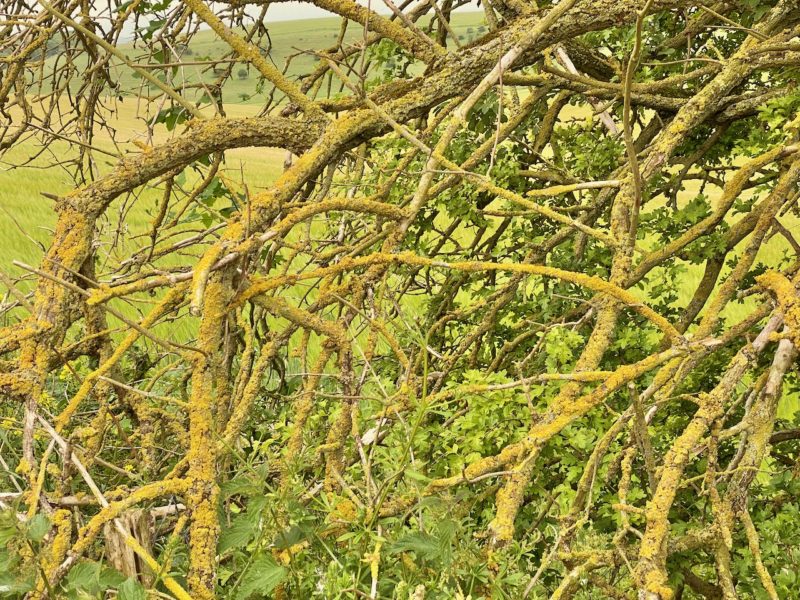
The fabulous wild flowers and hedgerows in the South Downs.

South Downs Way. Image © PlanetSKI

South Downs Way. Image © PlanetSKI
South Downs Way. Image © PlanetSKI
And here’s the only other person that we saw in the first part of the day coming towards us.
South Downs Way. Image © PlanetSKI

South Downs Way. Image © PlanetSKI
South Downs Way. Image © PlanetSKI
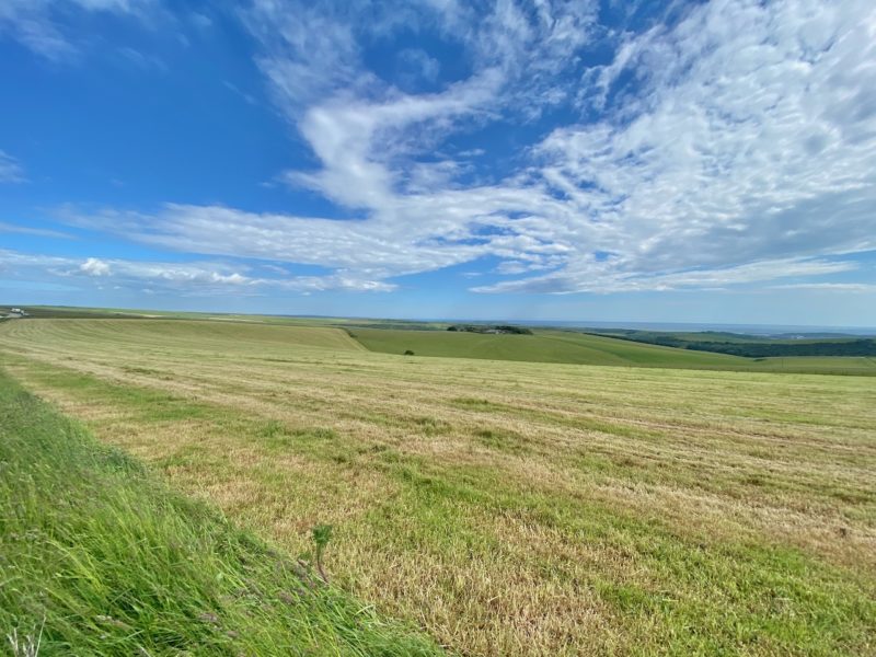
OK, we can’t resist one panoramic view.
South Downs Way. Image © PlanetSKI
Back to the flowers and wildlife.
South Downs Way. Image © PlanetSKI
South Downs Way. Image © PlanetSKI
South Downs Way. Image © PlanetSKI
South Downs Way. Image © PlanetSKI
South Downs Way. Image © PlanetSKI

South Downs Way. Image © PlanetSKI
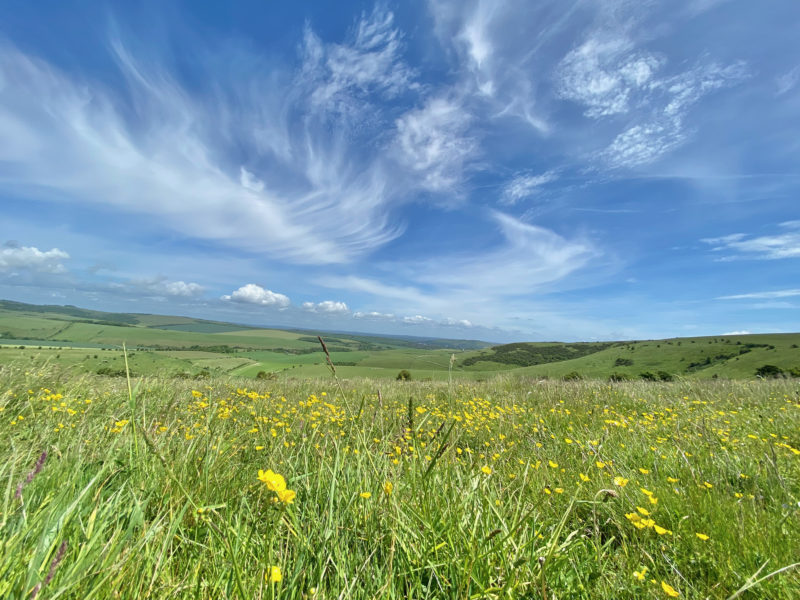
This was our picnic lunch spot by Ditchling Beacon and looking north.

South Downs Way. Image © PlanetSKI
The Beacon has some history.

South Downs Way. Image © PlanetSKI
The weekend after next, Sunday 19th June, I’ll be passing by Ditchling Beacon on my bike for the annual London to Brighton cycle ride, but today it was deserted at the summit.

South Downs Way. Image © PlanetSKI
And on the top of The Down there is water for the animals, whether in the man-made dew ponds or natural ponds.
South Downs Way. Image © PlanetSKI
South Downs Way. Image © PlanetSKI
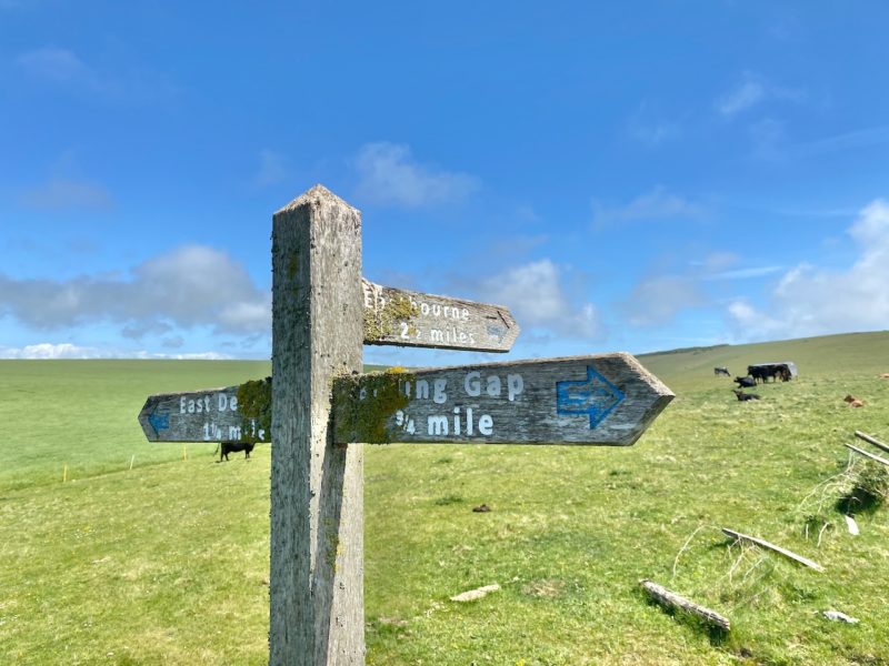
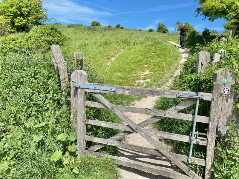
Once past the Beacon it was a a shortish walk down to Pyecombe on the A23 and the 270 bus to Burgess Hill and the train back to London.

South Downs Way. Image © PlanetSKI
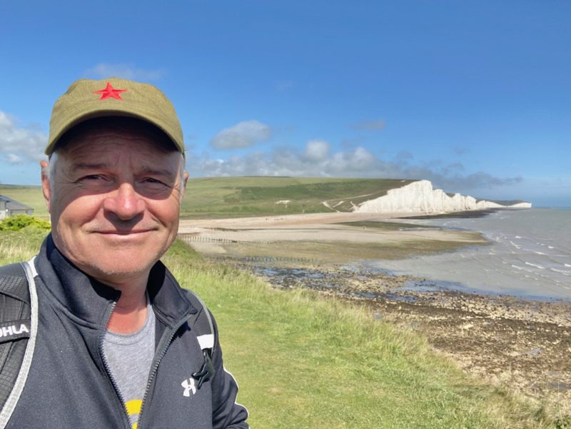
With a reminder of where we were and what we were doing, if any were needed.
South Downs Way. Image © PlanetSKI
We have now done about a third of the 100 miles or so and for the next few stages we are going to be staying overnight on the route.
Next stop Pyecombe to Steyning, and into West Sussex…
South Downs Way. Image © PlanetSKI


