Less Snow in Switzerland But Same Number of Avalanche Deaths
6th April 2023
Last modified on April 26th, 2023
That’s the conclusion from the Swiss Institute for Avalanche Research that has published its preliminary report on the 2022/23 season.
It says the winter was “exceptionally poor in snow, but the number of accidents close to the average.”
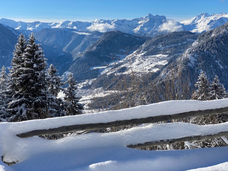
It states that Winter 2022/23 was significantly warmer and drier than normal.
“Over the whole winter, the average snow depths were significantly lower than average.
“Especially between mid-February and mid-March, the snow depths in the Swiss Alpine area have never been so low since the start of the measurements.’
Twelve avalanche accidents occurred, resulting in 15 fatalities with one person still missing.
The worst period was in March with five in five days, including four in the area around Verbier in the Valais canton.
We reported on them at the time here on PlanetSKI.

Avalanche accident. Image c/o Valais Cantonal Police
The number of victims was close to the 20-year average, which is 17 dead at the end of March.
It was only winter sports enthusiasts who were in unsecured terrain: nine people were hiking, and six off-piste skiing.
Three accidents claimed the lives of two people each time, and one person in the other cases.
This winter, a continuous snowpack formed around November 20th north of the main Alpine ridge, and in early December south of it.
Due to high temperatures with rain up to more than 2,000m this snow disappeared during the holiday season.
The snowpack did not form again in the north in below 1600 m only around January 10th.
Due to the low accumulations of fresh snow and the many days of snowmelt in February and early March, this snow also disappeared below 1,500m from the beginning of March over a large area.
The daily snow depths were therefore lower than average over a large part of winter.
However, there were two exceptions: first, in mid-December, several snowfalls left a continuous snowpack for a few days.
In mid-January, new snowfall down to low altitude, but this time only northwest of the main Alpine ridge.
This snow quickly melted away, so by the end of February many long-standing resorts had lower snowfall than ever at this time of year.
Despite some lesser snowfall in March, average snow depths at multi-year stations above 1,000m averaged only 26% of normal March snow depths.
Over the winter as a whole, the significant lack of precipitation and higher than average temperatures between November and March resulted in average snow depths well below average.
The deficit (compared to the average from 1991 to 2020) was about 80% in stations located at less than 1,000m, which means that the average relative snow depth was only 20%.
In the stations located above 1,000 m, the deficit was 70%.
The winter we have experienced so far can therefore certainly be called “exceptional”.
Verbier, Switzerland. Image c/o PlanetSKI
The data from the stations show that the evolution so far can best be compared to the two winters of 1963/64 and 1989/90, these two winters not having been above 1000 m quite as much.
In total, from October 1st 2022 to March 31st 2023, 118 avalanches causing damage (material and bodily) were reported to the SLF.
Of these, 103 avalanches involving people (average over the past 20 years: 125) affected a total of 149 people.
The number of people affected, 169, is slightly lower than the average of the past 20 years.
On March 31st, the number of avalanches causing material damage was 15
This is significantly lower than the average of the last 20 years at the end of September, which was 90 avalanches; however, the complete inventory of material damage is not available until the end of September.

Verbier Piste Patrol. Image © PlanetSKI
The full report from the Swiss Institute for Avalanche Research, SLF, (in French) is posted here.
Below is a Google translation of the report:
The high altitudes (above 2000 m) were covered in snow at the beginning of November.
Over the whole of the winter, the average altitudes (between 1000 and 2000 m) were covered in snow only temporarily.
The low altitudes (below 1000 m) only for a few days in mid-December, at the end of January and in March.
The phases of increased avalanche activity took place in the second half of December as well as in the first half of January and February.
On the other hand, due to the low snow cover and the rare episodes of snowfall, avalanche activity was relatively low from January to early March.
It was the abundant precipitation in March over a large part of the territory which, combined with a fragile old snowpack, led to persistent critical avalanche situations and numerous avalanche accidents.
In addition, the snowfall in March led to a marked improvement in snow cover at high altitudes in the north and the snow depths were closer to the average at the end of March.
However, the water stored in the snowpack has always been significantly lower than average, even at this altitude, due to the low density of the snow.
In Valais, Bernese Oberland and Grisons, twelve avalanche accidents occurred up to March 31, resulting in a total of 15 victims (normal: 17 victims at the end of March).
Until the end of March, the distribution of danger levels was roughly in line with the average of the past ten years.
After a particularly hot summer of 2022, there was only little snow in October on the shady slopes in the high mountains.
OCTOBER
During the last decade of October, it then snowed heavily in the high mountains, especially in parts of the main ridge of the Alps where it fell by 100 to 150 cm above 3500 m.
NOVEMBER
In November, the ground gradually became snow-covered at medium and high altitudes.
During the first and third week of November, it snowed up to medium altitudes over a large part of the territory, except in the extreme south.
In the high mountains, and especially on the shaded slopes, the snow has settled on a layer of old snow; elsewhere, it generally settled on bare ground.
During the last week of November, it also snowed over a large part of the territory, mainly in the west.
The heights of the Jura and the highest peaks of the Sotto Ceneri were also whitewashed for the first time.
In the west, snow depths at the end of November were average to slightly above average, while elsewhere they were generally below average.
In the south, they remained well below average.
In the western and northern Swiss Alps, a still thin, but increasingly continuous and stratified snowpack has developed.
At altitude, it was strongly worked by the wind.
The avalanche hazard usually came from windblown snow.
In addition, loose layers having undergone a constructive metamorphosis with angular grains were already present in the snowpack.
Dangerous spots for breaks in old snow were, however, only present in small areas due to the thinness of the snowpack.
Avalanche activity remained low in November.
These were usually small avalanches.
DECEMBER
At the beginning of December, it then snowed in the south up to medium altitudes.
It was in western Ticino that the snow accumulation was the greatest with around 100 cm.
The south wind blew moderately south and carried the fresh snow.
In the north, the foehn rose and carried loose old snow close to the surface.
The avalanche danger has increased over a large part of the territory, due to fresh snow and snow drift.
Some medium to large spontaneous avalanches occurred, especially in the south and in areas adjacent to the main ridge of the Alps.
Small avalanches triggered by people have been reported locally.
On December 3, the first fatal avalanche accident of the season occurred at Piz Radönt at around 3000 m above sea level (Zernez/GR).
First snow in December down to the plains, then continuous rain up to 2200 m with a high danger of avalanches and numerous avalanches of wet snow and dry snow
The rest of December was initially cold and snow fell over much of the territory during the second week of December, with a predominance in the west.
To the east and south, the amounts of fresh snow have decreased significantly.
For the first time, it also snowed down to the plains over a large part of the Plateau.
The avalanche danger has increased at altitude, and significantly in the west.
Fresh snow and windblown snow were the main hazard.
In addition, the thin old snow cover and the old snow surface had undergone a constructive metamorphosis and therefore formed a fragile base for fresh snow and snow drift.
Avalanches could be easily triggered or sometimes occurred spontaneously in areas affected by fresh snow, but also on the main ridge of the Alps, where loose old snow was transported by the northern foehn.
Subsequently, several avalanche accidents involving people occurred, with two deaths to be deplored (Pass dei Omenit, Mesocco/GR and Chantonnet, Orsières/VS).
During the days before Christmas, when the rain-snow limit rose to 2200 m with persistent precipitation, the avalanche situation was characterized by wet snow at the middle altitudes and, at altitude, by fresh snow and old.
Most of the precipitation, with an accumulation of up to 100 cm of snow, occurred above 2500 m in the extreme west of Bas-Valais.
But heavy precipitation also fell in the rest of Valais, on the northern slopes of the Alps and in northern Graubünden.
Only in Ticino and southern Graubünden the weather remained generally dry.
Below 2200 m, the intense and continuous rains soaked the snowpack.
The avalanche danger has increased significantly, reaching level 4 (high) in large parts of Valais and the northern ridge of the Alps.
The snowpack has sometimes become completely wet and many wet snow avalanches have resulted.
At high altitude, the old snowpack was fragile and, with the fresh snow load, many spontaneous avalanches were also triggered there.
Most of the avalanches occurred in Valais and were medium to large in size.
In some cases, the avalanches reached a very large size and descended to snow-free altitudes.
This was the first of the two most active avalanche periods of the winter, with avalanches of wet snow and dry snow.
During this period, however, no one was injured and only one damage has been recorded in the forest so far.
After the rain, spontaneous avalanche activity quickly diminished, but the situation at altitude remained dangerous in many places for hiking and off-piste.
This is explained in particular by the snow cover which only made it possible to cover many routes at this time for the first time this winter, and therefore by the fact that the “ very frequented ” bonus had not yet could be taken into account in the evaluation.
The avalanches could be easily triggered by people, on the one hand directly in the old snow, or near the surface, and they then carried the fragile old snow and thus gained momentum.
Around the end of the year, this situation caused several avalanche accidents.
At the end of December, there was very little or no snow below 2000 meters.
This was a completely exceptional situation.
But even above 2000 m the situation was not much better, the snow depths at the end of the year were only in the average in Valais, everywhere else they were lower.
JANUARY
January with fresh snow in the west and a persistent problem of old snow in the east
During the first week of January, the weather was mild and the avalanche danger initially decreased slowly to become limited (level 2) over a large part of the territory.
Windblown snow and fragile old snow were the main hazard.
During the second week of January, it snowed in the west and north, with a predominance in the north of Bas-Valais.
Due to the fresh snow and the strong wind, the avalanche danger has increased to a marked degree (degree 3) over a large part of the territory and sometimes to a high degree (degree 4) in the west.
In the west of Lower Valais, the fragile layers of old snow were meanwhile covered with a thick layer, so that the avalanches were mainly triggered at the transition to the old snow surface and no longer in deeper weak layers.
In the other regions with little coverage, the old snowpack remained fragile and other avalanche accidents occurred, including a fatal one in mid-January in the Gorihorn region (Davos/GR).
Strong west to southwest winds brought precipitation during the third week of January, which was once again particularly heavy in the west.
In the west of Valais, in the Vaudois and Friborg Alps, above 2000 m, 50 to 100 cm of snow has been recorded, and locally up to 150 cm.
Towards the east, the accumulations of fresh snow have decreased significantly.
At the end of the precipitation, the rain-snow limit descended to low altitudes and the plains also whitened.
The avalanche danger rose to high degree (degree 4) in the very west and was considerable (degree 3) over a large part of the territory.
In the west, numerous natural avalanches occurred, generally medium to large in size.
For snow sports enthusiasts, the situation was still dangerous in the western regions affected by fresh snow, but also in the northern and eastern regions where the snow was less abundant.
With generally sunny weather in the mountains during the last decade of January, avalanche triggers involving people were reported almost daily.
An accident that killed two people occurred in the Dent de Fully region (Fully / VS).
At the end of January, the snow depths were equal to or slightly lower than the average values in the Lower Valais, if not generally significantly lower than these.
FEBRUARY
February first cold with a north wind and fresh snow in the east, then spring with sluffs and avalanches of wet snow during the day, historically low snowfall.
During the north wind episode from late January to early February, frost formed on the snow surface and the constructive metamorphosis of the snowpack progressed.
In addition, the northeast wind carried loose snow close to the surface.
Where windblown snow settled on a loose surface that had undergone constructive metamorphosis or on an overall fragile old snowpack, the latter was susceptible to rupture and avalanches could easily be triggered by people.
During the first week of February, it snowed up to medium altitudes in the eastern Swiss Alps, and especially, with up to 50 cm of new snow, on the northern slope of the Alps east of the Reuss as well as in northern Graubünden and northern Lower Engadine.
An at times strong to stormy northwesterly wind carried the fresh snow and loose old snow.
The avalanche danger has increased significantly in the regions affected by the fresh snow, reaching the high degree (level 4) in the Prättigau and in parts of the Lower Engadine.
The reason for this was not only the fresh snow, but also the extremely fragile old snowpack and the high probability of triggering avalanches at all aspects.
In areas affected by fresh snow, an increased number of natural avalanches and avalanches triggered artificially, i.e. by mines or by people, have occurred.
An accident that killed two people occurred in the off-piste ski area of Sedrun/Disentis (GR).
Remotely triggered avalanches and noticeable signs of danger, such as thuds, were also frequently observed.
Most avalanches were small to medium in size, they rarely reached a large size.
They generally stalled at the transition between fresh snow and windblown snow with old snow or deeper in old snow.
During the rest of February, spring conditions set in with lots of sunshine and great mildness.
The danger of dry snow avalanches has decreased significantly.
Avalanche triggers in old snow have become increasingly rare.
The danger of wet snow avalanches increased slightly each time during the day, generally reaching level 2 (limited).
With the drought of this period, the lack of snow worsened.
During the second half of February, snow depths at medium altitude broke records for low levels over much of the territory and, above 2000 m, there has never been so little snow for 50 years.
MARCH
Return of winter in March, persistent critical avalanche situation and numerous avalanche accidents
March started with lots of sunshine and a favorable avalanche situation.
During the first week of March, the avalanche danger remained low (level 1) for several days in all regions of the Swiss Alps.
The surface and the old snowpack having undergone a strong constructive metamorphosis at that time largely contributed to the evolution towards a persistent critical avalanche situation under the influence of the precipitations which followed.
Strong to stormy westerly winds at high altitudes led, from the second week of March, to rising but also strongly fluctuating temperatures, as well as abundant and repeated snowfalls at high altitudes until the end of March.
Due to the marked weak layers in the old snow, the probability of triggering avalanches was high, even over large areas.
The avalanche situation remained critical for a long time, especially in Valais, on the northern ridge of the Alps and in Graubünden.
Mid-March saw the highest natural dry snow avalanche activity of the winter.
Due to the fluctuating rain-snow boundary and the humidification of fresh snow and old snow, many wet snow avalanches also occurred.
Along with the peak of spontaneous avalanche activity, the highest number of avalanche accidents of the winter also occurred in mid-March.
An avalanche accident with two victims occurred in the Six Blanc off-piste area (Bruson/VS) on March 11th and an accident with one victim in the Lobhörner hiking area (Lauterbrunnen/BE) on March 12th .
On directly neighboring slopes, an avalanche accident claimed one victim in the Mont-Fort off-piste area (Nendaz/VS) on March 13th and 15th, and another caused a victim in the Mont-Fort off-piste area.
‘Arosa/Lenzerheide (GR) on March 16th.
An avalanche accident occurred on March 21 in the hiking area of Gstelliwang (Meiringen, BE).
One person was found dead and a second is still missing.
With the large accumulations of fresh snow in March, the fragile layers of old snow in the Lower Valais as well as in the northern Valais were covered with a thick layer in many places.
In the other regions, these fragile layers were closer to the surface and therefore still remained, at altitude, easier to trigger by people.
During the last days of March, the heat and rain gradually moistened and weakened the old snowpack.
On the northern slopes, it became wet for the first time between 2,000 and 2,500m.
The eastern and western slopes were wet between 2,500 and 2,800m, the southern slopes were generally also higher.
On March 30th in particular, an increasing number of wet snow avalanches occurred, which in Valais also reached a large, or even isolated, very large size.
At the end of March, the snow depths at altitude were slightly lower than the average values in the west and north.
In the south, which received little rainfall in March either, it remained well below average.
PlanetSKI logo