PlanetSKI Snow Report
3rd March 2024
Last modified on March 10th, 2024
The snow is continuing in the Alps with more areas seeing fresh snow. PlanetSKI is in France and Austria. UPDATED
Sunday 10th March
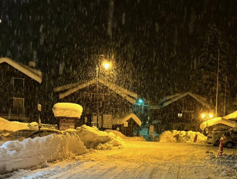
Today’s PlanetSKI Snow report is from Jane Peel in the Tignes/Val d’Isere ski area in the French Alps.
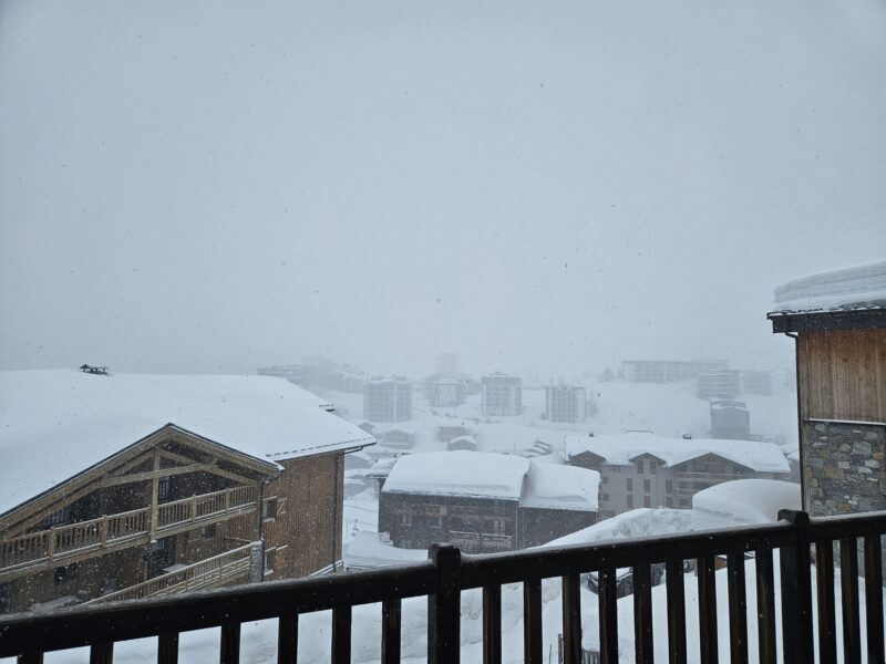
Snowing in Tignes early on Sunday morning. Image © PlanetSKI
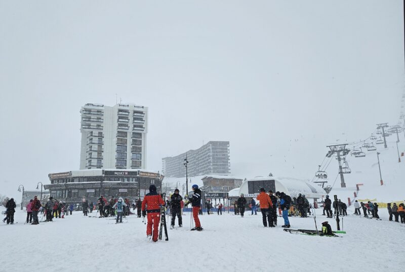
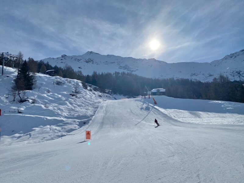
Tignes 2100 snowfront on Sunday morning. Image © PlanetSKI
La Daille, Val d’Isere, Sunday 10th March 2024. Image © PlanetSKI
Bellevarde, Val d’Isere Sunday. Image © PlanetSKI
“And, of course, the weather decided to clear a little once I’d given up for the day,” Jane said.
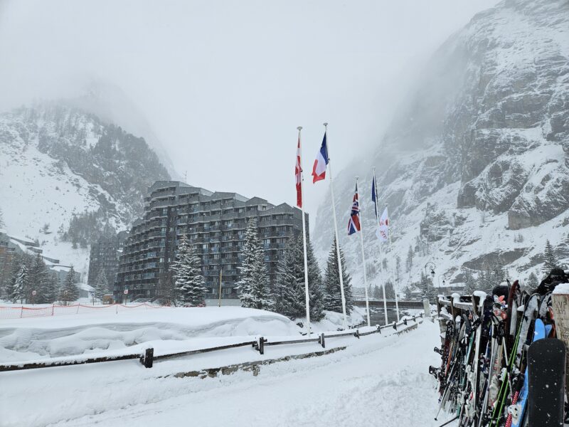
Tignes, France. Sunday afternoon. Image © PlanetSKI
PlanetSKI reader Oonagh Griffith is in the Madonna di Campiglio ski area of the Italian Dolomites where she is hoping to enjoy some fresh snow at altitude on Monday.
“We decided to give skiing a miss today as there is rather a lot of weather about,” she said.
“It has been raining heavily and non-stop all day here in Carisolo village (beside Pinzolo), altitude approximately 770 metres.
“Skiing is only possible down to around 1500m due to lack of snow at lower altitudes.”
This photo was taken from the village on Friday.
Carisolo, Italy. Friday 8th March 2024. Image c/o Oonagh Griffith
“Judging by the trees we can see as the clouds drift by it has definitely been snowing heavily higher up this morning,” Oonagh added.
“The front is due to pass through by around teatime, which should give the pisteurs time to assess and prepare the slopes for tomorrow.
“Judging by the Met Office app, tomorrow should be cloudy and the rest of the week is expected to be sunny – and hopefully not too warm.”
And a bit later, the rain in Carisolo turned to snow.
Carisolo, Italy, Sunday 10th March 2024. Image c/o Oonagh Griffith
“Considering there was continuous heavy rain from at least 7am, I am surprised to see the snow lying on the ground,” Oonagh said.
“I’m looking forward to skiing on all the fresh snow tomorrow!”
Saturday 9th March
PlanetSKI’s Jane Peel arrived in Tignes in France on Saturday.
“The resort app says significant snowfall is expected tonight and the forecast is for heavy snow tomorrow,” said Jane.
“We’ll have to wait and see what materialises.”
More to follow…
Friday 8th March
Here we go again folks!
Another storm is approaching the Alps from the west and is set to dump significant amounts of snow in the SW Alps.
“Over the weekend there will be further pulses of potentially heavy snow for parts of the south-western Alps, with the Monte Rosa region likely to see the most, where storm totals could be in the region of 50-80cm by Sunday,” said weathertoski.co.uk.
“As happened last weekend, some significant snow could also spill over into the south-east of the French Savoie (Val Cenis, Val d’Isère) and into parts of the southern Swiss Alps (Zermatt, Saas-Fee).”
PlanetSKI’s Jane Peel is arriving in Tignes this weekend so look out for her snow reports later as some of the snow might make it to Tignes.
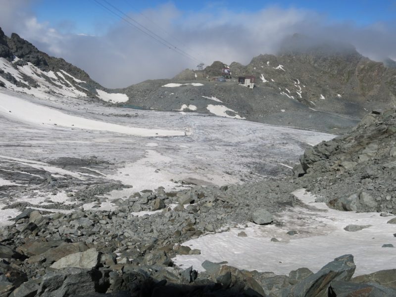
PlanetSKI’s James Cove is currently in Kaprun in Salzburgerland in Austria where the conditions are excellent up on the Kitzsteinhorn glacier.
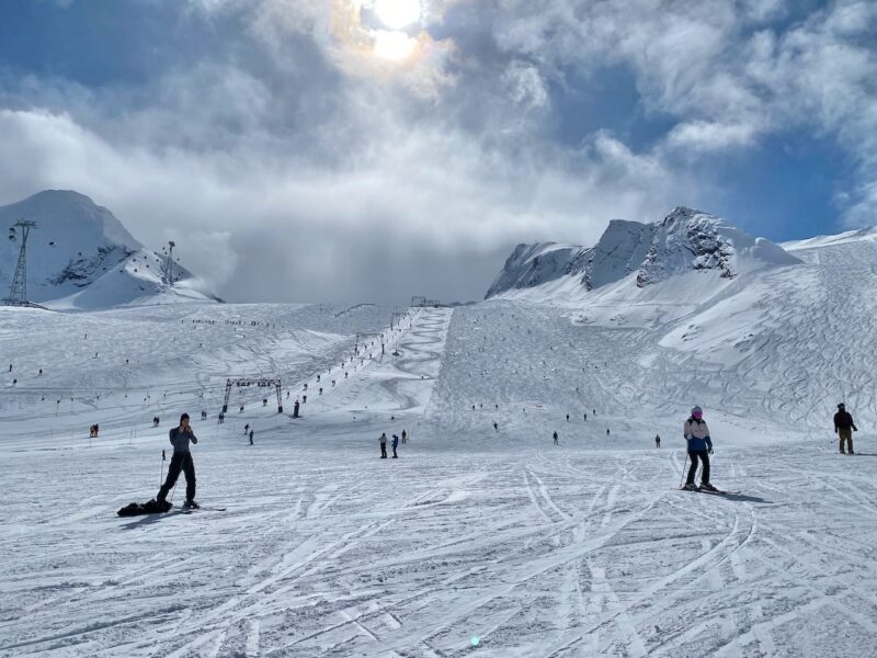
Kaprun, Austria. Image © PlanetSKI
Kaprun, Austria. Image © PlanetSKI
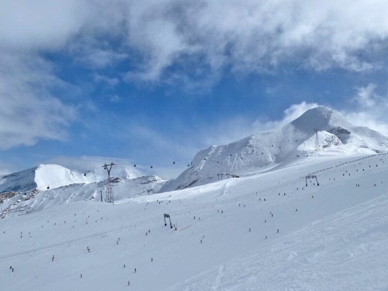
Kaprun, Austria. Image © PlanetSKI
James is heading over to the Tirol at the weekend and will be based in Innsbruck for the next four weeks or so.
More to follow…
Thursday 7th March
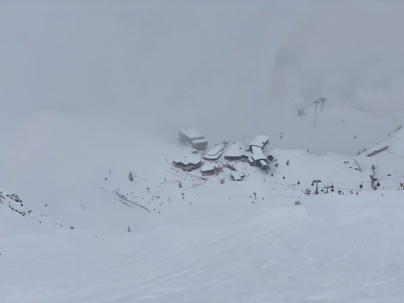
PlanetSKI has just arrived in Kaprun in Austria and we headed straight up to the Kitzsteinhorn glacier area.
Good call.
More to follow…
Wednesday 6th March
Snow is now falling in parts of the north west and central Alps following the massive weekend falls further south (see below).
PlanetSKI editor, James Cove, is travelling from France to Austria by road, and will be based in Innsbruck in the Tirol for a month or so.
The snow conditions look rather good in Austria today as he arrived:
Here’s Flaine in France:
La neige continue de tomber sur Flaine ! ❄️ 😇#poudreuse #ski #snow #cacestflaine
The snow continues to fall on Flaine! ❄️ 😇#freshsnow #winter24 pic.twitter.com/jxPTOTBPjj
— Station de FLAINE (@FLAINESki) March 5, 2024
The temperatures have fallen and snow is coming down to lower levels.
Here’s Morzine this morning.
Morzine, France. Image c/o Morzine tourist office.
Snow is falling in Chamonix town centre.
It is also falling in Sainte Foy at resort level.
PlanetSKI was in the resort last week.
To say it is welcome is a bit of an understatement after a lean time.
PlanetSKI has recently been in Morzine in the Portes du Soleil and was surprised to see how well resorts and holidays makers were dealing with the conditions.
Now some snow has arrived.
PlanetSKI editor, James Cove, is now heading east to Austria and will be updating today as he drives across, passing by many of the ski areas.
It’s looking good at altitude in Austria.
And here’s a little reminder of what the weekend storm brought to parts of the SW Alps:
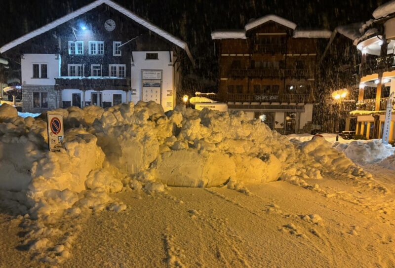
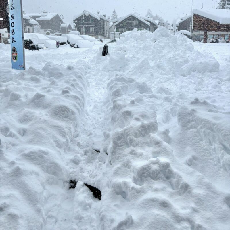
It has led to a massive snow clearing operation in the areas affected.
There’s a lot of snow clearing happening in @valdisere after over 50 cm of fresh snow over the weekend! ❄️
Great news for those thinking about spending Easter on the slopes! Tempted? We still have some availability left if you’re quick…https://t.co/GbIYBHMruR#ValDisere pic.twitter.com/CPOjYD4w8h
— VIP SKI (@VIP_SKI) March 5, 2024
More to follow…
Tuesday 5th March
We start with some images of the huge snowfall that has hit parts of the SW Alps – we have the full details lower down this article as we reported live over the past few days as the storm hit.
Quand tu prends 👉+ 1 m le dimanche ❄️❄️
Le lundi ça donne ça ! 😍
Qui nous rejoint ? ⛷ #Montgenèvre #MyMontgenèvre #MontgenèvreExpérience pic.twitter.com/eXR7LSgebL— ☀️❄️ Montgenèvre ❄️☀️ (@Montgenevre) March 4, 2024
More to follow…
Monday 4th March
The storm that hit the south-western Alps over the weekend has delivered some truly staggering snowfall totals in places.
Much more than originally predicted.
“Some areas have seen between 1- 2m of new snow in the last three days, and in some cases 1m or more in just 24 hours alone,” said Fraser Wilkin from weathertoski.co.uk
“As is normal with a ‘Retour d’est’ type situation, these huge snowfalls were quite localised, with huge differences between one valley and the next.
“For example, while this storm delivered over 1m of snow to the far southern end of Val d’Isère, Tignes only received 25cm, Les Arcs just 5cm and most of the northern French Alps saw little if anything.”
Weathertoski reports that the regions that saw the most snow were:
- The Italian Piedmont and far eastern Aosta (Prali, Sestriere, Monte Rosa, Macugnaga),
- Close to the Italian border in the southern French Alps (Isola 2000, Queyras),
- The Haute- Maurienne (Bonneval sur Arc).
Other areas that have done very well, but with slightly less extreme figures, include Montgenèvre, Val d’Isère (although over 1m has fallen on the Pisaillas glacier), Zermatt and Saas-Fee.
Here at PlanetSKI we have been following things closely over the past few days.
Here’s Macugnaga in Italy, as mentioned in Sunday’s report:
Macugnaga, Italy. Image c/o Davros (Adrian Wallace).
Macugnaga, Italy. Image c/o Davros (Adrian Wallace).
There have been avalanche fatalities in the storm.
A 16-year-old boy died after being hit by an avalanche while skiing off-piste in Val Passiria in the Sud Tirol in Italy.
A skier was buried by an avalanche on the pistes in the Kreuzboden-Hohsaas area of Saas-Grund in Switzerland on Saturday.
According to the cantonal police an avalanche occurred at around 11:40 a.m. and hit the slope above the mountain restaurant in Hohsaas.
The avalanche caught a skier traveling on the 1a “Gletscher Hohkraut” run and buried him under a meter of snow.
There is currently a Level 4 danger of avalanche in the area, meaning there is a “high” risk of avalanche.
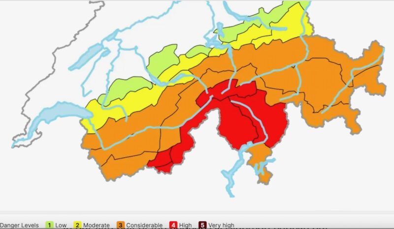
Image c/o Swiss Avalanche Institute.
See our related story as we look at the avalanche danger in the areas where the snow has fallen:
Macugnaga, Italy. Image c/o Davros (Adrian Wallace).
Sunday 3rd March
The resorts around Monte Rosa in Italy are seeing the most of the snow – well over a metre in places and it is still snowing.
It has also spilt over into Switzerland and to some resorts across the border in France.
PlanetSKI’s James Cove is currently further north in the Portes du Soleil
It is very warm with no fresh snow, but there are once again good piste conditions at altitude.
Here is the area he is talking about, the little-known resort of Macugnaga in the Monte Rosa area.
Macugnaga, Italy. Image c/o Davros (Adrian Wallace).
Macugnaga, Italy. Image c/o Davros (Adrian Wallace).
“I arrived in Macugnaga, late on Friday, then it snowed all night and lifts were shut due to an avalanche risk of 5/5,” said PlanetSKI reader, Davros.
“We looked at driving to a couple of other local resorts, but one was closed due to avalanche risk and the other due to no snow.
“Today, Sunday, snow is belting down and everything is closed.
“Driving elsewhere, to other resorts, would be challenging.
“Looking at the forecast the snow will continue for at least a couple of days.
“Good chance everything will be shut again tomorrow.”
Avalanches are disrupting the transport system and in places people are being advised to travel only if essential.
Some resort around Monte Rosa report more snow in this storm than the whole of the rest of the winter so far.
Over the border in Switzerland there is a Level 4 risk of avalanche – High.
Much of the rest of the Swiss Alps is at Level 3 – Considerable.
Other PlanetSKI readers in the area around the snowfall have been posting on our Facebook page.
Martin Creasey – Aosta valley getting the goods.
Kylie Field Yelp – I’m in Montgenèvre atm and it’s snowing.
In France Montgeneve and Isola 2000 are set to do well and the snow will reach as far north as Val d’Isere.
Sestiere in Italy should also see some decent amounts of snow in the latest storm.
As will the resorts in the Monte Rosa region. including Alagna and Gressoney.
“The rest of the French Alps, the south-western Swiss Alps (e.g. Zermatt) and the western Aosta (e.g. La Thuile) will see some snow, but probably only in the 5-15cm range at best,” said Fraser Wilkin from weathertoski.co.uk
“The rest of the Alps (i.e. the northern and eastern Swiss Alps, the eastern Italian Alps and all of Austria) will miss out on this storm.”
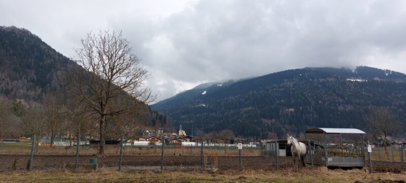
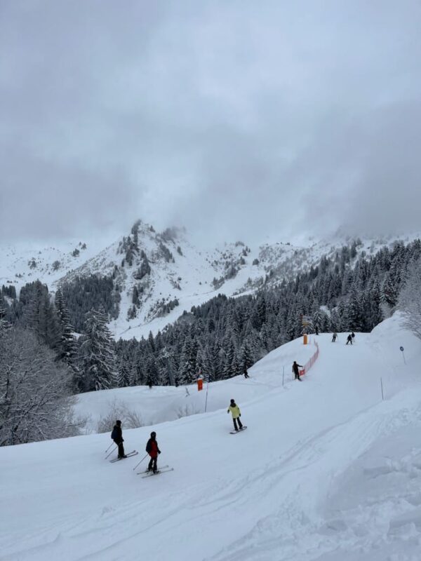
Before visiting the Portes du Soleil PlanetSKI was in Sainte Foy in France for a couple of days where the on piste skiing was little short of exceptional.
Sainte Foy, France. Image © PlanetSKI
Evidence of the season’s snow fall is in evidence.

Sainte Foy, France. Image © PlanetSKI
There has also been some decent, but chopped up, off piste terrain.
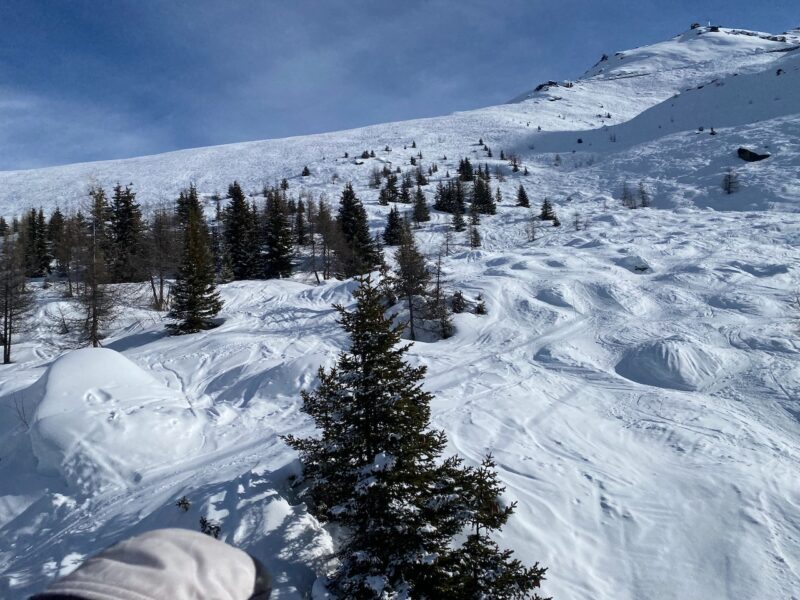
Sainte Foy, France. Image © PlanetSKI
Do check back as we update this report…
![]()
![]()