The PlanetSKI Snow Report
24th March 2024
Last modified on March 31st, 2024
Sunday 31st March
High winds continue to hit parts of the Alps, and there has been some fresh snow to be enjoyed.
It’s been a good day in the 4 Vallees in Switzerland according to one of our regular readers.
Today turned into a beauty – last night’s storm deposited 10cm of fresh on the upper slopes and there were even some moments of sunshine #Nendaz #Thyon #Veysonnaz pic.twitter.com/5XiUA9OeWQ
— Valais Dude (@ValaisDude) March 31, 2024
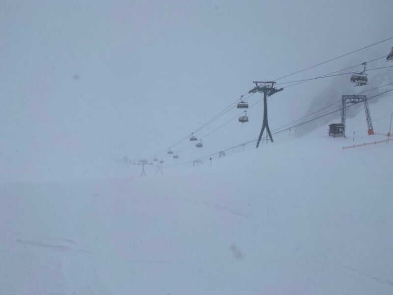
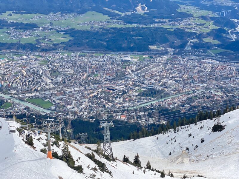
PlanetSKI’s James Cove has been back on his touring skis as the resorts around Innsbruck remain closed due to high winds.
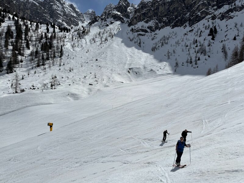
Axamer Lizum, Innsbruck. Image © PlanetSKI
Axamer Lizum, Innsbruck. Image © PlanetSKI
More to follow…
Saturday 30th March
Good late season conditions continue at altitude for Easter in parts of the Alps.
It is though a mixed picture.
Many lifts were closed today due to high winds.
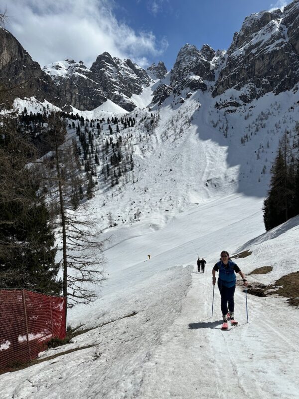
We have reported on it in a separate article on PlanetSKI as we went ski touring to make a few turns:

Patscherkofel, Innsbruck. Image © PlanetSKI
It also meant lower slopes were busy as the higher slopes were shut:

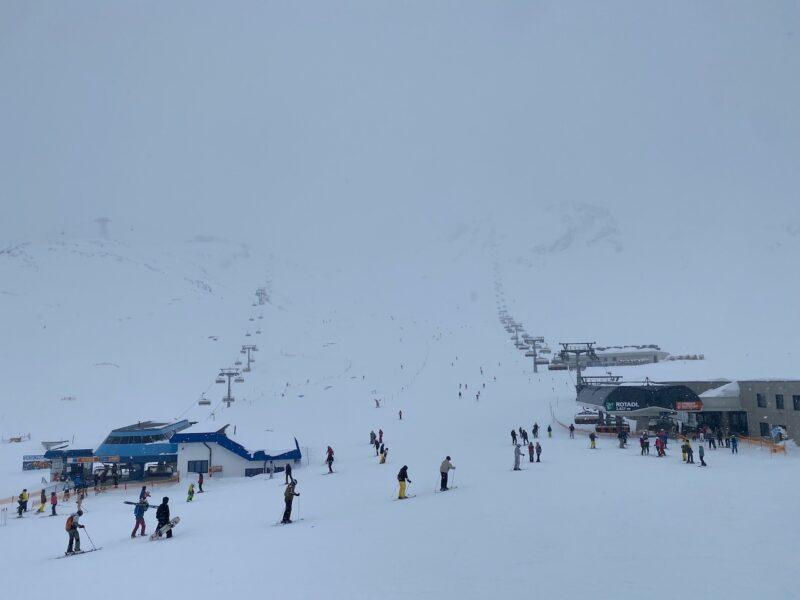
St Anton, The Tirol. Image © PlanetSKI
The latest storm has delivered plenty of snow to some resorts in the south-western Alps, such as those in the Monterosa region, Isola 2000, Montgenèvre and Sestriere.
The snow has also fallen further north at times, with Val Cenis in Italy , Val d’Isère & Tignes in France, plus Zermatt & Saas-Fee in Switzerland also seeing significant totals in the last couple of weeks.
Elsewhere it has been spring weather and at many lower altitude spots it remains poor.
For the latest round-up see weathertoski.co.uk.
Temperatures overall are mild with the strong foehn wind blowing in from the south.
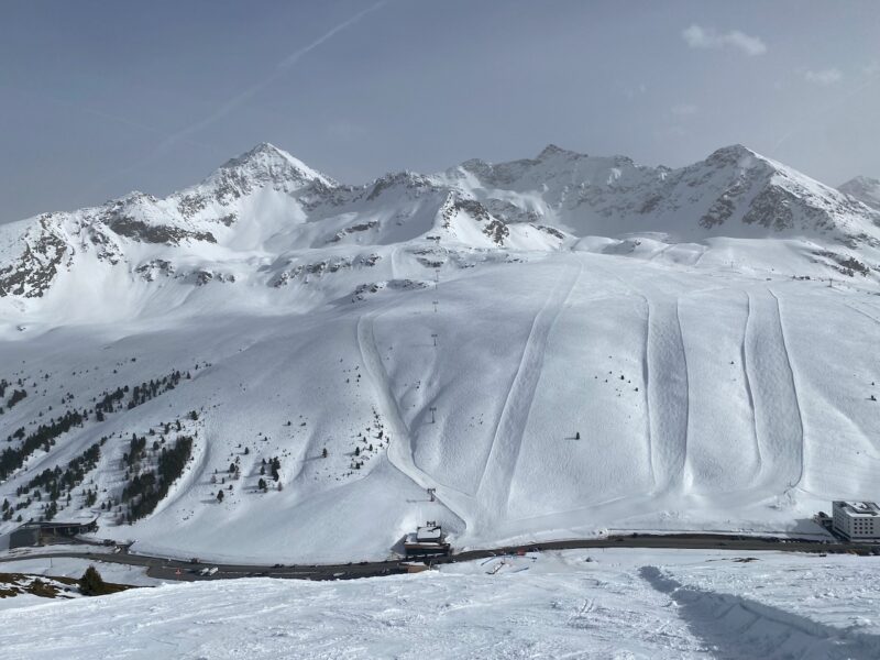
Kuhtai, The Tirol. Image © PlanetSKI
Friday 29th March
The Easter weekend is starting with more snow falling in parts of the Alps – some heavy and accompanied by high winds.
The south west Alps are seeing the wildest of the weather in resorts including Isola 2000, Montgenèvre, Sestriere and those in the Monte Rosa region.
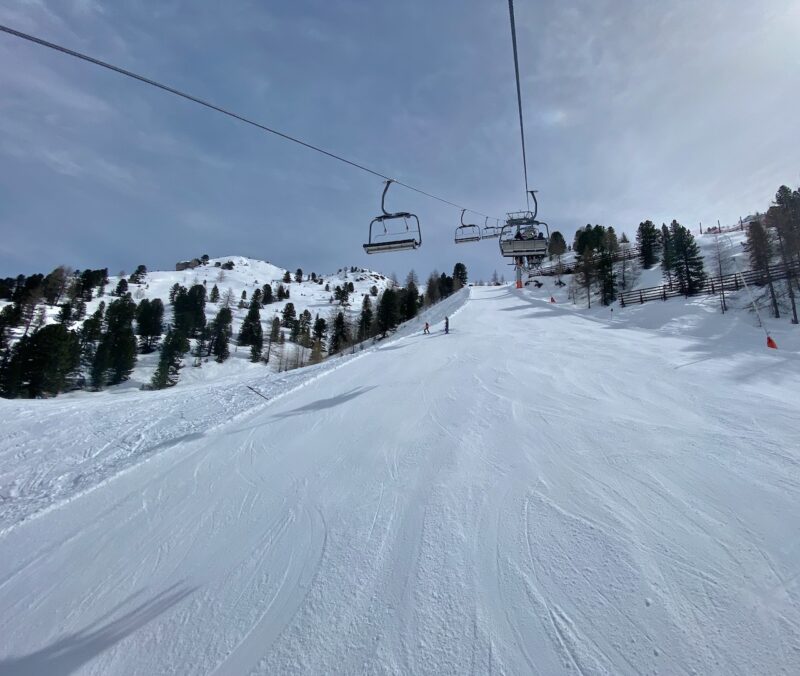
PlanetSKI has been in the resort of Kuhtai in the Tirol on Friday where it’s a different story.
We had some fresh overnight snow and blue sky, with spring snow off piste.
It was a change from where we were the previous day – the glacier resort of Stubai as the weather closed in (see below).
Stubai, the Tirol. Image © PlanetSKI
Stubai, the Tirol. Image © PlanetSKI
“It will remain unsettled over the weekend with the heaviest snow returning to the south-western Alps. Indeed, Cervinia and the Monte Rosa region could see up to 1m or more by Sunday night,” said weathertoski.co.uk.
“For anyone off to the Alps over the next week or so, conditions look very promising in the high resorts, especially in the south-western Alps which have seen the biggest storm totals in recent days.
“Lower down though, any new snow is mostly only of aesthetic value as there is little, if any, natural base below about 1600m in the western Alps (even on north-facing slopes), and below 1200m in some eastern parts of the Alps.”
Thursday 28th March
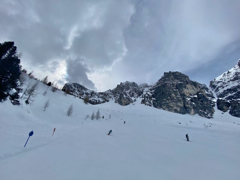
PlanetSKI editor, James Cove, has been in Stubai in the Tirol.
The day’s conditions have been, er, ‘challenging’:
As the Easter weekend approaches some areas in the Alps are seeing some great snowfall – parts of Italy and the north west of France, plus Switzerland.
As always it is all about the temperature – will it be rain or snow, and will it last?
The best of the snow is in the south western Alps though there is a “high” risk of avalanche in places.
Up to 60cm has fallen in some areas.
The Dolomites in Italy has also seen the snowfalls.
To the north in Innsbruck in Austria and the forecast storm arrived on Wednesday, but a little later than expected.
Ahead of the storm we went up to the unique ski area of Nordkette directly above the city.
The snow was old and slushy, but more than enough to make a few turns.

Nordkette, Innsbruck. Image © PlanetSKI
The steep, very steep, stuff in Nordkette was off-limits.
This is Karrine – one of Europe’s steepest marked ski routes with a gradient of 70%.
When you’re looking down from 2,300m to Innsbruck at 574m you will know the meaning of vertigo.

Nordkette, Innsbruck. Image © PlanetSKI
There was fun to be had on the magic carpet and in the snow-park.

Nordkette, Innsbruck. Image © PlanetSKI
And those views down to the city of Innsbruck.
Nordkette, Innsbruck. Image © PlanetSKI
Wednesday 27th March
Looks can de deceptive.
This was the view from the PlanetSKI office in Innsbruck this morning with views to the local resorts of Nordkette, Axamer Lizum and Mutter.
From the kitchen window at the back it’s Patscherkofel and Gungezer.

Innsbruck, the Tirol. Image © PlanetSKI
Looks good, but the video and photo don’t show the winds hitting the Inn Valley and its surrounding areas.
Lifts are closed and snow resorts may not open with rain and snow forecast for this afternoon.
We’re currently keeping our powder dry and waiting to see how the weather develops in this part of the Alps as the latest storm arrives.
We’ll bring you more on other parts of the Alps later…
Tuesday 26th March
PlanetSKI editor, James Cove, is in the Tirol in Austria where a storm is due to arrive in the next couple of days.
Forecasts of how much snow and where it will fall are variable.
As he says, fingers crossed!
First thing in the morning the slopes at Schlick 2000 were hard-packed but uncrowded.
Schlick 2000, the Tirol. Image © PlanetSKI
By lunchtime the weather began to close in.
Schlick 2000, the Tirol. Image © PlanetSKI
By mid-afternoon the once full deck chairs in the sun had been abandoned.

Schlick 2000, the Tirol. Image © PlanetSKI
High winds affected other areas around Innsbruck with both Glungezer and Patscherkofel shut as the winds meant the lifts were unable to operate.
Monday 25th March
It’s been a sunny day across many parts of the Alps today.
It follows some fresh snow over the weekend in places, with Austria seeing some of the best of it.
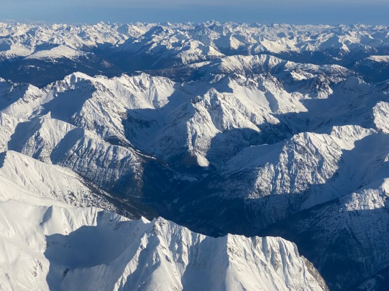
PlanetSKI was flying into Innsbruck in the Tirol today and it was a glorious day across the Austrian Alps with views down to Italy.

Austrian Alps. Image © PlanetSKI
There was some snow down to the valley floor in places.

Austrian Alps. Image © PlanetSKI
Although there was no snow at Innsbruck itself, the surrounding peaks looked to be in great condition.
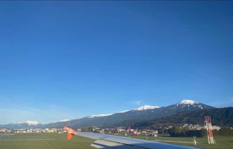
Austrian Alps. Image © PlanetSKI
The weather though is about to change with a new storm coming in, with the south and western Alps seeing the most of the snow.
“Over the next two to three days, between 20-50cm of snow can be expected in many southern regions, including the likes of Isola 2000, Sestriere, Monte Rosa and the Dolomites, with a rain/snow limit varying between 800m and 1,500m,” said weathertoski.co.uk.
“The northern Alps will also see a bit of snow at times though it will generally be lighter and patchier, with perhaps 10-20cm for the likes of Avoriaz, Engelberg and Lech.”
Austria is expected to see more snow on Wednesday.
Once again the key factor will be where the freezing level is.
Austrian Alps. Image © PlanetSKI
Sunday 24th March
Some snow is falling but there has also been rain.
“Over the weekend, between 5-15cm is expected above 1800m quite widely across the northern Alps, with 30-40cm possible in parts of eastern Switzerland and western Austria (e.g. Lech/St Anton),” said weathertoski.co.uk on Saturday.
“The southern Alps will generally see little, if any, precipitation, except for the south-east which later today will see some potentially quite heavy rain/snow in the eastern Italian Alps (e.g. Dolomites) and far south of Austria, produced by a secondary area of low pressure forming over Mediterranean.”
PlanetSKI’s James Cove has been out in the tiny resort of Glungezer near Innsbruck in recent days and has a bit of advice on the type of ski to use in the heavy conditions:
See here for his full report: Week Two continues in Innsbruck for PlanetSKI
See here for last week’s PlanetSKI snow report
More to follow…


