SUNSHINE AFTER THE STORM
31st January 2020
Last modified on May 15th, 2021
The weather has stabilised after the storms across the Alps with some reasonable snow conditions on offer. It’s looking pretty good with another storm expected. UPDATED
First there was torrential rain, then the temperatures dropped and the snow returned – in places with disruptive winds.
Now, on Thursday 6th February, there’s a period of sunshine and calm.
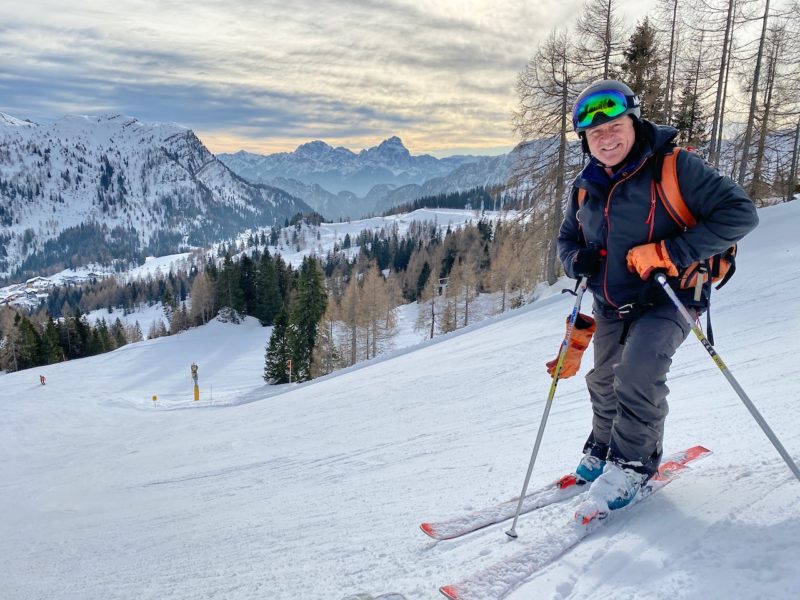
Our latest snow report comes from our editor, James Cove, in Argentiere in the Chamonix Valley in France.
https://www.facebook.com/planetski/videos/188056695898001/
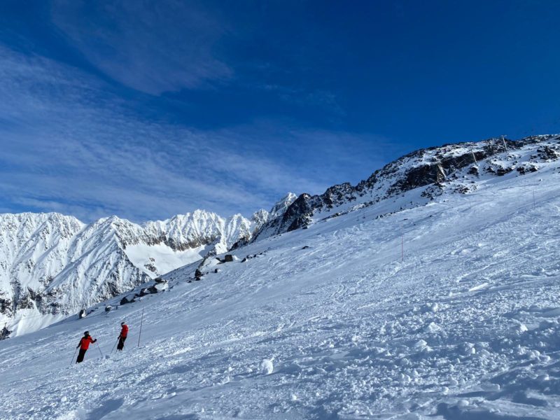
Argentiere, France, 6th February. Image © PlanetSKI.
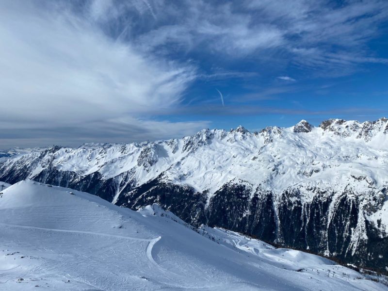
Argentiere, France, 6th February. Image © PlanetSKI.
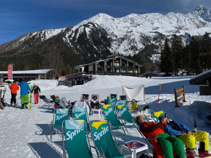
Argentiere, France, 6th February. Image © PlanetSKI.
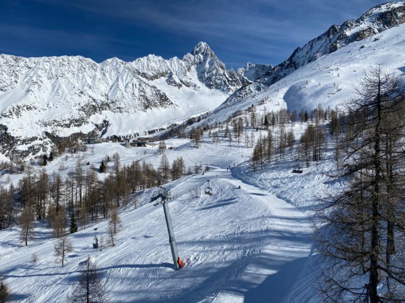
Argentiere, France, 6th February. Image © PlanetSKI.
It’s cleared in Austria with blue skies all the way in Ischgl.
Tuesday 4th February
As the day dawned, the rain and mild temperatures were a memory across much of the Alps.
It’s turned colder again.
There is snow and there is wind.
The wind is the big problem.
Many ski areas have closed or partially closed.
Val d’Isere in France had the Funival running up from La Daille with all other lifts shut on Tuesday morning and were advising that only strong skiers should venture out.
Isgchl in Austria has closed its entire ski area.
And the Dolomites in Italy is affected too with the famous Sella Ronda route shut in both directions by the storm.

Closed by strong winds
Weather To Ski’s Fraser Wilkin describes the weather as ‘evolving at a furious pace’ with snow showers falling to increasingly low levels across the northern half of the Alps.
“Areas affected in the north are the French Alps (roughly north of Grenoble), much of the Swiss Alps (with the exception of some parts of the south, like Ticino), much of the Austrian Alps (but with the exception of Carinthia and Osttirol),” he said on Tuesday morning.
“These areas will see plenty of snow showers today, heaviest in Switzerland and Austria where they will continue through the night and into tomorrow.”
There’s snow falling in St Anton in Austria.
This is the latest video sent to us by the resort.
The snow has returned to the Low Tatras mountains in Slovakia too.
This was posted by our friends at Jasna Adventures on Tuesday afternoon:
https://www.facebook.com/jasnaadventures/videos/524022431557495/
Over the weekend and into Monday, heavy rain fell to low altitudes in parts of the Alps as the temperature rose.
Many of the major resorts in France were hit and some in Switzerland.
“Today’s rain has been generated by an active warm front which is dragging in tropical air all the way from the Caribbean,” said the alpine weather expert, Fraser Wilkin from weathertoski.co.uk.
“Heavy rain is expected across the north-western Alps all day and all night, with a rain/snow limit rising to between 2200m and 2700m.
“This is set to affect the northern French Alps (3 Valleys, Chamonix, Portes du Soleil), and the northern and western Swiss Alps (e.g. Verbier, Gstaad, Wengen).
“There will be heavy snow at high altitudes, but there will also be very strong winds.”
Meanwhile a shocking image is being shared of the famous Mer de Glace, or Sea of Ice, in the Vallee Blanche of Chamonix.
The Mer de Glace, on the north side of Mont Blanc, is the largest glacier in France.
The image is taken from the webcam at Montenvers on Monday afternoon, 3rd February.
It is not how it should look at this time of year.
The mild, wet weather in the Alps follows the heavy snow of last week.
The snow came at cost with a number of avalanches in France and Switzerland.
In France on Wednesday, two avalanches occurred in Arêches and La Plagne.
Two skiers were killed.
Two people died on Thursday in an avalanche in the Comborcière valley, at an altitude of 1,850 meters, near the La Toussuire ski resort.
A third person is being treated in hospital.
In Meribel in Les3Vallees a skier in his 40s was buried while he was in the off-piste sector at Roc de Fer.
He is being treated in Chambery hospital.
A man was caught in an avalanche between Arc 1950 and Arc 2000. He created an air pocket and was rescued by the piste patrol.
One of our regular readers, Michael Pettifer from MPI Brokers, is in Courmayeur in Italy.
“On the upper slopes, pistes are in good condition with a light dusting of snow on top, while the mid slopes are hard and icy in shady places.”
“Further down pistes are becoming ‘sticky’ pre slush, by mid afternoon noon, as the temperature rises this will turn to slush.
“Off piste has the full range. There is some skied out powder higher up, some springish snow, variable and wet snow.
“All in all pretty good skiing.”
MPI is in resort sponsoring the Snowcamp Courmayeur Classic.
Our editor, James Cove, is further east in Nassfeld in Carinthia in Austria.
Nassfeld, Austria. Image © PlanetSKI.
We could have done with some of the recent snow in the western Alps over here in the East, but the pistes remain in very good condition considering we haven’t had a decent snowfall for a while,” said James.
“The snowmaking systems here are first rate as is the grooming and that combined with the cold temperatures means the snow remains good.”
Nassfeld, Austria. Image © PlanetSKI.
Nassfeld, Austria. Image © PlanetSKI.
Our full and detailed snow report below, that was filed on Friday 31st January comes from Fraser Wilkin at weathertoski.co.uk.
A lot of snow has fallen in parts of the Alps this week, especially in the north and west where 40cm to 80cm has fallen above 1800m in the likes of Val d’Isère, Flaine, Verbier and Lech.
The weather in the Alps is currently very changeable though, and the arrival of much warmer sub-tropical air means that snow quality is taking a turn for worse, especially lower down and across the northern and western Alps.
Some areas have also seen some rain, with more forecast over the next few days, especially in the northern half of the Alps where it could fall as high as 2500m in places on Sunday.
It’s not all bad news though – the southern Alps will be less exposed to this mild spell, and much colder Arctic air will return to the Alps with a vengeance by next Tuesday.
Across the pond there is plenty of snow in most western US and Canadian resorts…
Austria
Most Austrian resorts have seen fresh snow this week, heaviest in the west where 50cm or so has fallen at altitude in Lech (115/145cm) and St Anton (90/200cm), whose snow depths are now not far off average for January.
The lower resorts of the Tirol and Salzburgland, such as Kitzbühel (15/85cm) and Zell-am-See (40/145cm), have also seen some snow this week, though snow quality has temporarily deteriorated thanks to the influx of much milder and humid subtropical air.
The current warmer spell will last through the weekend, but much colder and snowier weather will return from the north-west by Tuesday.
FRANCE
Lots of new snow fell across the French Alps earlier this week, especially in the north where between 50cm and 80cm fell at altitude in parts of the Savoies.
Unfortunately, the weather has now turned much milder and is affecting the quality of the snow, especially lower down.
In Megève (40/80cm), for example, while snow cover may be good, the snow is now wet below 2200m or so, which essentially includes most of the ski area.
For better snow conditions you currently need to be much higher, in the likes of Tignes (150/240cm) or Val Thorens (215/275cm).
The weather will remain mild over the weekend with the chance of rain to 2000-2500m before it turns colder and snowier again by Tuesday.
ITALY
Although Italian resorts have generally seen less snow than other Alpine countries from this week’s storms, they are actually going to ride the current mild spell better than resorts further north due to lower humidity.
One area that did catch some significant snow earlier in the week is the far north-west, where resorts such as La Thuile and Cervinia have very impressive base depths of 50/260 and 160/300cm respectively.
Further east there is also plenty of snow in the Dolomites, where Selva is currently posting 50/150cm and Kronplatz has 60/130cm.
Expect mostly dry and mild weather over the next few days, but with more in the way of cloud at times, and a few showers/flurries close to the border areas.
SWITZERLAND
Lots of snow fell across most Swiss resorts earlier this week (typically 30-70cm) which was great news for resorts that had been in need of a good top-up near the northern foothills, such as Adelboden (10/105cm).
The bad news, however, is that the weather has now turned much milder and, with some rain also in the mix, snow conditions have temporarily deteriorated at lower altitudes in the likes of Villars (20/120cm) and Wengen (25/65cm).
For the best skiing right now, you need head to higher resorts such as Zermatt (65/145cm) and Saas-Fee (45/285cm).
The good news is that winter is set to return with a vengeance by Tuesday, when colder and potentially very snowy air will move down form the Arctic.
REST OF EUROPE
Thanks to last week’s big storms, snow depths are generally impressive in the Pyrenees, especially in the west.
The weather has turned milder though, meaning that snow quality is now variable.
Spain’s Baqueira Beret currently has 80/180cm of snow depending on altitude, while France’s Les Angles has 120/200cm.
There is lots of good skiing in Scandinavia at the moment, with Norway’s Oppodal (130/170cm) among the front runners.
However, Scotland’s troubled season continues as, once again, it has insufficient snow cover for any serious skiing.
NORTH AMERICA
USA
Wyoming’s Jackson Hole has had one of its snowiest ever Januarys and is in superb condition right now with base depths of around 2.5m up top.
Most Colorado resorts are also in good shape, albeit with slightly lower base depths.
Vail currently has 148cm mid-mountain while Steamboat has 196cm.
Utah is also doing well, with new snow in Snowbird where there is now 267cm mid-mountain.
CANADA
The weather is currently very unsettled in Whistler, where a lot of snow is expected at altitude over the next few days.
However, with freezing levels that are going to be up and down, rain will also be a nuisance at times lower down.
There is currently an impressive 265cm of settled snow mid-mountain here, testament to the large number of storms that have affected the area since the turn of the year.
Significant snow is also falling further inland at Lake Louise (145cm mid-mountain base) where conditions are expected to be superb this weekend.