More Snow Falls in the Alps
8th March 2023
Last modified on March 14th, 2023
The long-awaited storm hit the Alps with up to 1m in places. PlanetSKI is out in the thick of it as ore snow falls. UPDATED
Tuesday 14th March
Further snow is falling in parts of the Alps with some very unsettled weather.
“The snow has returned to Peisey Vallandry at 1600m (Les Arcs ski area) Tuesday morning after rain and thunderstorms overnight,” said PlanetSKI’s chief reporter, Jane Peel.

Les Arcs, France. Image © PlanetSKI

Les Arcs, France. Image © PlanetSKI
“Most of the highest lifts have been closed today but it’s been a generally excellent morning skiing around Peisey-Vallandry, Arc 1800 and Arc 1600,” added Jane.

Les Arcs, France. Image © PlanetSKI
The fresh snow has brought considerable risk of avalanche off piste.

Avalanche danger in Les Arcs. Image © PlanetSKI
There have been a number of fatalities in Switzerland.
See here for further details:

Verbier, Switzerland.
Winter is back in Austria too:
And Italy:
More to follow…
Monday 13th March
Temperatures have warmed up in the Alps after the recent snow.
In places the freezing level has risen to 3,000m though it is set to fall again later in the week.
More snow is also in the forecast for overnight and into Tuesday in the western Alps including France, Switzerland and parts of Austria.
The freezing level should be around 1,000m.
The is a Level 3 warning across parts of the Swiss Alps with “Considerable avalanche danger over a wide area” according to the Swiss Institute for Avalanche Research.

Avalanche danger levels in Switzerland
In Verbier one of our readers, Sparky, has send this image of an avalanche near Col de Gentiennes which is a good example of how unstable the snowpack is in places.
Verbier, Switzerland.
There were no reports of any injuries.
Sunday 12th March
PlanetSKI’s chief reporter, Jane Peel, is in Les Arcs, France.
And here’s an idea of what Jane means about the weather in the Les Arcs ski area today…..

Cloudy & low vis in Les Arcs. Image © PlanetSKI

Sunny spells in Les Arcs. Image © PlanetSKI

Heavy going on the slopes & 10 degrees Celsius at 2pm in Vallandry, Les Arcs. Image © PlanetSKI
“The consequence of the snowstorm and the current conditions is that the avalanche risk has been at Level 4 in the Paradiski area today so staying on piste was the only option,” Jane added.
“The piste patrol were out blasting to protect the slopes throughout the morning and the lifts in some sectors – specifically the summit above Arc 1950 – stayed shut.
“That probably explained the busy pistes and lifts around Arc 1800.”

Les Arcs, France. Image © PlanetSKI

Les Arcs, France. Image © PlanetSKI
In Switzerland:
A socked in day of heavy snow, rain below 1500m, and many lifts closed. But put in a few runs for form’s sake! And indeed 30cm of fresh … pic.twitter.com/g6ajpSsHhW
— Valais Dude (@ValaisDude) March 11, 2023
“After religiously checking the weather 17 times a day for the 2 weeks in the run up to our holiday, arriving in the dark to rain was less than ideal,” said PlanetSKI reader, Jo Vizard, who has just arrived in Meribel in Les3Vallees.

Meribel, France. Image © PlanetSKI

Meribel, France. Image © PlanetSKI
Helen Gillespie is also in Les3Vallees – in Val Thorens.
“It’s been snowing since Friday with high winds too but the much needed storm now ebbing. Three Valley crossings closed last two days,” sad Helen.
“Think close to 30cms has fallen- but has gone heavy fast.
“The temperature sadly hasn’t held as much as had hoped with warmer weather on Saturday with a freezing rain style snow – which at the higher altitude that VT sits – is note worthy; lower down – sadly rainy.
“But with a clearer day ahead – on piste will be for sure fun; suspect because of the conditional heaviness the avalanche rating will be high so not sure what off piste will be advisable/available.
“Resort people are talking colder temperatures coming.”

Val Thorens, France. Image © Helen Gillespie
Saturday 11th March
The latest storm is hitting the north-west Alps and has spread east.
“Snow will continue to fall across many north-western parts of the Alps today, roughly north of a line from Les 2 Alpes/Alpe d’Huez to the Arlberg, heaviest (again) in the northern French and far western and south-western Swiss Alps,” said our resident snow expert, Fraser Wilkin from weathertoski.co.uk.
“The rain/snow limit will rise towards 1300-1600m (and even 1800m+ in places close to the western foothills, e.g. Alpe d’Huez) but will remain lower in the more enclosed internal valleys.
“The storm will peter out early tomorrow, by which time well over 1m of new snow will have fallen at altitude in some parts of the northern French and western Swiss Alps (e.g. Tignes, Chamonix, Zermatt), with as much as 1.5m or more in places.”
PlanetSKI’s chief reporter Jane Peel has just arrived in Peisey-Vallandry, part of the Les Arcs ski area.
“It seems they’ve had a LOT of snow up top here with more forecast to come so hopefully there’ll be some decent conditions to enjoy this week after a drought that had lasted almost two months,” Jane said on Saturday afternoon.
“However, here at 1600 metres it’s pretty miserable right now – cloudy with light drizzly rain.
“On the bus drive up to resort it was clear that snow had fallen down to valley level but it’s disappearing fast in the milder rainy weather at that altitude.

On the road to Peisey-Vallandry on Saturday 11th. Image © PlanetSKI
“It did mean that, fortunately, there was no weather-related disruption getting here.
“The only problem was the 20-minute delay on the RN90 at Albertville where pension protestors blocked the road for a while before being cleared by police.

French pension protestors block traffic in Albertville. Image © PlanetSKI

Traffic waiting to join the RN90 in Albertville. Image © PlanetSKI
“We still arrived in plenty of time to pick up my rental skis from the local Intersport so I’m geared up and ready to go and check out the snow on Sunday.”

PlanetSKI’s Jane Peel with her Intersport rental skis. Image © PlanetSKI
PlanetSKI’s George Eykyn has been in St Anton in Austria this week and is leaving the resort today.
“Snowing quite hard now at resort level, and it has settled overnight, restoring the full look of a ski resort in winter,” said George this morning.

St Anton, Austria. Image c/o George Eykyn.
By the end of today resorts such as Chamonix, Tignes and Val d’Isere could see well over 1m of snow at the high points in their ski areas.
Lower down it is falling as rain with the freezing level currently below 1,000m.
More to follow…
Friday 10th March
The next storm in the Alps is starting and it’s set to bring plenty of snow at altitude with high winds, heavy rain lower down and the Saturday transfer day could be a long one in the north-west Alps.
Some PlanetSKI readers heading out to the Alps are voicing concerns on our Facebook page about the impact of the storm on travel.
“Am off to Cham this weekend! just hope the roads are clear up to Argentiere to get to the apartment,” said Dick Donovan.
The area is home to many of the major French ski resorts, and Swiss resorts including Verbier.
Next week should be superb above the freezing line in that part of the Alps.
People are advised to exercise extreme caution if skiing off piste when the weather clears.
More than 1m could fall at altitude in resorts such as Chamonix, Tignes & Val d’Isere with plenty of snow elsewhere in the surrounding areas.
This morning line was at around 1,500m and it will descend to 1,000m later today before dropping to 800m or so on Saturday.
It will then rise to 1,500m or higher later in the day.
PlanetSKI reporter, George Eykyn, is further east in St Anton in Austria.
“It is snowing steadily above St Anton, but high winds have forced numerous lift closures,” said George.

St Anton, Austria. Image c/o George Eykyn.
Updated:
LIVE 🔴
Juste à temps pour le week-end 🌬😍
___
Just in time for the week-end 🌬😍 pic.twitter.com/Ib2M8kq5nR— Verbier (@VerbierResorts) March 10, 2023
Yesterday we heard from PlanetSKI reporter, George Eykyn, in St Anton, Austria about the current conditions.
Today we start our rolling & updated snow report with reporter, Tim Clark, in Les2Alpes, France.

Les2Alpes, France. Image © PlanetSKI
“Snow, and plenty of it has hit Les2Alpes in the past couple of days,” said Tim.
“On Wednesday there was 15-20cm in the off piste areas around the top of the Super Diable lift, which tops out at 2,813m.

Les2Alpes, France. Image © David Jackson
“On the pistes the fresh snow had accumulated into the familiar soft moguls in many places as the snowfall continued early morning.
“The fresh snow is most certainly welcome, taking the edge of the icy patches which had formed on most pistes earlier in the week.
“On areas around Tete Moute and Toura the snow was soft and deep enough to enjoy a decent off piste escapade, occasionally hearing the scrape of ice underneath the fresh powder.
“As the weather closed in visibility fell to practically zero at times with the wind whipping up on exposed areas from around 2,600m.
“The top runs of Jandri 4 and Glacier 1 and 2 at around 3,200m were practically deserted as people sought lower slopes away from the worst of the weather.

Les2Alpes, France. Image © David Jackson
“Seeking shelter we took ourselves away from the main Jandri piste to the Pierre Grosse and Fee red runs which were less congested and offered some sheltered solace from the wind.
“These areas, Fee 1 in particular had long flats which were inescapable.

Les2Alpes, France. Image © PlanetSKI
“Fee 3 and 4 reds however had excellent conditions, being on the sheltered side of the mountain.
“By late afternoon wind had stripped the fresh snow off of some west-facing pistes making some descents a little more challenging at least from 2,300m..
“At resort level of 1,650 the good snowfall on Tuesday and Wednesday had by turned to rain by Wednesday evening.

Les2Alpes, France. Image © PlanetSKI
“By 11pm Wednesday this turned into a deluge in Les 2 Alpes itself, with a lightning storm crossing over the resort from the west until around 1am.
“Although it was heavy rain and slush at resort level the lower pistes had been groomed well enough to last the day and with the freezing point at around 2,300m most of Les 2 Alpes were still well within snow range.
This meant a very large dump of snow from the late night storm had covered the higher up pistes, with avalanche explosions heard from early Thursday morning until around 10am.
“Conditions early on Thursday were clear, slightly sunny and around 6 degrees.
“The warm weather looks to be a small blip however as it’s forecast to turn colder with snow flurries over the course of the rest of the week and weekend.
If the temperatures stay low the fresh accumulations look to have prepared the pistes for a good week of skiing next week.<
“It’s all about the temperature over the next couple of days.”
 Les2Alpes, France. Image © PlanetSKI
More to follow…
Thursday 9th March
We end today as we began.
With a report from PlanetSKI reporter, George Eykyn, who is in St Anton in the Tirol in Austria.
“After an inauspicious start, with rain at resort level, it turned into a blue skies and sunshine day,” said George as his day drew to a close.
“Official readings at Galzig show 13cm more snow depth than yesterday.
“Wind has been a problem and closed key connecting lifts and the top ones on Rendl and Valluga for a time on Thursday.
“Friday seems sure to see some snow and perhaps rain, with forecasts over the next three days promising quite a mixture of weather.”
The photos below were taken taken on Kapall/Schoengraben above St Anton at 4pm today.

St Anton, Austria. Image c/o Simone Sasse.

St Anton, Austria. Image c/o George Eykyn.

St Anton, Austria. Image c/o George Eykyn.

St Anton, Austria. Image c/o George Eykyn.
For George’s full report on recent condition see the coverage below at the start of the day.
Elsewhere in the Alps the starter has been served and now we are waiting for the main course.
There have already been falls of up to 50cm at altitude, but the real action is set to happen this weekend with 1m forecast in some places by Saturday.
It has though already brought heavy rain lower down and that is set to continue as the temperatures remain relatively warm.
The freezing level is currently hovering around 1,800m in the north-west Alps and it is set to fall.
Here is the scene in the high-altitude resort of Val Thorens in Les3Vallees.
“It is this next storm that will drop really big quantities of snow across the north-western Alps on Friday and Saturday, with a rain/snow limit thankfully lower than originally forecast, probably between 1200m and 1500m on Friday, possibly dropping to 1000m or lower on Friday night/Saturday morning, before rising again to 1500m in places later on Saturday,” said Frazer Wilkin from weathertoski.co.uk on Thursday.
“On Friday and Saturday, some really serious quantities of snow will fall above 2000m in the northern French and western Swiss Alps in particular, with higher parts of the Chamonix valley and Haute-Tarentaise (Val d’Isère/Tignes) likely to see the most, with perhaps as much as 1m.
“Throughout this period, any rain or snow will be lighter and more intermittent the further south-east you are.
“Much of the Swiss Alps (away from the far south), the north-western Italian Alps (e.g. Courmayeur, La Thuile) and the western Austrian Alps (e.g. Arlberg) will also see significant precipitation, but the south-east (e.g. Dolomites) will stay mostly dry.”
Again the temperature will determine whether the precipitation is snow, or rain.
Do keep across weathertoski.co.uk for the full details.
This from PlanetSKI reader, Kevin Woodrow, in La Rosiere:

La Rosiere, France. Image c/0 Kevin Woodrow
We have a detailed report today from PlanetSKI reporter, Gerorge Eykyn, who is in St Anton in the Tirol in Austria.

St Anton, Austria. Image c/o George Eykyn.
“It’s raining at resort level at 09.00 today. It is falling as snow from about 1,600m but it’s quite bright and sun is trying to break through.
“Thursday and Friday will be mostly cloudy, with some sunny spells on Thursday, and then on Saturday 11th March “heavy precipitation” is expected.
“The issue is whether this falls as rain or snow, with daytime resort temperatures hitting 6-8 degrees.
“Predictions are for snow to settle above 1,500m, so there’s confidence at least the upper slopes will get snow.
“Some forecasts say 30cm may fall over the coming week.
“However next week starts with warm weather again on Monday: 12 degrees forecast at resort level.

St Anton, Austria. Image c/o George Eykyn.
“Wednesday in St Anton saw light snowfall during the middle part of the day – just a dusting on the lower slopes, and a few centimetres on upper slopes.
“More snow was forecast overnight into early Thursday, but resort staff I spoke to were not expecting substantial amounts.
“Conditions are still good on the pistes.

St Anton, Austria. Image c/o George Eykyn.
“By mid afternoon the lowest runs into the resort deterioriate and skiers negotiate a mixture of icy patches and clumps of slush.
“Above St Anton at Kapall the red run alongside the Schoengraben T-bar (2,330m) still offers superb creamy conditions.
“The Kandahar and Steissbachtal (Happy Valley) runs are in excellent condition, and there is still some powder to be found on the Bachseite slope above them that enjoys so much shade.
“The popular Schindlergratbahn gondola was closed on Wednesday due to high wind at the top Links to Zurs and Lech were open, with minimal queuing, and conditions in Zurs were good.
“Obviously, some of St Anton’s main offpiste routes badly need the awaited snowfall.

St Anton, Austria. Image c/o George Eykyn.
“However, good (if broken) snowfields are still to be found on the Hinterer Rendl; whichever route your guide or instructor takes you, expect to do a fair bit of carrying your skis in the last couple of hundred metres to the valley floor.”

St Anton, Austria. Image c/o George Eykyn.

St Anton, Austria. Image c/o George Eykyn.

St Anton, Austria. Image c/o George Eykyn.

St Anton, Austria. Image c/o George Eykyn.
More to follow…
Wednesday 8th March
The forecast snow has arrived in the north-west Alps.
Here’s the scene in Les3Vallees:
#neige #snow #latania #les3vallees 🎞️ @La_Tania pic.twitter.com/HW0NxWR51h
— Les 3 Vallées (@3Vallees_france) March 8, 2023
One of our readers, Helen Gillespie, has just arrived in Val Thorens in Les3Vallees.
“Just this minute arrived to a most welcome changing scene in Val Thorens of falling snow over next few days,” she said on Wednesday afternoon.
“What was brown a few hours ago is dusting up white!
“It is very Spring-like lower down and more like late April than early March, with higher temperatures keeping it all as rain below 2,200m — but hopefully some colder temperatures are to follow,” Helen added.

Val Thorens, France. Image c/o Helen Gillespie.
It now remains to be seen where the freezing level will be over the next few days in resorts across the area – what falls as snow and what falls as rain.
It is very welcome after weeks and weeks of no snow and brings a welcome boost, not just for skiers and snowboarders.

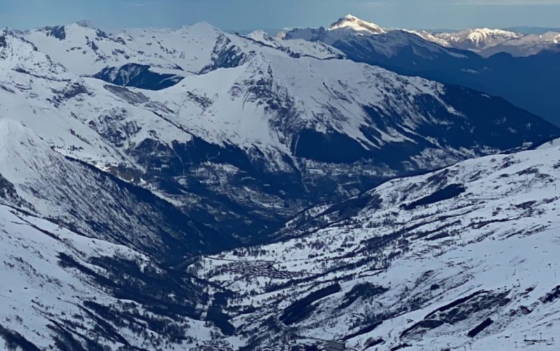
Mont Blanc in the distance. Image © PlanetSKI
PlanetSKI’s Tim Clark is in Les2Alpes in the southern French Alps.
“A wide weather front moved in from the West from around 3pm on Tuesday, making its way steadily across both Les Deux Alps and Alpe de Huez, with view from the Glacier showing the snow beginning to roll into other resorts further north such as Les Three Vallees, Val D’Isere Arc 1950 and La Plagne,” said Tim.

And we have an update from a regular PlanetSKI reader, Valais Dude, over in Switzerland:
Here it comes – the new weather front pushes through, bringing either a forecast METRE of snow during Wednesday-Friday or a whole lot of rain that will wash away snow cover in much of Valais, we will soon see which it is 🙏🏻 pic.twitter.com/bh3goxHx4H
— Valais Dude (@ValaisDude) March 7, 2023
Another of our reporters, George Eykyn, is in St Anton in the Tirol in Austria.
“Snowing now, risk of rain later,” said George on Wednesday morning.
St Anton, Austria. Image c/o George Eykyn.
George will be sending a full update from the Austrian resort later.
St Anton, Austria. Image c/o George Eykyn.
More to follow….
Tuesday 7th March
There is a large amount of snow forecast for the the north-west Alps, home to many of the major French resorts that have seen little snow since mid-January.
Sadly there is also a large amount of rain in the forecast.
As the storm approaches the key thing will be the temperature.
Where will the freezing level be?
“Between now and Sunday we are likely to see some serious quantities of snow at high altitude in the north-western Alps, with 1m to 1.5m of snow possible above 2,300m in the likes of Val d’Isère, Tignes, Val Thorens, La Plagne, Les Arcs and Chamonix,” said Fraser Wilkin from weathertoski.co.uk.
“Some western Italian resorts (e.g. La Thuile), and northern and western Swiss resorts (e.g. Verbier, Mürren, Engelberg), as well as the far west of Austria (e.g St Anton) could also see significant quantities of snow above 2000-2300m.
“Lower down, there will be plenty of rain this week, especially in the north-western half of the Alps.
“This will be heaviest and most problematic later this week and this weekend.
“This is obviously not great news for the likes of Megève, Morzine, Samoëns, Villars, Gstaad and Grindelwald, where natural snow cover is already patchy,” added Fraser.
French Alps. Image © PlanetSKI
Watch this space…
PlanetSKI logo


