Heavy Snow is Falling in the Alps
18th December 2024
Last modified on December 21st, 2024
With Xmas approaching it couldn’t have come at a better time. PlanetSKI reports from the Alps. UPDATED
Snow was coming down across many parts of the Alps on Friday, with another storm set to roll in later on Saturday.
The second storm will last for a couple of days, and in some places well over 1m is forecast.
Friday was much colder ahead of Saturday’s storm.
This storm will mostly affect the northern half of the Alps, delivering another 40-70cm.
France, Switzerland and much of Austria will benefit and it should set things up very nicely for the Xmas week and into New Year.
Snow falls above 1,800m are likely to be in the 70-120cm range in many northern/north-western Alpine ski resorts.
These include Flaine, Avoriaz, Verbier, Mürren, Engelberg, and possibly more resorts in the Arlberg region of Austria (Lech, St Anton, Warth).
Here was the scene in Murren on Saturday.
The images were sent to us by PlanetSKI reader, Dave Ashmore.

Murren, Switzerland. Image c/o Dave Ashmore.

Murren, Switzerland. Image c/o Dave Ashmore.
Storm totals during this same period in the southern half of the Alps (Sestriere, Alta Badia) will be more in the 10-30cm range.
The freezing level remains low across the Alps.
The weather forecast is looking like there will be a good amount of snowfall in the next days, with the snow line dropping right down to the city of Innsbruck! ❄️
So, fingers crossed Innsbruck will transform into a winter wonderland just in time for Christmas!
📷: Markus Mair pic.twitter.com/GwaAGMrKPj
— Innsbruck Tourism (@InnsbruckTVB) December 20, 2024
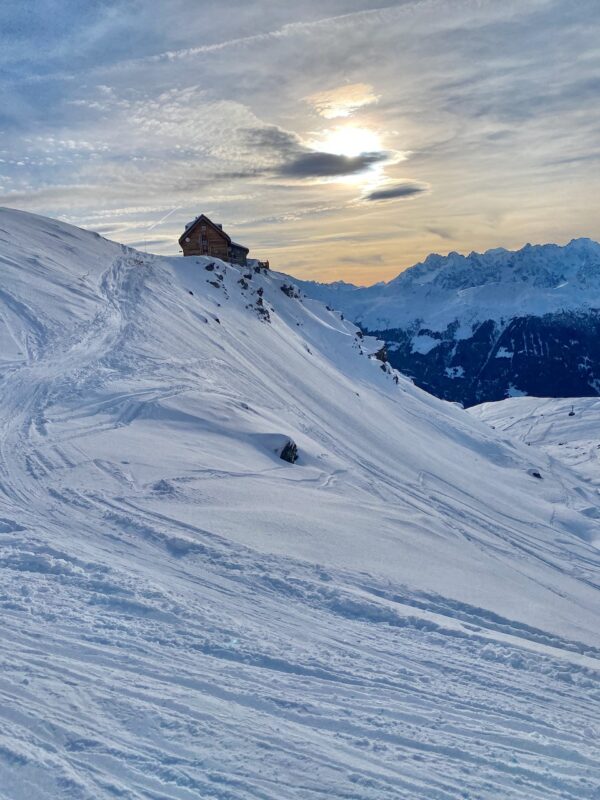
One of the areas doing well is Verbier in Switzerland, where PlanetSKI is.
We were queuing for the first lift on Friday morning, along with a few others.

Verbier, Switzerland. Image © PlanetSKI
And up the mountain?
Here’s the PlanetSKI editor, James Cove:
It turned out to be quite a morning.

Verbier, Switzerland. Image © PlanetSKI

Verbier, Switzerland. Image © PlanetSKI
And the clouds even lifted for a while.

Verbier, Switzerland. Image © PlanetSKI
During Thursday rain was falling at resort level – 1,491m.

Verbier, Switzerland. Image © PlanetSKI
But higher up snow was coming down with the freezing level hovering around the 2,000m mark.
There was about 10cm or so of fresh snow, though the visibility was pretty bleak for much of the day.

Verbier, Switzerland. Image © PlanetSKI
PlanetSKI is currently on a course in Verbier with the Warren Smith Ski Academy, WSSA, and we’ll be reporting on it shortly.

Verbier, Switzerland. Image © PlanetSKI
With heavy snow forecast for Thursday night we took the precaution of changing the K2 piste skis, for some off piste Atomics at WSSA’s recommended hire shop, Mountain Air.

Verbier, Switzerland. Image © PlanetSKI
It seemed a good call as by 6pm the rain in town had turned to snow at the bottom of the Medran lift.

Verbier, Switzerland. Image © PlanetSKI
Here is what it looked like in Verbier on Wednesday as the weather began to change, as described by PlanetSKI’s James Cove:
Here are the storm clouds approaching.

Verbier, Switzerland. Image © PlanetSKI

Verbier, Switzerland. Image © PlanetSKI
So, what is the detail of the next few days?
Here’s Fraser Wilkin from weathertoski.co.uk.
“A new storm will cross the Alps from west to east,” said Fraser on Wednesday.
“Most regions will benefit from at least some new snow though the heaviest falls will again be in the north-west, with resorts like Avoriaz potentially seeing as much as 40-50cm above 1800m by Friday morning.
“The rain/snow limit will start at around 2000m on Thursday but will fall steadily throughout the day and on Thursday night to reach 400-700m by Friday morning.”
Verbier, Switzerland. Image © PlanetSKI
Another storm is set to roll in on Saturday which may bring “significant quantities of snow”.
80-120cm of new snow can be expected above 1800m across many north-western parts of the Alps, including:
- Tignes, France
- Flaine, France,
- Avoriaz, France
- Arc1950, France
- La Plagne, France
- Verbier, Switzerland
- Mürren, Switzerland
- Engelberg, Switzerland
- St Anton, Austria
PlanetSKI has been monitoring the situation direct from the Alps in recent weeks:
- Good conditions in the run up to Xmas
- Excellent snow conditions in large parts of the Alps & Pyrenees
One of our regular contributors, Tord Nilson, is in La Plagne in France and has been enjoying some excellent early season conditions this week.
“Tuesday was a fantastic day with the sun shining and the pistes in incredible shape – hats off to the pisteurs,” said Tord.
“Most of the resort is open too which is fantastic to see.
“On Wednesday it’s a bit warmer and cloudy but with snow coming in tomorrow there’s no doubt this is a great start to the season in La Plagne.”

La Plagne, France. Image © PlanetSKI

La Plagne, France. Image © PlanetSKI
With the snow coming in there should be some excellent conditions for Xmas next week and it further solidifies one of the best starts to a ski season in recent years.
PlanetSKI will be updating on what exactly the storm delivers over the next few days, so do check back.
Meanwhile, if you’re heading across the Atlantic to ski, it’s not too shabby there either.
![]()
![]()
PlanetSKI: Number 1 for digital ski news.
Your digital platform for ski news, resort information, travel, equipment rental, money saving deals and everything connected with snowsports – web site, social media & more.