PlanetSKI Snow Report Direct from the Alps
7th January 2025
Last modified on January 14th, 2025
Monday 13th January
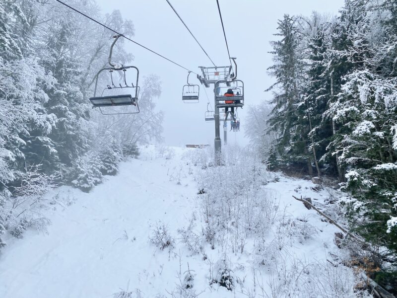
We start in the Austrian Alps where it’s been a beautiful, sunny but cold Monday in Hochkönig, Austria.

Hochkönig, Austria, Image © PlanetSKI
“It was minus 14 Celsius at 1000m altitude at 9.30am and had risen to only minus 7 at 1200m by 11.30am, where the temperature gauge stayed for the rest of the day,” says PlanetSKI’s Jane Peel, who’s in the ski area.
“Fortunately there has been no wind and all the chairlifts have covers so it’s not felt too bad.
“The cold also means that the pistes are generally holding up with good conditions on most runs though it’s not that unusual to find some hardpack and icy spots, especially in the afternoon, making it challenging for tired legs.
“The snow cannons are doing overtime even during the day, taking advantage of the low temperatures.
“There’s no significant snowfall forecast in the immediate future, though there could be around 5cm on Wednesday.”
And from Big Sky in Montana, USA:
View this post on Instagram
More to follow…
Sunday 12th January
Here’s PlanetSKI’s James Cove who is in the French Alps:

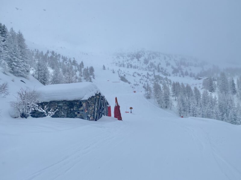
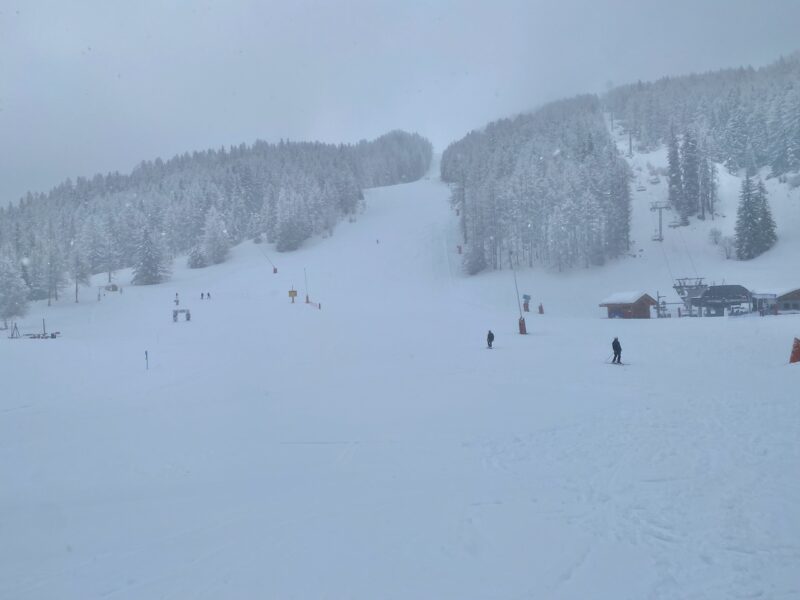
La Clusaz, France. Image © PlanetSKI

La Clusaz, France. Image © PlanetSKI
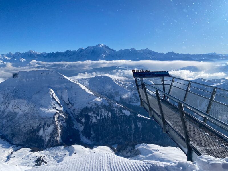
La Clusaz, France. Image © PlanetSKI
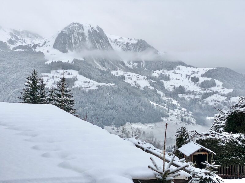
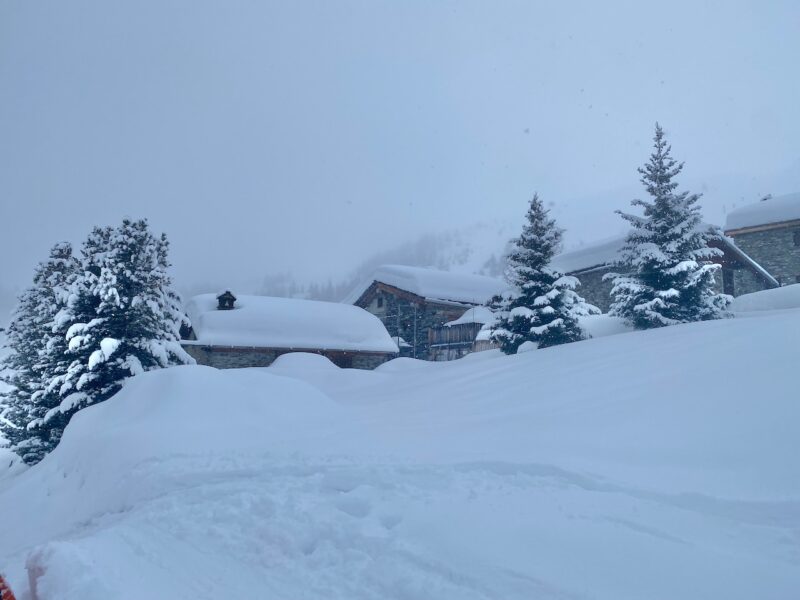
PlanetSKI’s Jane Peel is in Hochkönig in Austria. It’s one of the lesser known ski areas in the Eastern Alps.
It’s not sunny there today, though, but it’s cold and there have been snow flurries throughout the day.
Some of the snow cannons have been working hard to top up pistes that are already in pretty good shape.

Hochkönig, Austria. Image © PlanetSKI

Snow flurries in Hochkönig, Austria on Sunday 12 Jan 2025. Image © PlanetSKI

Snow cannons topping up in in Hochkönig, Austria. Image © PlanetSKI
Here’s Jane’s full snow report from Hochkönig.
And PlanetSKI is also in the USA at Big Sky, Montana:
View this post on Instagram
Saturday 11th January
Today’s snow report should really be called the temperature report as it is going up and down dramatically in the Alps.
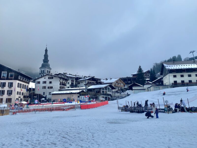
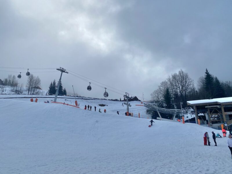
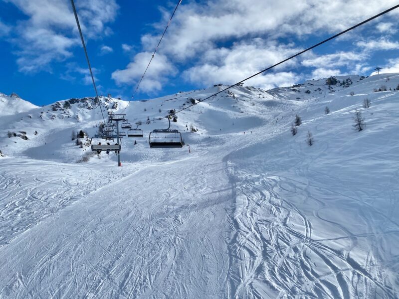
Here is La Clusaz, in France at 12.30pm at 1,860m: +8c.

La Clusaz, France. Image © PlanetSKI
“After such a volatile week, snow conditions in the Alps are extremely mixed; generally poor again at low altitude in the north-west, which has seen quite a lot of rain in recent days, but potentially quite good higher up, which has mostly seen snow,” said Fraser Wilkin from weathertoski.co.uk.
For much of the day on Saturday the slopes in La Clusaz were shrouded in dense cloud and mist that was affecting many ski resorts in this part of the north-west French Alps.

La Clusaz, France. Image © PlanetSKI

La Clusaz, France. Image © PlanetSKI
Here is a video snow report from PlanetSKI’s James Cove:
One hour after filming the video report the temperature fell and outside the restaurant it started to snow.
The freezing level had dropped down the mountain significantly in just 60-minutes.
As we ended our day things began to brighten up at village level.
La Clusaz, France. Image © PlanetSKI
La Clusaz, France. Image © PlanetSKI
Sunday is forecast to be colder with blue sky.
Fingers crossed.
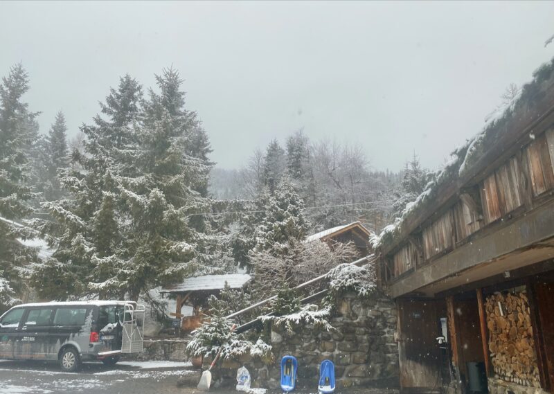
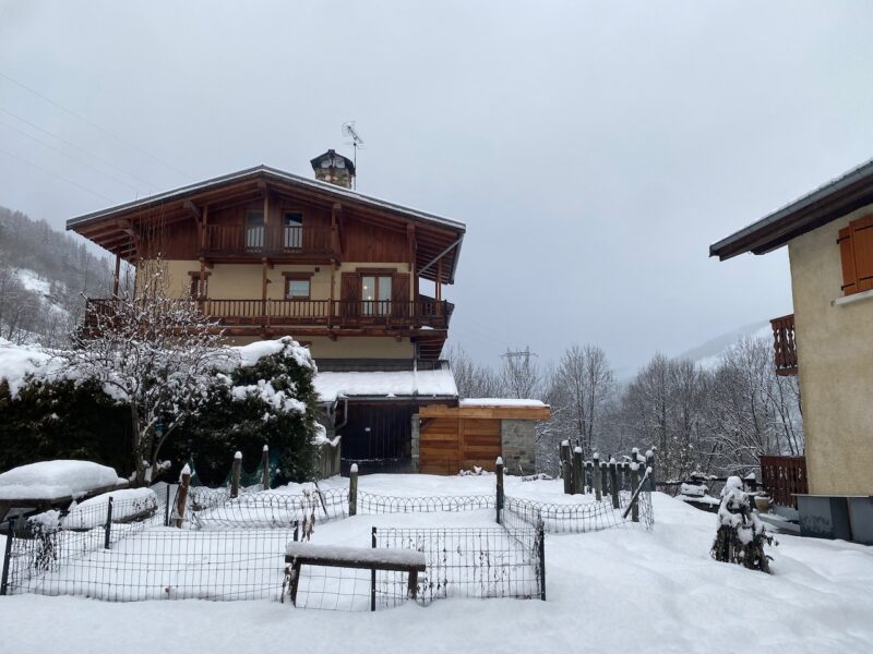
Elsewhere in the Alps PlanetSKI’s chief reporter, Jane Peel, has just arrived in Hinterthal in Austria to ski in the resort of Hockoenig.
“It’s looking promising with plenty of snow on the ground at 1,000m altitude,” said Jane on arrival.

Hinterthal, Austria. Image © PlanetSKI
She will be reporting from Austria over the next few days.
If you want to know about conditions in the USA another one of our reporters has just arrived in Big Sky:
Do check back later for Simon’s report on Big Sky in Montana…
Friday 10th January
On it goes in the north-west Alps.
Rain and snow.
PlanetSKI reader Mark Edbrooke is in Tignes.
“Tignes 1800 and 1550 have great snow and decent visibility today,” said Mark.
“At Tignes 2100 it has been snowing steadily so there is lots of snow, but the visibility is poor though not the nasty wind that we have had in the past few days.”
PlanetSKI’s James Cove is leaving the village of Villaroger lower down in the Tarantaise beneath Les Arcs and Ste Foy.
He is heading to Manigod near Lake Annecy.
It is normally a drive of under 2-hours, but today it was well over 2-hours.
It was snowing hard in Villaroger at 1,200m as the freezing level had finally dropped.
PlanetSKI has winter tyres on its car so no matter, but driving conditions were slow in the snow and cloud.

North-west French Alps. Image © PlanetSKI
Once out of the mountains it turned to rain at about 1,000m and those with chains battled to take them off.

North-west French Alps. Image © PlanetSKI
It is a similar picture elsewhere in this part of the Alps with snow finally falling to low altitude after heavy rain in the past few days.
The weather has caused some travel disruptions, but we have heard of no major incidents.
As James approached Manigod there was snow in the mountains where he was heading.

North-west French Alps. Image © PlanetSKI
And on arrival mid-afternoon at his accommodation, the Chalet Hotel de La Croix Fry, the snow was wet but it was snow not rain.
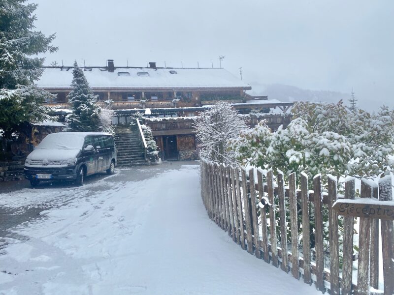
North-west French Alps. Image © PlanetSKI
North-west French Alps. Image © PlanetSKI
The key question was could James get to the lifts in time to make a few afternoon turns in the fresh snow?
Sadly no.
The journey took longer than planned and resort’s night skiing was not on offer on Friday.
No matter as Saturday should be an absolute cracker with the weather set to clear a bit.
It’s looking good:
Bring it on.
North-west French Alps. Image © PlanetSKI
Thursday 9th January
It remains decent at altitude in the north-west Alps though the warm temperatures are having an impact.
PlanetSKI’s James Cove was in Ste Foy, France, on Thursday as more snow fell (after the rain).
There has been a good start to winter in Ste Foy with plenty of coverage.
Ste Foy, France.Image © PlanetSKI
Ste Foy, France.Image © PlanetSKI
Ste Foy, France.Image © PlanetSKI
“The weather will remain very unsettled on Thursday and Friday, with further weather fronts arriving from the west,” said Fraser Wilkin from weathertoski.co.uk on Thurday.
“Temperatures will yo-yo but, on the whole, it will remain mild with further rain lower down and significant quantities of snow in the north-western Alps higher up.”
Thursday was essentially a continuation of the weather on Wednesday.
Wednesday 8th January
“Woke up to rain in the village,” said PlanetSKI’s senior reporter, Simon Wilson, on Wednesday from Verbier in Switzerland.
“But it was snowing from about 2000 metres and some lovely piste skiing conditions above that.
“Forecast is for some sun later and more fronts later in the week with freezing level moving up and down the mountain.
“The resort and slopes are very quiet, with not a lift queue in sight.”
Here is Simon’s latest video report:
Lower down in the Alps the temperatures are warm and rain has been falling.
Here was the scene on Wednesday morning in Le Pre, a village beneath Les Arcs in France, with light rain falling at 1,200m.
Le Pre, LesArcs, France. Image © PlanetSKI
Up top though, in and above Arc 1950, it was a different story.
“There was some good piste skiing on the higher slopes with empty slopes and few lift queues,” said PlanetSKI’s editor, James Cove.
“There remains plenty of snow coverage, but to be honest it would be great if the temperatures were lower.”
Arc 1950, France. Image © PlanetSKI

Arc 1950, France. Image © PlanetSKI
Above Arc 1950, France. Image © PlanetSKI

Arc 1950, France. Image © PlanetSKI
The forecast is for rain/snow to continue over the next few days with the temperature fluctuating.
At Tignes, higher up the valley, the sun made an appearance on Wednesday through the clouds.
PlanetSKI reader, Mark Edbrooke, is in the high-altitude French resort.
“There is excellent snow, especially above 2,500m but 2,000m and below snow is quite wet,” said Mark.
“It is sunny at lunchtime, but there is a strong breeze in some parts.”

Tignes, France, Image © Mark Edbrooke.

Tignes, France, Image © Mark Edbrooke.
The changeable weather has also affected the World Cup ski racing calendar.
‼️ Program change for the Men’s Audi FIS World Cup in Adelboden 🇨🇭
👉🏼 This is to inform you that due to the weather forecast announced for the upcoming weekend, the Men’s Audi FIS Ski World Cup program in Adelboden has been adjusted as follows in order to maximize the chances of… pic.twitter.com/wP6GDp53uP
— FIS Alpine (@fisalpine) January 8, 2025
It all follows some excellent conditions over Xmas/New Year and the start to winter.
Tuesday 7th January
On Tuesday PlanetSKI editor, James Cove, was making some turns in Arc 1950 in France:
Arc 1950, France. Image © PlanetSKI
Arc 1950, France. Image © PlanetSKI
Overall, the weather in the Alps remains very changeable, with one storm clearing from the eastern Alps while a new warm front approaches the west.
Here’s Simon’s earlier video report from Verbier on Tuesday:
Between 5cm and 10cm of snow fell overnight in Verbier.
“Above 2,000m there is some excellent piste skiing and a bit of powder on the edge of pistes,” Simon added.
“Fully off piste is quite windblown and tricky.
“More snow and valley rain is expected throughout the week with the forecast changing day by day.”

Verbier on Tuesday 7 January. Image © PlanetSKI
More to follow…….
![]()
![]()
PlanetSKI: Number 1 for digital ski news.
Your digital platform for ski news, resort information, travel, equipment rental, money saving deals and everything connected with snowsports – web site, social media & more.