The PlanetSKI Snow Report
9th March 2026
Last modified on March 17th, 2026
We update from the Alps after a mid-March snowfall has topped things up but led to avalanche risk. UPDATED
Tuesday 17th March
We start today with an update from the resort of Gausta, in Norway.
View this post on Instagram
See more here about Gausta:

Gausta. Image c/o Norway – Home of Skiing

Gausta. Image c/o Norway-Home of Skiing.
We will have a full update from the Alps later today as the weather warms up with the sun back.
PlanetSKI editor, James Cove, remains in Morzine/Les Gets in France.
It’s looking rather good.
View this post on Instagram
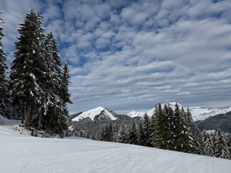
Morzine/Les Gets, France. Image © PlanetSKI
Monday 16th March
The latest storm has passed with some fine weather returning to the Alps.
“The rest of this week will be relatively calm in the Alps, with plenty of sunshine but also some areas of cloud drifting around,” said weathertoski.co.uk.
“Temperatures will be on the cool side, meaning that freeze-thaw cycles will be less extreme than they might otherwise be at this time of year.
“Towards the weekend there is the chance of some further snow in the south-western Alps.”
The latest storm has caused ‘considerable’ risk of avalanches in parts of the Alps.
One person has died in France with another injured.
The avalanche risk is ‘considerable’ in parts of Switzerland, France and Italy.
Sunday 15th March
The forecast storm has delivered in places.
1m of snow is reported to have fallen in parts of western Italy and the south of Switzerland.
Zermatt and Saas-Fee have seen up to 1m of fresh snow, accompanied by some high winds.
Resorts in the Monte Rosa area in Italy have done well.
Many other parts of the Alps have also seen snow, with 10-30cm above 1,600m across some parts of the French Alps.
There was less snow at lower altitudes than expected.
PlanetSKI is now in Morzine where snow fell, but not in the quantities expected with a dusting of around 5cm on the slopes.
It has though been very welcome.
View this post on Instagram

Morzine/Les Gets, France. Image © PlanetSKI

Morzine/Les Gets, France. Image © PlanetSKI
In Morzine the ‘Rock the Pistes’ event is underway.

Morzine/Les Gets, France. Image © PlanetSKI\\
And let’s not forget the Jura mountains to the north of Lake Geneva that looked good on Sunday.

The Jura mountains. Image © PlanetSKI
More to follow…
Saturday 14th March
A major storm is hitting parts of the western Alps with over 1m set to fall in places.
According to weathertoski.co.uk. the areas most likely to see extreme snowfall from this storm are:
- The eastern Aosta (e.g. Gressoney),
- The northern Piemonte (e.g. Alagna, Macugnaga)
- The border regions of the Haut-Valais above Zermatt, Saas-Fee and the Simplon region.
“These regions are likely to see 1m or more snow (with some models predicting up to 1.5m) above 2000m in just 36 hours between Friday night and Sunday morning,” said Fraser Wilkin from weahtertoski.co.uk.
Most French, Swiss and western Italian resorts should see 20-60cm above 1600m or so.
PlanetSKI reader Laura Polglase has sent us this image from Wengen on Saturday morning.

Wengen, Switzerland. Image c/o Laura Polglase.
More to follow…
Friday 13th March
Further snow is set to fall this weekend in the Alps.
There should be some significant falls in some localised parts of the western Alps tonight and into Saturday.
Up to 1m forecast in some places.
“This storm is potentially very significant because it is two-pronged – with weather fronts moving in from the west that will also spawn a secondary low in the northern Mediterranean,” said Fraser Wilkin from weathertoski.co.uk.
“This secondary depression will throw a lot of energy northwards, particularly into the eastern Aosta/northern Piemonte regions, but also spilling over the border into parts of Switzerland.
“So, while most of the western Alps will see at least a moderate fall of snow on Friday night and Saturday, some models are predicting snowfalls of 50-100cm in a very short space of time in quite a specific area.
“This includes Cervinia, the Monte Rosa region, Saas-Fee, Zermatt, and further north into areas like the Aletsch Arena and Andermatt.”
There is some snowfall forecast over the weekend for the Ski Arlberg area in western Austria, where PlanetSKI’s Jane Peel currently is.
“The local forecasts say around 9cm could fall in St Anton on Saturday, with a few more centimetres on both Sunday and Monday,” Jane said.
“But for my last day here, it was blue skies and warm sunshine all the way.
“I headed over to Warth on the far right hand side of the piste map and enjoyed the best conditions of the whole week.

Warth, Austria. Image © PlanetSKI
“The snow was good on almost every run, with heavy, spring snow on just a few lower sections of some slopes.
“What’s more, because it’s at the extremity of the ski area, the runs were pretty empty and there were no lift queues.
“What a way to end my six days in this fantastic ski area.”

Warth, Austria. Image © PlanetSKI
Jane has been staying with Inghams and will be reporting on the Inghams holiday experience very soon, so look out for her report on PlanetSKI.
A couple of days ago we heard from one of our regular reader, Lynsey Devon, who is currently cat-skiing in Georgia (see her reports from Wednesday below).
She has just sent us a few updated pictures of the snow conditions in Georgia.
Looking good.

March snow conditions in Georgia. Image c/o Lynsey Devon.

March snow conditions in Georgia. Image c/o Lynsey Devon.

March snow conditions in Georgia. Image c/o Lynsey Devon.

March snow conditions in Georgia. Image c/o Lynsey Devon.
Thursday 12th March
We have two video snow reports today from the Alps.
The first comes from PlanetSKI’s chief reporter, Jane Peel, who is in the Arlberg in Austria.
St Anton to be precise.
View this post on Instagram
The next is from our man in Tignes/Val d’Isere, Steve Angus.
View this post on Instagram
More to follow…
Wednesday 11th March
Here at PlanetSKI we like updating our snow reports from some of the more unusual places in the mountains to ski and snowboard.
Today we hear from PlanetSKI reader, Lynsey Devon, who is cat-skiing in Georgia.

Cat skiing in Georgia. Image c/o Lynsey Devon.

Cat skiing in Georgia. Image c/o Lynsey Devon.
“There is an abundance of snow here and when we arrived last Sunday heavy fresh flakes were falling,” said Lynsey.
“It has been snowing for the past three days in Bakhmaro in the Caucasus in western Georgia.”

Cat skiing in Georgia. Image c/o Lynsey Devon.
“We have skied two days of fluffy light powder coming off the Black Sea and we are cat-skiing so are able to make the most of the current conditions.”

Cat skiing in Georgia. Image c/o Lynsey Devon.

Cat skiing in Georgia. Image c/o Lynsey Devon.

Cat skiing in Georgia. Image c/o Lynsey Devon.

Cat skiing in Georgia. Image c/o Lynsey Devon.
“Tuesday was another blue sky powder day.
“It’s so good that Cat Skiing Georgia has extended its season by a week.”

Cat skiing in Georgia. Image c/o Lynsey Devon.

Cat skiing in Georgia. Image c/o Lynsey Devon.

Cat skiing in Georgia. Image c/o Lynsey Devon.
“One of the many fabulous views here in Georgia is a sight of Mount Elbrus in Russia.
“At 5,642m it is the highest mountain in Europe.
“Seeing it in the distance was an utter treat.”

Cat skiing in Georgia. Image c/o Lynsey Devon.
Tuesday 10th March
PlanetSKI reporters Max Cove and Sally Lovegrove are currently in Val d’Isere in France.

Val d’Isere, France. Image © PlanetSKI
“The pistes are in really good condition, but it really does need to snow,” said Max and Sally.
“There has been no fresh snow since 20th February and it is now really feeling it.
“However we have been enjoying the clear blue skies and enjoying drinks and food in the sun – one of the best parts of March skiing.
“But we are missing some powder!”

Val d’Isere, France. Image © PlanetSKI

Val d’Isere, France. Image © PlanetSKI

Val d’Isere, France. Image © PlanetSKI
PlanetSKI’s chief reporter Jane Peel could also do with some more snow and colder temperatures in St Anton in the massive Ski Arlberg in Austria.
“There’s still plenty of cover on the pistes but it’s been very warm and sunny here for the past three days that I’ve been here,” Jane said.
“Many of the runs have that heavy, thigh-burning snow that cuts up quickly and turns into slushy moguls – and not just in the late afternoon.
“Having said that, today I skied over to Zürs where the snow conditions were, on the whole, pretty good.

Zürs, Austria. Image © PlanetSKI
“A few, notably red 156 which was my run of the day, were so nice that I thought it was winter again!
“Certainly the skiing over in Zürs was more enjoyable than the slush-fest on the home-run to St Anton.
“It was definitely a day to rest the weary legs and re-invigorate with a quick drink at St Anton’s legendary après-ski spot, the Mooserwirt, before the final stretch back to the Inghams chalet.”

The legendary Mooserwirt après-ski bar, St Anton. Image © PlanetSKI
There could be a few flurries of snow in the south west Alps over the next few days, but it will only be a dusting here and there.
However, there is a change in the weather at the end of the week with some forecast models predicting significant levels of snow in the western Alps.
It remains unclear at the moment, but we’ll keep you posted.
Do check back…
Monday 9th March:
PlanetSKI’s Jane Peel has travelled across from her base for the week in St Anton in Austria with Inghams Ski to another of the ski resorts in the Arlberg – Lech.
View this post on Instagram

Heavy going on the way down to Lech, Austria, on Monday afternoon. Image © PlanetSKI
Meanwhile here’s the overall assessment for the week in the Alps from Fraser Wilkin from weathertoski.co.uk
A man who knows about these things.
“Over the next few days, many parts of the Alps will remain dry with some sunshine,” said Fraser.
“However, there will be areas of cloud drifting around, especially in the far west and south-west where some showers or flurries are possible.
“These could become more consequential for a time in the far south-west (e.g. Isola 2000, Prato Nevoso) on Monday night and Tuesday, when 5-15cm of snow is possible.
“The best of the sunshine over the next few days is likely to be found the further north-east you are.”
There are early indications that there might be some snowfall in the Alps at the end of the week, but it is too early to say so.
PlanetSKI’s editor, James Cove, will be in the French & Swiss Alps later this week, so look out for his updates.
He is currently driving out and stopping en route.
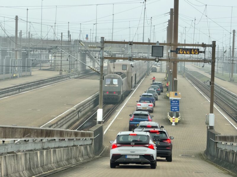
Driving to the French Alps with LeShuttle. Image © PlanetSKI
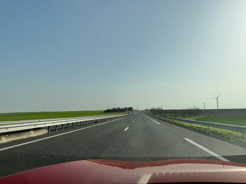
Driving to the French Alps with LeShuttle. Image © PlanetSKI
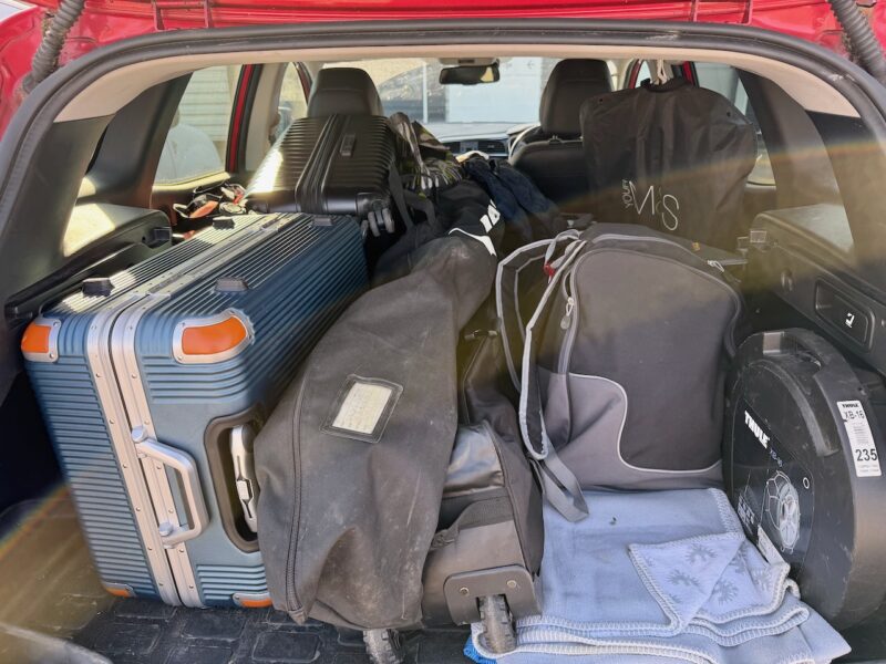
Driving to the French Alps with LeShuttle. Image © PlanetSKI
Sunday 8th March
It was sunshine and late season conditions in the Austrian resort of St Anton for PlanetSKI’s Jane Peel.
“The temperature first thing this morning was around 10 degrees Celsius in the town, which is at 1,300m altitude,” Jane said.
“It was not a surprise to find that it felt more like April up on the mountain with the first turns on hard pistes that quite quickly changed to soft spring snow.
“There’s no snow in the immediate forecast so it’ll be a case of choosing our runs carefully this week.”

St Anton, Austria, Sunday. Image © PlanetSKI

St Anton, Austria, Sunday. Image © PlanetSKI
PlanetSKI: Number 1 for digital ski news
Your digital platform for ski news, resort information, travel, equipment rental, sport, money saving deals and everything connected with snowsports – web site, social media & more.
![]()
![]()