CHECK OUT THE UPDATED PLANETSKI SNOW REPORT
14th February 2020
Last modified on May 15th, 2021
Snow conditions in the Alps are mixed as Half Term gets underway. Most resorts still have plenty of snow at altitude, but mild weather means some low resorts are in need of new snow. UPDATED
Sunday 16th February
Our editor, James Cove, is in La Thuile in the Aosta Valley.
https://www.facebook.com/planetski/videos/498135351117979/?eid=ARDz0HpfUiaeY84BBXqLxOO61cjLwHG4qErj2WVWf94PpRWWNWu9EoRHUXwqX0Xp4jcIhGIZn4h2iG3u
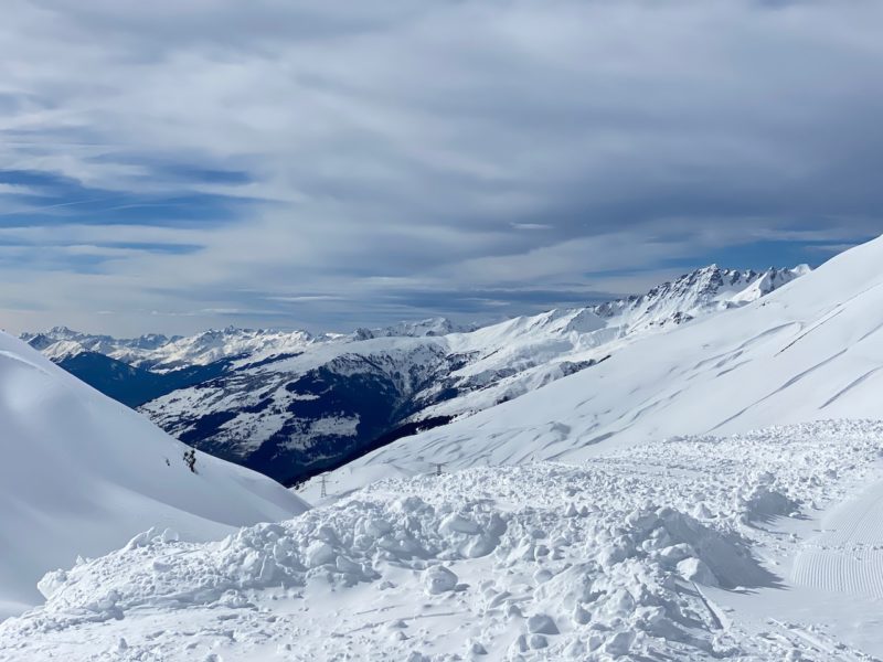
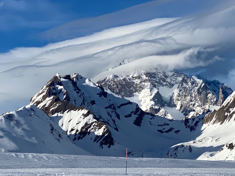
As James said the clouds over Monte Bianco were impressive.
Here we bring you a few more images as the overhead conditions across La Rosiere in France and La Thuile in Italy put on an impressive show today.
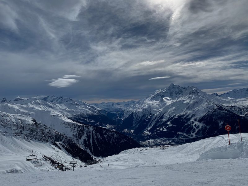
Overhead in the Alps. Image © PlanetSKI.
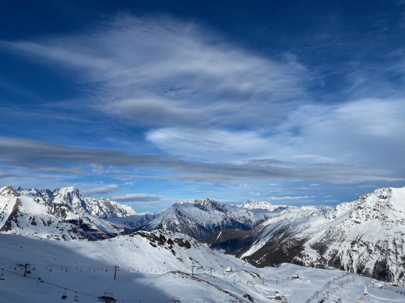
Overhead in the Alps. Image © PlanetSKI.
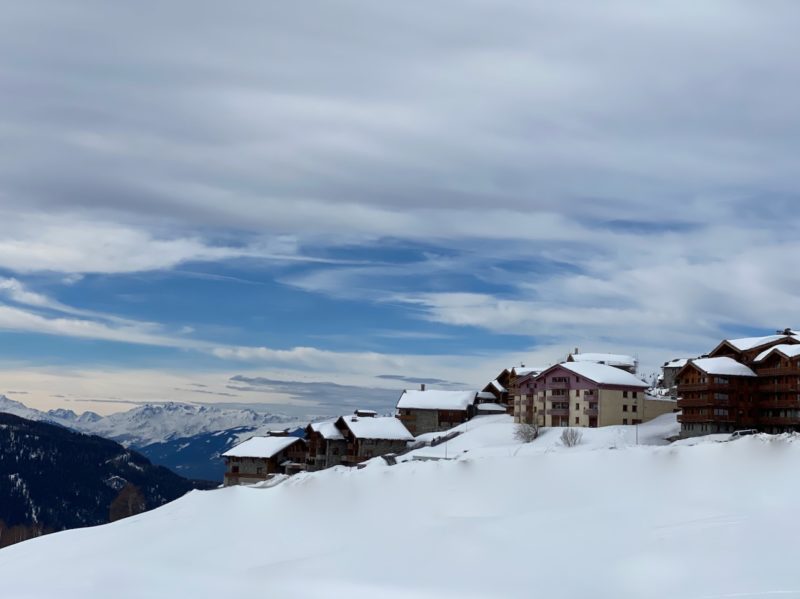
Overhead in the Alps. Image © PlanetSKI.
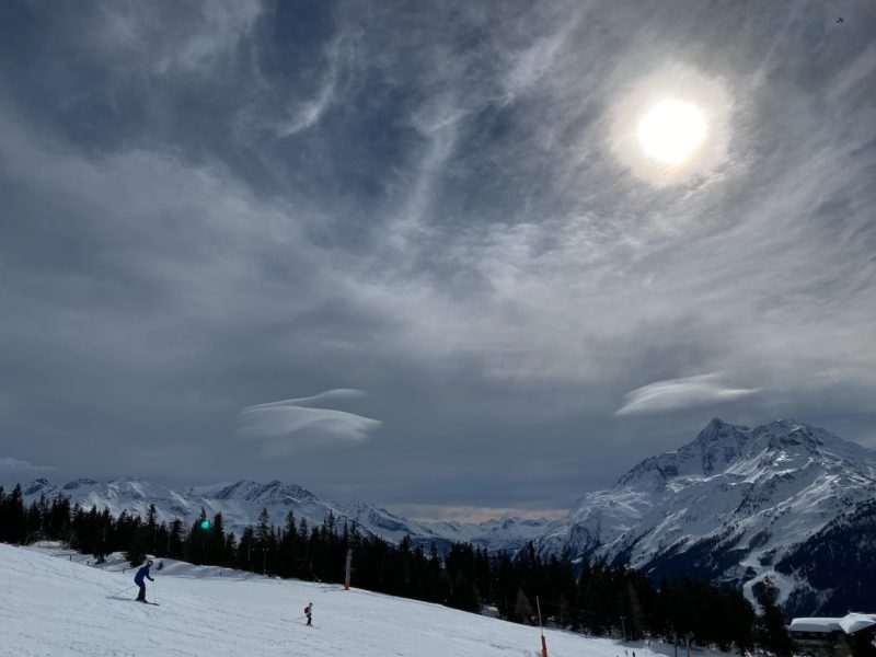
Overhead in the Alps. Image © PlanetSKI.
Overhead in the Alps. Image © PlanetSKI.
Overhead in the Alps. Image © PlanetSKI.
And what about the weather forecast for rest of the week?
As always we turn to the alpine weather expert, Fraser Wilkin from weathertoski.co.uk
“For the rest of the week, the Alps will be under the influence of a mobile westerly airflow, with occasional storms scheduled to arrive late on Monday, on Wednesday and on Friday, and some more settled interludes (especially on Tuesday and Thursday),” said Fraser on Sunday.
“These storms are NOT expected to be particularly potent, but will be most active in the north-western Alps where we could see between 20cm and 50cm of new snow above 1600m by the end of the week. The southern and eastern Alps (e.g. Dolomites) will see the most sunshine and little, if any, snow.”
“The rain/snow limit this week will generally be between 800m and 1600m, although it will be a little higher to begin with during the first storm tomorrow afternoon.”
Our full and detailed snow report below, that was filed on Thursday 13th February comes from Fraser Wilkin at weathertoski.co.uk.
Snow conditions in the Alps are mixed as we approach the busiest week of the season.
Most resorts still have plenty of snow, especially at altitude, but the mild weather pattern of recent weeks has meant that some low resorts are in urgent need of new snow, especially in the north-west (e.g. Morzine, Gstaad).
It is important to note that these resorts do still have plenty of snow at altitude, but many of the low valleys in the French and western Swiss Alps are now nearly or completely devoid of natural snow, which is unusual for mid-February.
Higher up, the situation is much more positive, with resorts such as Val d’Isère, Val Thorens, Avoriaz, Verbier, Zermatt, Cervinia, Mürren, St Moritz, Ischgl, St Anton, Sölden and Obergurgl all in good shape as we enter the second half of the season.
Some new snow is expected across the Alps today/tonight (13th February), heaviest at altitude and in the north-west.
There will then be a drier, brighter and very mild spell of weather for all areas late on Friday and through the weekend, before it then turns unsettled again early next week.
Across the pond there have been huge snowfalls across many western US resorts in recent days…
AUSTRIA
Snow conditions are pretty good across most of Austria, and even excellent at altitude in resorts such as Ischgl (70/140cm) and Obergurgl (65/135cm).
Lower down, milder weather has made snow quality a bit more variable, but there is still plenty of good skiing to be had in the likes of Saalbach (50/115cm) and the Ski Welt (10/90cm).
The weather will be a bit mixed over the next few days – mostly dry and mild over the weekend, but with some showers or flurries early next week.
FRANCE
Snow conditions in the French Alps remain very good at altitude, with further snow falling today in the likes of Avoriaz (110/260cm) and Les Arcs (185/290cm).
The picture is more mixed lower down though, with some decent skiing still on offer in the likes of Morzine (5/120cm) and La Clusaz (10/160cm), but natural snow cover at resort level is only patchy at best.
The southern French Alps are generally in good shape, with base depths of 45/210cm in Serre Chevalier and 90/150cm in Isola 2000.
Expect generally dry and mild weather everywhere on Sunday before it turns more unsettled again on Monday and Tuesday, with a bit of snow in places, mostly in the northern half of the French Alps.
ITALY
Snow conditions remain good across most of Italy, especially at altitude in the north-west where fresh snow has fallen in recent days.
Cervinia now has snow depths of 105/270cm while La Thuile has 40/250cm, however both resorts are quite vulnerable to wind which has been a big issue at times this week.
Further east there is also plenty of good skiing available in the Dolomites, with base depths of 60/160cm in Madonna di Campiglio and 50/155cm in Selva.
SWITZERLAND
Switzerland is currently offering lots of good skiing, even if natural snow is in short supply in some of the lower resorts in the north and west.
Gstaad (5/90cm), for example, can still offer plenty of good skiing (and at the time of writing it was snowing again at altitude) but is virtually devoid of snow at resort level.
Higher altitude Davos (70/180cm) and Zermatt (50/180cm) are two resorts that are in better overall shape, and also have some fresh snow.
Expect mild and mostly fine weather across Switzerland this weekend before further showers or flurries move in from the north-west early next week.
REST OF EUROPE
We are happy to report that there is at last plenty of snow in Scotland.
Weather permitting – the wind will be an issue again this weekend – all five main areas should be up and running, with base depths of 25/40cm at Glenshee and 25/50cm at Cairngorm.
In the Pyrenees, very mild weather has led to a rapid thaw of the snow at lower levels.
Higher up there is still plenty of good piste skiing though, with base depths of 70/170cm in Spain’s Baqueira Beret and 30/110cm in France’s Peyragudes.
There is also plenty of good skiing on offer in Scandinavia, where Norway’s Voss has 90/190cm depending on altitude, with some serious snow in the forecast for next week.
Sweden’s Åre is also in good shape with 80/100cm depending on altitude.
US
Many western US resorts have seen huge snowfalls over the last week, meaning that there is now some superb skiing on offer.
Colorado is no exception, with fantastic conditions both on and off piste in Vail where the mid-mountain base is now 213cm.
Montana’s Big Sky is another resort that is wallowing in the white stuff, with a very healthy 271cm upper base and more snow in the forecast.
CANADA
Whistler continues to offer plenty of good skiing even if the 23cm of new snow in the last week is well short of some of its western US competitors.
A few more flurries are forecast over next few days before the weather settles down again early next week.
Light snow is also expected over the weekend further inland in the Banff/Lake Louise area, where temperatures are colder and the upper snow depth is 162cm.


