Further Snow is Falling in Parts of the Alps with ‘Considerable’ Avalanche Danger
29th January 2021
Last modified on May 20th, 2021
Huge amounts of snow have fallen in parts of the Alps. Some people have been caught in avalanches, villages were cut off and more snow is on the way. There have been some large spontaneous avalanches. There are some excellent skiing conditions, but it’s highly dangerous off piste.
The fiercest storms started in the north and western Alps, in Switzerland and France, last week.
Up to 2m fell at altitude in a few places.
There remains some spontaneous avalanches happening.
Further east, Austria has also seen some heavy snow in the Tirol and Salzburg.
The new snow has been falling on the snowpack that has an extremely weak, and widespread, layer near the base of the snow.
The fresh snow is putting extra pressure on this already very weak snowpack.
See here for our separate story on recent avalanche fatalities:
The temperatures have been warm in the Alps and heavy rain has also fallen with flooding worries.
Update:
The weather in the Alps will remain broadly similar and stay mild for the rest of the week, though it will generally be a little brighter on Thursday and Friday.
Here’s the outlook from Fraser Wilkin at weathertoski.co.uk:
“The mild (and in places damp) weather this week means that snow quality will be highly variable, especially in the north-western Alps, where there will be wet snow lower down in resorts such as Villars, Gstaad, Grindelwald, Flumserberg and St Anton.
“For more consistent “wintry” snow quality you will need to stick to slopes above 2000m this week, ideally even higher.
“Note that the avalanche situation remains complicated in the north-western Alps, with large spontaneous avalanches still possible.
“Furthermore, weak layers in the snowpack will continue to pose a danger later in the season, even if/when the current situation has stabilised.”
Here at PlanetSKI we are following the situation closely in Switzerland, not least because it is the only alpine country with ski resorts that are open to all nationalities.
The ski resorts are open in Austria, but to locals only.
In the west and north it of Switzerland it will remain mostly very cloudy on Wednesday.
“Precipitation will fall at times, in particular in the afternoon,” said the Swiss Institute for Snow and Avalanche Studies.
“The snowfall level will be approximately 1800 to 2200 m.
“In the afternoon it will drop towards 1500 m. In the south there will be only a little precipitation, which will fall as snow above 1200 to 1500 m.”
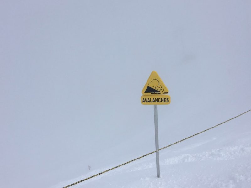
The avalanche risk continues across the country with much of the mountains on a Level 3 alert – that means “considerable” risk.
Do check back later on Wednesday for our updates…
Tuesday 2nd February:
The snow continues…
There is more snow falling in northern and western parts of the Alps.
Here is the scene in Val Thorens in Les3Vallees with an image from its Facebook page.
There remains ‘high’ and ‘considerable’ risk of avalanches.
One hit the Chatelet chairlift in Meribel and these pictures were posted by our friends over at Intersport.
The avalanche danger level has risen to ‘high’ today in some areas of western Switzerland.
Here is the full snow report from the Swiss Institute for Snow and Avalanche Studies:
“In the last five days, 1 to 2 m of snow have fallen over a wide area in Valais, on the northern flank of the Alps and in northern Grisons.
“Most recently, there have been frequent breaks in the precipitation. The fresh snow and snow drift accumulations are continuing to settle.
“Underneath these deep fresh snow and wind slab layers, distinct weak layers are to be found in Valais and Grisons in particular.
“Avalanches can be triggered in these layers, as evidenced by various avalanche releases with a large surface area in recent days.
“Additional snowfall in the west and north can give rise to further failures in the old snowpack here. In the south, the bonding of the snowpack is more favourable. Fractures are unlikely to occur in the old snowpack.
“The snowpack is thoroughly moist below approximately 1800 to 2000 m. Gliding avalanches can still occur here. These can reach a large size.”
We will be updating this article this afternoon so do check back…
Monday 1st February:
Snow Returns this Week & Avalanche Danger Remains
The Avalanche Death Toll in the Alps Continues to Climb and the latest incidents we have heard about come from Austria
Four people were killed in avalanches in the Tirol in Austria over the weekend.
Extreme caution is urged across many parts of the Alps.
It is one of the most dangerous periods in recent years across the Alps.
There have been more than 50 deaths so far this winter and that comes as many resorts are closed.
See here for further details:
After easing on Sunday more snow is on the way, though not in such large amounts.
Here’s the scene in Val d’Isere, France, first thing on Monday morning.
30cm is forecast and the avalanche danger is at Level 4.
People in Val d’Isere are being asked to clear the snow from the roof of buildings as it could slide off and bury passing pedestrians.
And Val Thorens has been monitoring the snow levels over the past few days.
It was quite a storm last week with Level 5 avalanche danger in parts of France and Switzerland, plus Level 4 in some places in Austria.
Up to 2m fell in a few spots with many others having well over a metre.
Ski resorts remain open across Switzerland with some lift closures due to the snow levels.
In Switzerland for Monday there remains a ‘considerable’ risk of avalanche with Level 3 in many places and ‘high’ at Level 4 in some areas in the east of the country.
“The large amounts of fresh fallen snow and freshly generated snowdrifts from this last week are continuing to consolidate,” said the Swiss Institute for Snow and Avalanche Studies.
“Beneath the thick layers of fresh snow, particularly in the Valais and in Grisons, there are strikingly weak layers.
“Avalanches can be triggered in these layers by persons, as various large-spread avalanche releases of the last few days have amply demonstrated.”
Avalanche danger
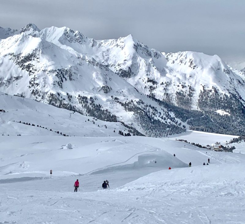
There is now excellent levels of snow across many parts of the Alps with conditions above average for the time of year.
For an analysis we turn to Fraser Wilkin from weathertoski.co.uk
“Following last week’s wild weather, snow depths are now way above average across the north-western Alps (e.g. Tignes, Val Thorens, Chamonix, Verbier, Zermatt, Mürren, Engelberg, Laax), especially at altitude where three-day storm totals (between Wednesday and Saturday) were between 1m and 1.5m above 2200m, with even more in places.
“Indeed, all parts of the Alps currently have excellent snow cover, though we do appreciate that publicly accessible lift-served skiing is still only possible in Austria and Switzerland.
“If skiing in the Alps does become more accessible to greater numbers of people later on this season, even if that means skiing in the Alps beyond the “normal” season (i.e. later in spring or in summer) then there is plenty to be optimistic about, from a snow perspective at least.”
Here at PlanetSKI we’ll be updating this story later on Monday so do check back…
Sunday 31st January
This is a sight many in the Alps haven’t seen in the past few days.
Sunshine and blue sky.
The weather has cleared in France and here is Val Thorens in Les3Vallees on Sunday after the heavy snow.
The images come from the Val Thorens Facebook page.
The resort has been monitoring the recent snow storm.
The latest storm has passed with the large amounts of fresh snow and freshly generated snowdrifts now stabilising to an increasing extent.
More than 1.5m fell in several parts of Switzerland.
The avalanche danger level remains at Level 4, ‘high’ in the east of the country.
The ski resort of Andermatt has some slopes open and had this warning.
“Warning: More sectors remain closed due to the high avalanche danger and wind. The connection to Cuolm da Vi and Sedrun remains closed. The Milez-Dieni sledging path will also be closed due to avalanche danger.”
The clearing up operation is underway in the resort.
We will be updating about conditions on Sunday in Andermatt later where it now claims a 5m depth at the top of the ski area.
In other resorts such as Verbier, Saas-Fee and Zermatt it is down to Level 3, but that means there is ‘considerable’ risk of avalanches.
More skiers and snowboarders get caught in avalanches when the risk is Level 3 than at any other level.
The authorities are now urging extreme caution as lifts re-open.
Further snow is expected to fall in Switzerland early in the week.
“On Monday and Tuesday, skies will be heavily overcast for the most part and in the northern regions repeated bouts of snowfall are anticipated,” said the Swiss Institute for Snow and Avalanche Studies.
On Monday snow will fall down to 1,200m and then the temperature rises on Tuesday with the snowline rising to 1,800m.
Up to 80cm could fall in the Valais canton.
“In the major areas of precipitation, avalanche danger levels could well increase again. In the other regions, avalanche danger will presumably decrease,” said the Institute.
Further east and over the border into Austria there has been fresh snow.
The ski resorts are open in Austria, but for locals only.
One local is our very good friend, Holger Gassler who lives in Innsbruck in the Tirol.
He was skiing in the local resort of Kuhtai and sent us these images from the slopes.
Kuhtai, Tirol, Austria
Kuhtai, Tirol, Austria
Kuhtai, Tirol, Austria
The snow continued in Kuhtai on Sunday morning and it is set to die away in the afternoon, then the skies will clear slowly.
There is avalanche danger in other mountain ranges in Europe.
In the Tatra mountain range in south Poland two men were rescued on Saturday.
They were found by a helicopter rescue team, both are well and unhurt.
A spokesperson from the Tatra National Park warned people not to venture out in the Tatra range owing to the heavy winds and snow.
We will be updating this article across Sunday so do check back…
Saturday 30th January
The resort of Zermatt has been able to reopen the railway line down to Tasch so the resort is no longer cut off.
“From 12:15 o’clock the shuttle trains between Täsch and Zermatt will again operate according to the timetable,” said the resort on Saturday morning.
Parts of the Swiss Alps have seen significant levels of snow and some more is set to come, but the main storm has eased.
In Grisons on Saturday, numerous avalanche releases were reported which fractured down to the old snowpack layers.
They are reported to be a “large size”.
Most areas are now at Level 4 and there are no areas at the highest danger warning, Level 5.
The warning from the Swiss Institute for Snow and Avalanche Studies is that “High avalanche danger will be encountered in some regions”.
The Institute continues, “Avalanches can fracture in the old snowpack and sweep the entire snowpack along.”
“From avalanche starting zones which have not yet discharged, avalanches can release and grow to very large size,” it warns.
Some residents in the commune of Orsières in the valley bear near Verbier were asked to evacuate their homes on Friday afternoon.
Avalanche exposed buildings were evacuated on the Neuvaz plateau in the villages of Granges and Ferret.
The cantonal police in the Valais says the canton has “experienced heavy snowfall in recent days and more are expected until the weekend. The situation remains serious throughout the canton and the cautionary opinion is maintained.”
The police are advising people to limit their movements outdoors.
It says “off-piste trips should be avoided until further notice.”
At PlanetSKI we’ll be updating later today on conditions in Switzerland and France so do check back.
Here is our overview of current conditions:
Switzerland
We have just received these latest images from Zermatt.
They come from regular reader and great friend of PlanetSKI, Rowena Phillips from the Matterhorn Diamond ski school , and some from the resort itself.
We go into some detail about the situation in the Swiss resort shortly as it is in the eye of the storm with some of the biggest totals of snowfall.
Take a look at these images from today, Friday 29th:
The resort was able to offer a small amount of skiing with the lifts up to Blauherd open in the Sunnega sector.
Five lifts were running.
“The blue runs were open and the red runs to the village from Sunnegga, but the Tuftern and Rothorn runs remained shut; there was just so much snow!” said Rowena.
More from Zermatt in a moment but meanwhile here’s the scene in western Switzerland:
Viele sehr grosse #Lawinen am Alpennordhang und im Wallis. Morgen im nördlichen #Wallis, im #Mattertal und in Teilen des Berner Oberlands sehr grosse Lawinengefahr! 📷O. Roch. Creux de Champ #LesDiablerets. pic.twitter.com/LpsDGsrjmw
— White Risk SLF (@whiteriskslf) January 28, 2021
The highest risk of avalanches in Switzerland is in the Goms valley, the Zermatt valley, as well as the entire right bank of the Rhône.
Some particularly threatened areas could even be evacuated said the authorities.
Roads have been close roads in the Valais canton and a number of villages in the Goms Valley, Lötschental and the Zermatt region are no longer accessible by road or train.
Zermatt itself is cut off with the railway line from Tasch closed due to the threat of avalanches.
This is not so rare and usually happens several times in the winter due to the exposure of the line.
There is so much snow in the village that roads are closed and buses are not running.
That is rarer.
“The railway line between Täsch and Zermatt remains suspended due to the clearance work – Travelling to Zermatt is currently not possible. The interruption is expected to last until tomorrow at 12:00,” said the resort on Friday.
And the digging out in town is continuous.
It is a similar pictures across other resorts in Switzerland including Andermatt.
Roads into the resort have been closed and the only way in or out is by train.
“Due to acute avalanche danger, the Schöllenen will be closed today, January 28. from 10 pm. If you have to go to Andermatt, park in Flüelen or Erstfeld and take the train from there,” said the resort on its social media page on Thursday.
“The large amounts of fresh snow and freshly generated snowdrifts are extremely unstable,” said the latest bulletin for Friday issued by the Swiss Institute for Snow and Avalanche Studies.
“Numerous naturally triggered avalanches were observed on Thursday, including many large-sized releases.
“Avalanche activity is expected to remain very high. Particularly in the avalanche starting zones which have not yet discharged, isolated extremely large-sized avalanches are still possible.”
Many of the high ski lifts in Switzerland are closed with people hunkering down and waiting for the storm to pass.
“The avalanche situation is expected to remain very critical,” said the Swiss Institute for Snow and Avalanche Studies as it looked ahead to the weekend.
France
It is Level 5 in parts of France and yesterday a man had a miraculous escape in Val d’Isere after he was hit by a huge avalanche while out snow shoeing with his family.
He was dug out alive after being buried under the snow for 2 hours and 40 minutes.
He was located by the signal from his mobile phone.
The Mayor of Val d’Isere said, “found alive after more than two hours in the snow, it’s a miracle”.
We have reported on it in full elsewhere on PlanetSKI:
In Val d’Isere the avalanche risk is now raised to ‘very high’ – Level 5.
Earlier on Thursday it was Level 4.
“Due to the heavy snowfall an Avalanche Trigger Intervention Plan is in progress. Ski touring is therefore strongly discouraged,” said the resort.
Now people are advised not to go out at all.
Chains are compulsory in the resort for vehicles and on the road down to Bourg St Maurice in the valley.
The roads to Fornet and Chatelard are closed to pedestrians, but vehicles are allowed.
In neighbouring Tignes it is also at Level 5.

Tignes warning
Some experts say the danger level and conditions from spontaneous avalanches in parts of the Savoie and Haute-Savoie areas of France are seen once every four or five years.
The storm is set to drop in ferocity later on Friday and then the snow continues again on Saturday before easing on Sunday.
We reported on Thursday as the storm started:
The temperatures are relatively warm across the Alps so there is heavy rain at lower altitude, with some flooding forecast.
“During powerful “warm” storms such as these, the areas that see the greatest snowfall are the higher intra-alpine resorts of the western Alps,” said our resident alpine snow expert, Fraser Wilkin from weathertoski.co.uk.
“Ski areas set deep in the mountains and backed by high mountains, such as Val Thorens, Val d’Isère, Tignes and Chamonix in France, plus Zermatt and Andermatt in Switzerland.”
Check out weathertoski.co.uk for the very latest and highly accurate snow news.
The authorities are urging people to be extra cautious in resorts where the lifts are open or for those who will be hiking up once the storms have passed.
Resorts in Switzerland are allowed to open, while the ski lifts in France remain closed.
The current conditions are extremely dangerous with a very unstable base layer in the snowpack in many places:
The new snow will fall on that unstable base off piste.
The Swiss Institute for Snow and Avalanche Studies says the situation when the storm passes will be “very critical”.
They know what they are talking about.
But for people that obey all the rules and stay in safe areas it is going to be rather special once the storm passes.
Here at PlanetSKI we will be updating this article across today and the weekend so do check back…


