What Does PlanetSKI Do In The Summer? Part Two…
27th June 2022
Last modified on July 10th, 2022
It’s the question we are asked most at this time of year. We’re currently hiking the South Downs Way in preparation for walking at altitude in the Alps later this summer. We’ve now done more than half the route, Eastbourne to Amberley. UPDATED
We started in Eastbourne in East Sussex and are now heading west towards Winchester in Hampshire – 100 miles of some of the most stunning scenery this part of the UK has to offer.
We’re not doing it one go, but rather spread out over several weeks, heading from our base in London for day trips combined with a few overnight stops.
It should set us up well for some hiking in the Alps later this summer.
South Downs Way. Image © PlanetSKI
We are not going to attack it in any sort of ‘boot camp’ way, but rather take it easy and head off the beaten track if we feel like it.
We’re going to be meandering, rather than marching.
Getting ‘match fit’ for the Alps is our primary goal.
And maybe we’ll be inspiring a few of our readers to do sections of the South Downs Way too if it is within reach.
See here for the first part of this rolling blog that contains our five daily hikes between Eastbourne and Pyecombe.
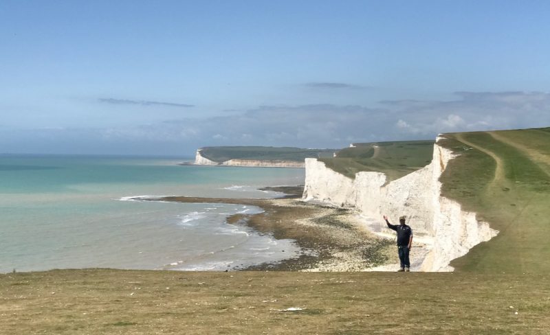
STAGE SEVEN – Steyning to Amberley

South Downs Way. Image © PlanetSKI
It was a train to Pulborough and then half an hour or so on the Number 100 bus to reach Steyning.
As we walked from the village of Steyning to the start of our day’s hike we were greeted with an unusual sight.

South Downs Way. Image © PlanetSKI
It was good to be back in the countryside.
Soon we were back on the route.

South Downs Way. Image © PlanetSKI
Gazing over the Steyning bowl and its surrounding wild flower meadows.

South Downs Way. Image © PlanetSKI
Next it was Chanctonbury Ring.

South Downs Way. Image © PlanetSKI
The ring of beech trees was first planted in 1760 by 16-year old Charles Goring who lived at Wiston House.
The site lies within the estate of the Goring family who had been prominent local landowners for centuries.
He decided to enhance the site by planting it with trees.
It is said he carried water up the hill each time he visited to water his trees.
His successors have continued to replant the trees ever since.
The Great Storm of 1987 destroyed over 75% of the trees so it was decided to replant the ring and to take a fresh opportunity to investigate the ring’s archaeology.
Chanctonbury Ring is a prehistoric hill fort and is thought to date to the late Bronze Age or early Iron Age.
Its exact usage is unclear, but archaeologists believe it could have been a defensive position, a cattle enclosure or a religious shrine.
After a few centuries it was abandoned for about 500 years until it was re-occupied during the Roman period.
Two Romano-British temples were built in the hill fort’s interior.
After its final abandonment around the late fourth century AD the hill fort remained unoccupied except for grazing cattle – until Charles Goring planted the beech trees.
Now it is a popular spot for hikers and one of the most striking features of the South Downs Way.
As we left the ring of beech tries we stopped to look North, South, East and West.
What a spot.
North

South Downs Way. Image © PlanetSKI
South

South Downs Way. Image © PlanetSKI
East

South Downs Way. Image © PlanetSKI
West

South Downs Way. Image © PlanetSKI
Then it was the walk towards Amberley along the top of the Downs.

South Downs Way. Image © PlanetSKI
Arundel Castle could be seen in the distance.

South Downs Way. Image © PlanetSKI
The castle is off the main South Downs Way, but perhaps on our return we should make a detour.
After all we had decided not to march the route, but rather to meander it.
We shall see…
And then after 20+kms and 5 hours we approached Amberley.

South Downs Way. Image © PlanetSKI
Getting back to London was a straight forward affair as there is a tiny station in Amberley.

Amberley station. Image © PlanetSKI
The trains go every hour and we had missed one by 10-minutes.
Oh well, the Bridge Inn is a couple of hundred meters from the station.

South Downs Way. Image © PlanetSKI
Next stop Amberley to …. not sure where.
It might even be that detour to Arundel Castle.
See here for the previous stage:
STAGE SIX – Pyecombe to Steyning

South Downs Way. Image © PlanetSKI
For the first time on the hike we are doing an overnight stay instead of our usual day trips from London via train and local buses.
Step forward Tottington Manor near Upper Beeding that nestles at the base of the Downs to the north west of Brighton.

South Downs Way. Image © PlanetSKI
And step forward the finest way to start a day hiking the South Downs Way.
A Tottington Manor breakfast.

South Downs Way. Image © PlanetSKI
We started today’s section at Pyecombe in East Sussex and headed towards Steyning in West Sussex.
Within a few minutes we were away from the busy and noisy A23 back into the heart of The Downs.

South Downs Way. Image © PlanetSKI

South Downs Way. Image © PlanetSKI
After 5-miles or so we reached Devil’s Dyke.

South Downs Way. Image © PlanetSKI

South Downs Way. Image © PlanetSKI
Devil’s Dyke is a 100m v-shaped dry valley that is now managed by the National Trust.
It was a major local tourist attraction in the late 19th and early 20th centuries.
It is now a popular viewpoint and area for walking.
Folklore explains the dyke as the work of the Devil.
Sussex was the last of the Anglo-Saxon kingdoms to embrace Christianity and its conversion apparently infuriated the Devil as he lost his last stronghold in England.
He therefore resolved to kill all of its inhabitants by digging a trench through the South Downs so that the sea would flood through and drown the people of the Sussex Weald.
The Devil’s plan was uncovered by a local hermit, Cuthman of Steyning.
Cuthman proposed that if the Devil could dig a trench in a single night he could have Cuthman’s soul, but if he failed then the Devil would have to abandon his plan and leave the people of Sussex alone for good.
The Devil accepted the wager and began digging that very night.
Shortly after midnight Cuthman lit a candle in his window while also startling a cock that began crowing in alarm.
The light and the sound of the cock crowing convinced the Devil that dawn was about to break, and that he had lost his bet with Cuthman.
He therefore ran away leaving behind the unfinished trench that became known as Devil’s Dyke.
Science explains it a different way and it is actually formed mainly due to melting snow.
In the last ice age glaciers did not reach this far south but snow did.
Snow capped the South Downs and permafrost conditions meant that the chalk of the Downs was permanently frozen.
In summer the snow melted and saturated the top layer of soil but the water could not permeate the frozen chalk underneath.
It therefore ran off the surface of the downs and slid down the gradient removing material by erosion.
When the ice age ended the snowfields covering the South Downs melted and rivers formed across Sussex.
Devil’s Dyke was formed by one such river.

South Downs Way. Image © PlanetSKI
In late Victorian times Devil’s Dyke became a tourist attraction much busier than it is today.
On Whit Monday in 1893 it is recorded that 30,000 people visited.
There was a fairground, two bandstands, an observatory and a camera obscura all served by a railway branch line from Hove.
During its heyday, Devil’s Dyke was a huge attraction for the Victorians.
From 1894 to 1909 there was a cable car that went across the valley.
It was 350m long and was suspended 70m above the valley floor.
Traces remain of the concrete pylon that supported the cable car system.
Devil’s Dyke is now a popular spot for paraponters and they were out in force as PlanetSKI passed through.

South Downs Way. Image © PlanetSKI

South Downs Way. Image © PlanetSKI
With fantastic 360 degree views:
After Devil’s Dyke is a truly stunning section with views over the Weald one way, and towards Chanctonbury Ring in the distance the other way.

South Downs Way. Image © PlanetSKI
There some pretty decent wildflowers growing in the meadows too.

South Downs Way. Image © PlanetSKI

South Downs Way. Image © PlanetSKI
After crossing the River Adur there is a gem not to be missed – St Botolph’s.

South Downs Way. Image © PlanetSKI

South Downs Way. Image © PlanetSKI
There has been a church on the site since AD 950.
It was wooden and there is nothing left of it.
The oldest part of the current flint church dates back to around 1050.
St Botolph is patron saint of wayfarers and it receives many visitors like us walking the South Downs Way.
It is highly worth a stop off.

South Downs Way. Image © PlanetSKI

South Downs Way. Image © PlanetSKI
And we can report that the organ still works.
We chatted to a local who said he was at a wedding in the church earlier in the summer and the organ was played.
We finished the day’s hike back where we started, Tottington Manor.
Time to rest the weary legs and start planning summer hiking in the Alps.
Cheers!

South Downs Way. Image © PlanetSKI

South Downs Way. Image © PlanetSKI
Next stop Steyning to Amberley…


