PlanetSKI Snow Report
28th February 2023
Last modified on March 8th, 2023
A storm has begun in the NW Alps, but the temperature is set to rise. Will it be rain or snow? UPDATED
Wednesday 8th March
The forecast snow has arrived in the north-west Alps.
It now remains to be seen where the freezing level will be over the next few days – what falls as snow and what falls as rain.
It is very welcome after weeks and weeks of no snow and brings a welcome boost.
“A wide weather front moved in from the West from around 3pm on Tuesday, making its way steadily across both Les Deux Alps and Alpe de Huez, with view from the Glacier showing the snow beginning to roll into other resorts further north such as Les Three Valleess, Val D’Isere Arcs1950 and La Plagne,” said Tim.

And we have an update from a regular PlanetSKI reader over in Switzerland:
Here it comes – the new weather front pushes through, bringing either a forecast METRE of snow during Wednesday-Friday or a whole lot of rain that will wash away snow cover in much of Valais, we will soon see which it is 🙏🏻 pic.twitter.com/bh3goxHx4H
— Valais Dude (@ValaisDude) March 7, 2023
More to follow….
Tuesday 7th March
There is a large amount of snow forecast for the the north-west Alps, home to many of the major French resorts that have seen little snow since mid-January.
Sadly there is also a large amount of rain in the forecast.
As the storm approaches the key thing will be the temperature.
Where will the freezing level be?
“Between now and Sunday we are likely to see some serious quantities of snow at high altitude in the north-western Alps, with 1m to 1.5m of snow possible above 2,300m in the likes of Val d’Isère, Tignes, Val Thorens, La Plagne, Les Arcs and Chamonix,” said Fraser Wilkin from weathertoski.co.uk.
“Some western Italian resorts (e.g. La Thuile), and northern and western Swiss resorts (e.g. Verbier, Mürren, Engelberg), as well as the far west of Austria (e.g St Anton) could also see significant quantities of snow above 2000-2300m.
“Lower down, there will be plenty of rain this week, especially in the north-western half of the Alps.
“This will be heaviest and most problematic later this week and this weekend.
“This is obviously not great news for the likes of Megève, Morzine, Samoëns, Villars, Gstaad and Grindelwald, where natural snow cover is already patchy,” added Fraser.
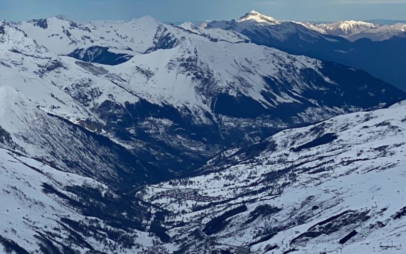
French Alps. Image © PlanetSKI
Watch this space…
Monday 6th March
Currently the main snow action is not in Europe but over in the USA where huge amounts continue to fall in this record-breaking season.
We have further details lower down this article, and here’s a taster from California.
Check out the images of southern California from space:
Snow in sunny southern California?
A powerful late-February storm brought blizzard warnings and low-elevation snow to parts of southern California. #Landsat 9 captured snow blanketing much of the San Gabriel Mountains before (Feb. 10) and after (Feb. 26) the storm. pic.twitter.com/0tQz93uKH9
— NASA Earth (@NASAEarth) February 28, 2023
Before looking at the Alps and North America we should also mention that ski resorts in Scotland are expecting to see a sharp drop in temperatures, with some snow, this week.
A Met Office yellow warning is in force for much of northern and eastern Scotland.
It says severe weather is possible, and people should prepare for the weather to affect travel and other activities.
Met Office meteorologist Craig Snell said that cold winds could make it feel like “some of the coldest weather we’ve had since the beginning of December”.
He said up to 10cm of snow could fall on high ground, with up to 5cm possible in lower areas.
The snow has already started falling in the ski centre of Glenshee.
The lack of snow and poor forecast in Scotland has already caused The Mighty Coe festival at Glencoe, that was due to be held this week, to be called off:
In the Alps the weather is due to become unsettled early this week.
“The first indications of this will be some light snow on Monday in the south-eastern Alps (e.g. Dolomites) before some more widespread and significant snow moves into the north-western Alps later on Tuesday and on Wednesday,” said Fraser Wilkin from weathertoski.co.uk.
Here at PlanetSKI we’ll keep you posted over the weekend, but on Saturday Fraser revised his forecasts as the weather models changed.
“Next week’s predicted major change in the weather pattern in the Alps has had a spanner thrown in the works, with the models no longer favouring the arrival of a blast of unstable polar air,” said Fraser.
“This polar air should have brought at least a moderate fall of snow to low altitudes in the snow-starved north-western Alps, however, the latest models suggest that this airmass won’t really make it to the Alps at all, at least not in a way that will deliver the widespread heavy snow that we had been hoping for.”
The lack of snow has resulted in an increase in accidents on the piste, as we have reported here:

Ski Accident. Image © PlanetSKI
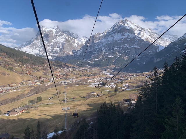
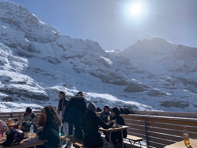
The latest images of the snow and conditions we have are from Grindelwald, in Switzerland.
They come from PlaneSKI reader, Helen Gillespie, who is in the resort.
“Some fresh dustings earlier this week slightly freshened up the pistes with colder temperatures firming up the ride, ” said Helen.
“It is more spring-like than expected and a big dump soon would change the game, but there is still some good piste skiing,” she added.
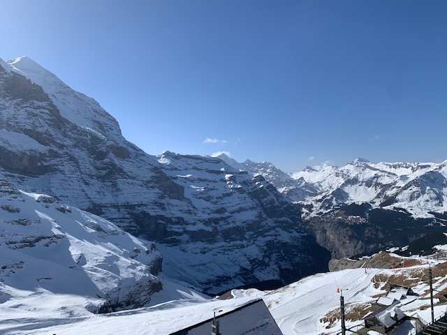
Grindelwald, Switzerland. Image c/o Helen Gillespie.

Grindelwald, Switzerland. Image c/o Helen Gillespie.
Grindelwald, Switzerland. Image c/o Helen Gillespie.
Grindelwald, Switzerland. Image c/o Helen Gillespie.
Some parts of the Alps have had a welcome big snowfall this week, but snow depths are generally way below where they should be for the time of year.
The areas that have been lucky with the snow this week are in the far south-western Alps.
Prato Nevoso in the Piedmont has had as much as 80cm fall.
And Isola 2000 over the border in France has seen some welcome snow.
🔴❄️ #DirectMétéo
26/02/2023 à 20h20 : Gavage de #neige en cours à #Isola2000(06) avec une température glaciale de -8.6°C ! Le phénomène de #lombarde est actif sur le chaînon frontalier du #Mercantour. 🥶 #CotedAzurFrance #Nice06 #AlpesMaritimes #Meteo06 pic.twitter.com/WzqBZMtIDC— Météo Côte d'Azur ☀️ (@MeteoCotedAzur) February 26, 2023
The alpine weather expert, Fraser Wilkin, of WeatherToSki, says more snow is expected in the region, with the heaviest the further south you are.
Some snow will reach the Milky Way resorts (eg Sestriere and Sauze d’Oulx), parts of the Maurienne such as Val Cenis and as far as Val d’Isère.
Elsewhere it will stay cold and fine.
Austria has some of the best of the skiing in the Alps at the moment.
It’s had more consistent snowfall – though nothing in the last couple of days – and lower temperatures than elsewhere.
We’ve been sent these photos from Holger Gassler who lives in Innsbruck in the Tirol.

Nordkette ski area, Tirol, from Innsbruck, Tuesday 28th February. Image © Holger Gassler

Nordkette ski area, Tirol, from Innsbruck, Tuesday 28th February. Image © Holger Gassler

Leutasch near Seefeld, Austria. Image © Holger Gassler

Leutasch near Seefeld, Austria. Image © Holger Gassler

Leutasch near Seefeld, Austria. Image © Holger Gassler
PlanetSKI reader, Kylie Field, reported on Sunday that there had been some snow in Soelden.
“Finally some snow in Austria, 12cm in Soelden,” she told us.
There has been some snow in Fieberbrunn too.
But the best of the snow was in the Arlberg.
🎿 Ski vacation anyone? 🤩 Schneehöhe / Snow depth (total):#Valluga 255cm, #Galzig 165cm, St. Christoph 150cm, #Gampen 105cm, #Rendl 105cm#stantonamarlberg
👉 https://t.co/uN626bxMBY
Photos by IG @ kathilaimer👍#arlberg #inTirol #austria #skiresortlife #skiing #winter2023 pic.twitter.com/0MNRQhHJGa— St. Anton am Arlberg (@StantonReview) February 28, 2023
“The snow situation in the Alps is an unusual one right now,” Fraser Wilkin said this week.
“Snow depths are way below where they should be for late February across most of the Alps, with very patchy or non-existent natural snow cover at lower altitudes in many central and western regions.
“Most major resorts can still offer plenty of reasonable piste skiing, and the recent cold has at least now put the brakes on the thaw.
“However, the pistes are often hard-packed or icy and more snow is urgently needed to both improve the snow quality and the prospects for the rest of the season.”
PlanetSKI reader, Sue McCausland, sent us this image from Les2Alpes in the southern French Alps at the weekend, where there had been a small top-up of snow.

Les2Alpes, France. Image c/o Sue McCausland
Elsewhere in France there were a few flakes falling in Tignes as PlanetSKI reporter, Claire McAteer, arrived at the weekend.
It hadn’t seen any snow for more than a month.
Around 5cm fell across the day.

Tignes, France. Image © PlanetSKI

Claire McAteer, Tignes, France. Image © PlanetSKI
See more detail from the last week in our earlier PlanetSKI Snow Report
And the forecast for the Alps?
There could be more widespread snow later next week but it’s too far away to be sure.
USA
Meanwhile, the epic season enjoyed by resorts in the west of the USA – in particular California and Utah – is continuing.
And it’s not just the west.
Conditions are good across the USA and Canada.
California…
After another 16" of snow in the last 24 hours, our upper mountain snowpack is sitting at over 14 FEET, and by our expert analysis, our lower mountain snowpack is looking pretty healthy as well.
Weather Blog: https://t.co/Q9dKqU5Rd4#PalisadesTahoe #snow #powder #Tahoe pic.twitter.com/5AieNW648u
— Palisades Tahoe (@palisadestahoe) February 27, 2023
The area is now at the centre of another storm cycle which is expected to deliver powdery snow.
“We could see up to 130 inches of snow in total by Wednesday afternoon for 8.5-day totals!” Palisades Tahoe resort says.
Utah…
Photo of the Day | 2.27.2023
Revved up as we enter another stormy week, today was a pop a wheelie type of day. 🏍️
⛷️: Andrew Bird
📸: @rockomenzyk https://t.co/MRJ6yODizO pic.twitter.com/WqZq0aIq4N— Alta Ski Area (@AltaSkiArea) February 27, 2023
Colorado….
North-East USA…
Canada…
Dropping into a winter wonderland this morning in Gil’s. Would you go back up for a second lap too?
🏂: Zuzy Rocka & Marlie Marchewka #sunpeaks #explorekamloops #explorebc pic.twitter.com/eTrYpZG57d
— Sun Peaks Resort (@SunPeaksResort) March 1, 2023
PlanetSKI logo


